Safety Score: 3,2 of 5.0 based on data from 9 authorites. Meaning please reconsider your need to travel to Czech Republic.
Travel warnings are updated daily. Source: Travel Warning Czechia. Last Update: 2024-08-13 08:21:03
Delve into Oldřichov na Hranicích
Oldřichov na Hranicích in Okres Liberec (Liberecký kraj) is located in Czechia about 58 mi (or 93 km) north of Prague, the country's capital town.
Current time in Oldřichov na Hranicích is now 12:26 AM (Friday). The local timezone is named Europe / Prague with an UTC offset of one hour. We know of 9 airports close to Oldřichov na Hranicích, of which 4 are larger airports. The closest is airport we know is Dresden Airport in Germany in a distance of 51 mi (or 82 km). The closest airport in Czechia is Ruzyně International Airport in a distance of 60 mi (or 82 km), West. Besides the airports, there are other travel options available (check left side).
There are several Unesco world heritage sites nearby. The closest heritage site is Dresden Elbe Valley in Germany at a distance of 47 mi (or 75 km). The closest in Czechia is Historic Centre of Prague in a distance of 58 mi (or 75 km), West. If you need a hotel, we compiled a list of available hotels close to the map centre further down the page.
While being here, you might want to pay a visit to some of the following locations: Olbersdorf, Mittelherwigsdorf, Hainewalde, Grossschonau and Liberec. To further explore this place, just scroll down and browse the available info.
Local weather forecast
Todays Local Weather Conditions & Forecast: 1°C / 34 °F
| Morning Temperature | -0°C / 32 °F |
| Evening Temperature | 1°C / 33 °F |
| Night Temperature | -1°C / 30 °F |
| Chance of rainfall | 1% |
| Air Humidity | 73% |
| Air Pressure | 1001 hPa |
| Wind Speed | Moderate breeze with 10 km/h (6 mph) from East |
| Cloud Conditions | Broken clouds, covering 72% of sky |
| General Conditions | Light snow |
Friday, 22nd of November 2024
1°C (34 °F)
-3°C (28 °F)
Light snow, gentle breeze, overcast clouds.
Saturday, 23rd of November 2024
2°C (36 °F)
0°C (32 °F)
Snow, fresh breeze, scattered clouds.
Sunday, 24th of November 2024
2°C (35 °F)
2°C (36 °F)
Rain and snow, moderate breeze, overcast clouds.
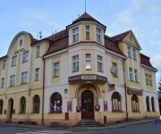
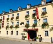
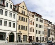
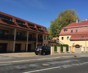
Hotels and Places to Stay
Apartmán-Hotel Jítrava
Dresdner Hof Haupthaus
Haus am See
Hotel Jimmy
Schwarzer Bär
Zittauer Hof
Dreiländereck
Dresdner Hof Pension
Hotel Weberhof HOTEL WEBERHOF GMBH
Riedel
Videos from this area
These are videos related to the place based on their proximity to this place.
Bei Zittau: Grenzübergang Kopaczow (Oberullersdorf) und Oldrichov border crossing
Fahrt von Polen nach Tschechien und zurück. Trinationale Verbindungstraße Deutschland-Polen-Tschechien. Hier in der Nähe von Hradek (Grottau). Die Bundesstraße B 178 beginnt bei Weißenberg...
Góry Łużyckie » Hrádek nad Nisou (Gródek nad Nysą - Czechy)
Gródek nad Nysą (czes. Hrádek nad Nisou, niem. Grottau) -- miasto w północnych Czechach, w Kotlinie Żytawskiej, nad Nysą Łużycką, u stóp Gór Łużyckich. Leży w pobliżu czesko-niemiec...
[Schengen] Porajów - Hrádek nad Nisou 07/14
Byłe przejście graniczne Porajów - Hrádek nad Nisou (Gródek Na Nysą). Kierunek Czechy. Former border crossing Porajow - Hradek nad Nisou towards Czechia.
Marcellis @ Shotgun Festival Hrad Grabštejn Hrádek nad Nisou 2014
Marcellis @ Shotgun Festival Hrad Grabštejn Hrádek nad Nisou Czech Republic 16.08.14 - pix @ http://www.sound-of-e.de/shotgun2014 - Live: Deadbeat (CA) Frederic Robinson (CH) Elektrabel,...
Überschwemmung im Zentrum von Hradek nad Nisou (08.08.10)
Gravierende Schäden im Zentrum von Hradek nad Nisou.
Click Joe @ Shotgun Festival Hrad Grabštejn Hrádek nad Nisou 2014
Click Joe @ Shotgun Festival Hrad Grabštejn Hrádek nad Nisou Czech Republic 16.08.14 - pix @ http://www.sound-of-e.de/shotgun2014 - Live: Deadbeat (CA) Frederic Robinson (CH) Elektrabel,...
Mažoretky Mochomůrky Jiříkov - 2012_06_09 - Hrádek nad Nisou - pochod městem
Mažoretky Mochomůrky Jiříkov - Hrádek nad Nisou - pochod městem.
Grottau Hrádek nad Nisou
Schon vor 100 Jahren wurde für Konsumprodukte geworben. Damals nannte man die Werbung jedoch Reklame und jede Firma welche was auf sich hielt, produzierte kleine Briefmarken ähnliche ...
Videos provided by Youtube are under the copyright of their owners.
Attractions and noteworthy things
Distances are based on the centre of the city/town and sightseeing location. This list contains brief abstracts about monuments, holiday activities, national parcs, museums, organisations and more from the area as well as interesting facts about the region itself. Where available, you'll find the corresponding homepage. Otherwise the related wikipedia article.
Mandau
The 40.9 km long Mandau is a river in Bohemia and Saxony. It originates from multiple springs north of the 580.6m (1902 feet AMSL) Wolf Mountain in the Šluknov Hook, which join in Panský at 1690 feet above sea level. Coming from Zahrady another stream joins in Nové Křečany (Neu Ehrenberg). From there the Mandau flows in a southeasterly direction through Rumburk (Rumburg; Bohemia), Seifhennersdorf and Varnsdorf (Warnsdorf; Bohemia).
Białopole, Lower Silesian Voivodeship
Białopole is a village in the administrative district of Gmina Bogatynia, within Zgorzelec County, Lower Silesian Voivodeship, in south-western Poland, close to the Czech and German borders. Prior to 1945 it was in Germany. It lies approximately 7 kilometres south-west of Bogatynia, 31 kilometres south of Zgorzelec, and 153 kilometres west of the regional capital Wrocław.
Kopaczów
Kopaczów is a village in the administrative district of Gmina Bogatynia, within Zgorzelec County, Lower Silesian Voivodeship, in south-western Poland, close to the Czech and German borders. Prior to 1945 it was in Germany. It lies approximately 10 kilometres south-west of Bogatynia, 33 kilometres south of Zgorzelec, and 156 kilometres west of the regional capital Wrocław.
Porajów
Porajów is a village in the administrative district of Gmina Bogatynia, within Zgorzelec County, Lower Silesian Voivodeship, in south-western Poland, close to the Czech and German borders. Prior to 1945 it was in Germany. It lies approximately 11 kilometres west of Bogatynia, 32 kilometres south-west of Zgorzelec, and 157 kilometres west of the regional capital Wrocław. The village has a population of 2,500.
Sieniawka, Zgorzelec County
Sieniawka is a village in the administrative district of Gmina Bogatynia, within Zgorzelec County, Lower Silesian Voivodeship, in south-western Poland, close to the Czech and German borders. Prior to 1945 it was in Germany. It lies approximately 10 kilometres west of Bogatynia, 31 kilometres south of Zgorzelec, and 156 kilometres west of the regional capital Wrocław.
Rybarzowice, Lower Silesian Voivodeship
Rybarzowice is a former village in the administrative district of Gmina Bogatynia, within Zgorzelec County, Lower Silesian Voivodeship, in south-western Poland, close to the Czech and German borders. Prior to 1945 it was in Germany. It was situated approximately 5 kilometres south-west of Bogatynia, 29 kilometres south of Zgorzelec, and 152 kilometres west of the regional capital Wrocław.






!['[Schengen] Porajów - Hrádek nad Nisou 07/14' preview picture of video '[Schengen] Porajów - Hrádek nad Nisou 07/14'](https://img.youtube.com/vi/ylJdCvW6OY8/mqdefault.jpg)


