Safety Score: 3,2 of 5.0 based on data from 9 authorites. Meaning please reconsider your need to travel to Czech Republic.
Travel warnings are updated daily. Source: Travel Warning Czechia. Last Update: 2024-08-13 08:21:03
Delve into Bobr
Bobr in Okres Trutnov (Královéhradecký kraj) is located in Czechia about 77 mi (or 123 km) north-east of Prague, the country's capital town.
Current time in Bobr is now 08:34 PM (Friday). The local timezone is named Europe / Prague with an UTC offset of one hour. We know of 12 airports close to Bobr, of which 5 are larger airports. The closest airport in Czechia is Pardubice Airport in a distance of 46 mi (or 74 km), South. Besides the airports, there are other travel options available (check left side).
There are several Unesco world heritage sites nearby. The closest heritage site is Churches of Peace in Jawor and Świdnica in Poland at a distance of 29 mi (or 47 km). The closest in Czechia is Kutná Hora: Historical Town Centre with the Church of St Barbara and the Cathedral of Our Lady at Sedlec in a distance of 57 mi (or 47 km), North-East. If you need a hotel, we compiled a list of available hotels close to the map centre further down the page.
While being here, you might want to pay a visit to some of the following locations: Kamienna Gora, Karpacz, Czarny Bor, Wojcieszow and Jezow Sudecki. To further explore this place, just scroll down and browse the available info.
Local weather forecast
Todays Local Weather Conditions & Forecast: 6°C / 42 °F
| Morning Temperature | 3°C / 37 °F |
| Evening Temperature | 5°C / 41 °F |
| Night Temperature | 1°C / 34 °F |
| Chance of rainfall | 0% |
| Air Humidity | 74% |
| Air Pressure | 1025 hPa |
| Wind Speed | Light breeze with 5 km/h (3 mph) from East |
| Cloud Conditions | Overcast clouds, covering 88% of sky |
| General Conditions | Overcast clouds |
Saturday, 16th of November 2024
5°C (41 °F)
0°C (32 °F)
Few clouds, gentle breeze.
Sunday, 17th of November 2024
2°C (36 °F)
2°C (35 °F)
Rain and snow, gentle breeze, overcast clouds.
Monday, 18th of November 2024
1°C (34 °F)
-1°C (29 °F)
Snow, moderate breeze, overcast clouds.
Hotels and Places to Stay
Grund Resort Golf & Ski
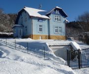
Blue Pension Villa
Pivovar Trautenberk
Videos from this area
These are videos related to the place based on their proximity to this place.
Žlutý pes - finále koncertu - Žacléř 2012
Kapela Žlutý pes při extrémních podmínkách (při větrné smršti, po výpadcích proudu) to prostě umí rozbalit. Záznam pořízen v Žacléři na dni řemesel dne 5. července 2012.
Ryanne voor t eerst op de latten...
Het commentaar van Ryanne op haar eerste ski-ervaringen...let ook op de smoel van Frits op t eind.
Videos provided by Youtube are under the copyright of their owners.
Attractions and noteworthy things
Distances are based on the centre of the city/town and sightseeing location. This list contains brief abstracts about monuments, holiday activities, national parcs, museums, organisations and more from the area as well as interesting facts about the region itself. Where available, you'll find the corresponding homepage. Otherwise the related wikipedia article.
Bóbr
Bóbr is a river which runs through the north of the Czech Republic and the southwest of Poland, a left tributary of the Oder River, with a length of 272 kilometres (2 in Czech Republic, 270 in Poland, 10th longest Polish river) and a basin area of 5,876 square kilometres (46 in Czech Republic and 5,830 in Poland).
Niedamirów
Niedamirów is a village in the administrative district of Gmina Lubawka, within Kamienna Góra County, Lower Silesian Voivodeship, in south-western Poland, near the border with the Czech Republic. Prior to 1945 it was in Germany. It lies approximately 9 kilometres west of Lubawka, 18 km south-west of Kamienna Góra, and 94 km south-west of the regional capital Wrocław.
Opawa, Lower Silesian Voivodeship
Opawa is a village in the administrative district of Gmina Lubawka, within Kamienna Góra County, Lower Silesian Voivodeship, in south-western Poland. Prior to 1945 it was in Germany. \t\t \t\t\tOpawa. jpg \t\t\t Opawa latem \t\t\t \t\t \t\t \t\t\tOpawa kosciol. jpg \t\t\t Church in Opawa
Szczepanów, Kamienna Góra County
Szczepanów is a village in the administrative district of Gmina Lubawka, within Kamienna Góra County, Lower Silesian Voivodeship, in south-western Poland, near the border with the Czech Republic. Prior to 1945 it was in Germany.


