Safety Score: 3,2 of 5.0 based on data from 9 authorites. Meaning please reconsider your need to travel to Czech Republic.
Travel warnings are updated daily. Source: Travel Warning Czechia. Last Update: 2024-08-13 08:21:03
Delve into Rybníček
Rybníček in Okres Havlíčkův Brod (Kraj Vysočina) with it's 66 habitants is located in Czechia about 53 mi (or 86 km) south-east of Prague, the country's capital town.
Current time in Rybníček is now 01:46 PM (Friday). The local timezone is named Europe / Prague with an UTC offset of one hour. We know of 10 airports close to Rybníček, of which 4 are larger airports. The closest airport in Czechia is Pardubice Airport in a distance of 20 mi (or 32 km), North-East. Besides the airports, there are other travel options available (check left side).
There are several Unesco world heritage sites nearby. The closest heritage site in Czechia is Kutná Hora: Historical Town Centre with the Church of St Barbara and the Cathedral of Our Lady at Sedlec in a distance of 17 mi (or 27 km), North-West. If you need a hotel, we compiled a list of available hotels close to the map centre further down the page.
While being here, you might want to pay a visit to some of the following locations: Pardubice, Jihlava, Hradec Kralove, Waldkirchen an der Thaya and Velka Bites. To further explore this place, just scroll down and browse the available info.
Local weather forecast
Todays Local Weather Conditions & Forecast: 7°C / 45 °F
| Morning Temperature | 4°C / 40 °F |
| Evening Temperature | 5°C / 40 °F |
| Night Temperature | 3°C / 37 °F |
| Chance of rainfall | 0% |
| Air Humidity | 69% |
| Air Pressure | 1026 hPa |
| Wind Speed | Gentle Breeze with 7 km/h (4 mph) from East |
| Cloud Conditions | Overcast clouds, covering 92% of sky |
| General Conditions | Overcast clouds |
Saturday, 16th of November 2024
7°C (45 °F)
2°C (35 °F)
Sky is clear, gentle breeze, clear sky.
Sunday, 17th of November 2024
7°C (44 °F)
4°C (39 °F)
Light rain, moderate breeze, scattered clouds.
Monday, 18th of November 2024
3°C (38 °F)
2°C (35 °F)
Rain and snow, moderate breeze, overcast clouds.
Hotels and Places to Stay
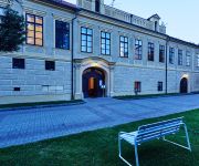
Hotel Chateau Hostacov
Videos from this area
These are videos related to the place based on their proximity to this place.
Hlazení candáta - lom BOREK - Smoothing pikeperch quarry Borek
Takto krásně hrbil hřbet, jak se mu to líbilo. This beautifully hunched back as he liked it. Czech Republic.
Kapr v laguně - lom BOREK
Kapří pštros, který si myslí, že když strčí hlavu pod větev, tak není vidět.
1211 Houby Portobello
Jak snadno a rychle připravit chutný burger s houbami Portobello v grilu Weber.
|FreeWay| - Trip No.2 !!!
Fakt super tréning na Vltavský,Kivadlu a na Právnický fakultě Doufám že se zas neobjeví u písničky autorský práva protože už se to stalo 2 :) Enjoy It!!
Path of Exile: The City of Sarn (Merc), Strongboxes, Arc Witch 1M HC league
Path of Exile: The City of Sarn (Merc), Strongboxes, Arc Witch 1M HC league Thank you for watching guys :) If you have any question just ask me in comments and cya next time. Skill-tree -...
Spas and Mineral Springs, Czech Republic - Unravel Travel TV
Spas and Mineral Springs in the Czech Republic. Unravel Travel TV http://www.unraveltraveltv.com Unravel Travel TV on You Tube http://www.youtube.com/UnravelTravelTV Unravel Travel TV Twitter...
Videos provided by Youtube are under the copyright of their owners.
Attractions and noteworthy things
Distances are based on the centre of the city/town and sightseeing location. This list contains brief abstracts about monuments, holiday activities, national parcs, museums, organisations and more from the area as well as interesting facts about the region itself. Where available, you'll find the corresponding homepage. Otherwise the related wikipedia article.
Geography of the Czech Republic
The Czech landscape is quite varied. Bohemia, to the west, consists of a river basin, drained by the Elbe and Vltava rivers. It is surrounded by mostly low mountains such as the Sudetes with its part Krkonoše, containing the highest point in the country, the Sněžka at 1,602 metres . Moravia, the eastern part, is also quite hilly and is drained predominantly by the Morava river, but also contains the source of the Oder river.


