Safety Score: 3,2 of 5.0 based on data from 9 authorites. Meaning please reconsider your need to travel to Czech Republic.
Travel warnings are updated daily. Source: Travel Warning Czechia. Last Update: 2024-08-13 08:21:03
Discover Stichlův Mlýn
Stichlův Mlýn in Okres Karlovy Vary (Karlovarský kraj) is a city in Czechia about 64 mi (or 103 km) west of Prague, the country's capital city.
Local time in Stichlův Mlýn is now 02:48 PM (Sunday). The local timezone is named Europe / Prague with an UTC offset of one hour. We know of 9 airports in the vicinity of Stichlův Mlýn, of which 3 are larger airports. The closest airport in Czechia is Karlovy Vary International Airport in a distance of 3 mi (or 5 km), West. Besides the airports, there are other travel options available (check left side).
There are several Unesco world heritage sites nearby. The closest heritage site in Czechia is Historic Centre of Prague in a distance of 64 mi (or 103 km), East. Looking for a place to stay? we compiled a list of available hotels close to the map centre further down the page.
When in this area, you might want to pay a visit to some of the following locations: Karlovy Vary, Barenstein, Crottendorf, Konigswalde and Annaberg-Buchholz. To further explore this place, just scroll down and browse the available info.
Local weather forecast
Todays Local Weather Conditions & Forecast: 4°C / 39 °F
| Morning Temperature | 3°C / 37 °F |
| Evening Temperature | 4°C / 39 °F |
| Night Temperature | 3°C / 37 °F |
| Chance of rainfall | 1% |
| Air Humidity | 94% |
| Air Pressure | 1012 hPa |
| Wind Speed | Moderate breeze with 10 km/h (6 mph) from East |
| Cloud Conditions | Overcast clouds, covering 94% of sky |
| General Conditions | Rain and snow |
Monday, 18th of November 2024
3°C (37 °F)
2°C (36 °F)
Rain and snow, moderate breeze, overcast clouds.
Tuesday, 19th of November 2024
6°C (43 °F)
7°C (44 °F)
Rain and snow, moderate breeze, overcast clouds.
Wednesday, 20th of November 2024
1°C (33 °F)
-1°C (30 °F)
Rain and snow, moderate breeze, overcast clouds.
Hotels and Places to Stay
Golf Karolina
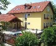
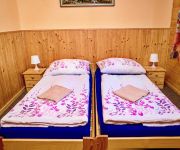
Radošov Privat
Videos from this area
These are videos related to the place based on their proximity to this place.
Lovecký zámeček u Moříčova
V letech 1738-1739 nechali držitelé ostrovského panství vystavět bratři Ludvík Jiří a August Jiří, markrabata z Baden-Badenu a Hochburku, na kopci v rozsáhlé oboře nedaleko Mořičova...
Fotbalová tryzna
I porážku je třeba řádně oslavit ... Sadov - Božíčany 1:2 (7. kolo OP 2007-2008, 29.9.2007)
Hrad Hartenštejn - Bochov
Poprvé se o tomto pozdně gotickém hradu dozvídáme 1473, postavil jej Jindřich z Plavna. Neměl sloužit jako obytný hrad, ale jako vojenský opěrný bod, čemuž odpovídá také jeho...
Fotovlak vedený parní lokomotivou 475.111 v úseku Chýše - Bochov
Photo train driven by a steam locomotive in section 475.111 Chýše - Bochov akce/event: Fotovlak Chýše - Bochov/ Photo train Chýše - Bochov datum/date 6. 8. 2011 lokomotiva/locomotive:4-8-2...
kostel sv. Jakuba, Bochov
Původně farní gotický kostel sv. Jakuba byl postaven koncem 13. století v místech původního založení městečka, středověké farní vsi Krašnov.
Videos provided by Youtube are under the copyright of their owners.
Attractions and noteworthy things
Distances are based on the centre of the city/town and sightseeing location. This list contains brief abstracts about monuments, holiday activities, national parcs, museums, organisations and more from the area as well as interesting facts about the region itself. Where available, you'll find the corresponding homepage. Otherwise the related wikipedia article.
Karlovy Vary Region
Karlovy Vary Region is an administrative unit of the Czech Republic, located in the westernmost part of its historical region of Bohemia. It is named after its capital Karlovy Vary. The region is world famous for its spas (Karlovy Vary, Mariánské Lázně and others). It is the only current region of Czech Republic situated completely inside the former majority German-speaking region of Sudetenland.
Doupov Mountains
Doupov Mountains is a cenozoic volcanic mountain range with the typical structure of stratovolcano. The centre of the stratovolcano was in the place of a former town of Doupov. The highest mountain is Hradiště (934 metres), the lowest point is by the river Ohře near Kadaň (cca 275 metres). In 1945, most of the German population was forced out so that Doupov Mountains were almost completely unpopulated. It became the Army Training Area in 1953 and still serves this purpose for NATO forces.
Andělská Hora (Karlovy Vary District)
See other locations named Andělská Hora. Andělská Hora (German: Engelhaus, earlier also Engelsberg) is a small village in the Karlovy Vary Region of the Czech Republic. It is located 7 km southeast of Karlovy Vary and has a population of 208. Ruins of Andělská Hora Castle are located above the village.
Šemnice
Šemnice is a village and municipality in Karlovy Vary District in the Karlovy Vary Region of the Czech Republic.
Stružná
Stružná, until 1949 Kysibl is a village and municipality in Karlovy Vary District in the Karlovy Vary Region of the Czech Republic. The municipality covers an area of 12.6 square kilometres and as of 2006 it had a population of 539.
Andělská Hora Castle
Andělská Hora, originally called Engelsburg, is a castle located above the village of Andělská Hora, about 7 km southeast of Karlovy Vary, in the Karlovy Vary Region of the Czech Republic. The ruins of the Andělská Hora castle stands upon a rock overlooking the village of Andělská Hora which lies just below. It was founded at the turn of the 14th to the 15th century by Boreš z Rýznburk, a noblemen from the Rýznburk family, as protection for their estates.


