Safety Score: 3,2 of 5.0 based on data from 9 authorites. Meaning please reconsider your need to travel to Czech Republic.
Travel warnings are updated daily. Source: Travel Warning Czechia. Last Update: 2024-08-13 08:21:03
Discover Chaloupky
Chaloupky in Okres Prachatice (Jihočeský kraj) is a place in Czechia about 86 mi (or 139 km) south-west of Prague, the country's capital city.
Current time in Chaloupky is now 06:49 AM (Wednesday). The local timezone is named Europe / Prague with an UTC offset of one hour. We know of 11 airports near Chaloupky, of which 5 are larger airports. The closest is airport we know is Straubing Airport in Germany in a distance of 50 mi (or 80 km). The closest airport in Czechia is Mariánské Lázně Airport in a distance of 78 mi (or 80 km), West. Besides the airports, there are other travel options available (check left side).
There are several Unesco world heritage sites nearby. The closest heritage site in Czechia is Holašovice Historical Village Reservation in a distance of 29 mi (or 47 km), East. If you need a hotel, we compiled a list of available hotels close to the map centre further down the page.
While being here, you might want to pay a visit to some of the following locations: Borova Lada, Mauth, Philippsreut, Hinterschmiding and Neuschonau. To further explore this place, just scroll down and browse the available info.
Local weather forecast
Todays Local Weather Conditions & Forecast: 10°C / 51 °F
| Morning Temperature | 4°C / 39 °F |
| Evening Temperature | 7°C / 44 °F |
| Night Temperature | 5°C / 42 °F |
| Chance of rainfall | 0% |
| Air Humidity | 61% |
| Air Pressure | 1029 hPa |
| Wind Speed | Calm with 2 km/h (1 mph) from North-East |
| Cloud Conditions | Overcast clouds, covering 100% of sky |
| General Conditions | Overcast clouds |
Thursday, 7th of November 2024
12°C (54 °F)
4°C (40 °F)
Few clouds, light breeze.
Friday, 8th of November 2024
10°C (51 °F)
4°C (39 °F)
Broken clouds, light breeze.
Saturday, 9th of November 2024
9°C (48 °F)
4°C (39 °F)
Sky is clear, calm, clear sky.
Hotels and Places to Stay
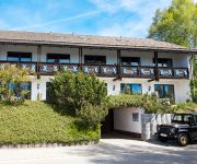
Scottish Highlander Guesthouse
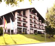
Haus Waldeck Landhotel
Almberg
Sportalm Landhotel
Videos from this area
These are videos related to the place based on their proximity to this place.
Mauth/ Nationalpark Bayer. Wald: Ausstellung der Glas- und Fotokünstler Fruth- Glasmacherlied
In der Informationsstelle des Nationalparks und der Gemeinde Mauth zeigen die Glas- und Fotokünstler Gunther und Rosemarie Fruth vom Atelier in Perlesreut und Schloss Fürsteneck Werke ihres...
Abfahrt Dreikönigsloipe Mauth Reschbachtal - www.3könig.info
Finale Abfahrt auf der Dreikönigsloipe bei der 5 Km, 10 Km und 20 Km Runde.
Bayer. Wald: Musikverein Annathal singt und spielt Ein Jäger aus Kurpfalz
Der Bayerische Wald als einer der waldreichsten Landschaften Mitteleuropas ist historisch eng mit der Jagd verbunden. Herzöge aus Bayern (Wittelsbacher) und Fürstbischöfe aus Passau hatten...
Ski areál Kvilda
SKI Areál Kvilda - "Prameny Šumavy" http://www.skikvilda.cz/ 5 vleků, lyžařská škola, půjčovna sjezdových i běžeckých lyží, servis lyží a snowboardů, zasněžování,...
Hotel Šumava Inn - Kvilda
Hotel Šumava Inn, 384 93 Kvilda 26 www.sumavainn.cz , info@sumavainn.cz , +420 777 671 600.
SKipenzion - Kvilda - Šumava
http://skipenzion.sumava.net/skipenzion/ SKipenzion nabízí ubytování v 5ti dvoulůžkových pokojích a 2 čtyřlůžkových pokojích s možnostmi přistýlek. V každém pokoji je vlastní...
Apartmán Malík - Kvilda
http://www.sumava.net/malik/ Navštivte Kvildu - nejvýše položenou obec v České republice. Nabízíme ubytování v plně vybaveném apartmánu v centru Kvildy. Naši hosté mají možnost...
Videos provided by Youtube are under the copyright of their owners.
Attractions and noteworthy things
Distances are based on the centre of the city/town and sightseeing location. This list contains brief abstracts about monuments, holiday activities, national parcs, museums, organisations and more from the area as well as interesting facts about the region itself. Where available, you'll find the corresponding homepage. Otherwise the related wikipedia article.
Siebensteinkopf
Siebensteinkopf is a mountain of Bavaria, Germany.


