Safety Score: 2,8 of 5.0 based on data from 9 authorites. Meaning we advice caution when travelling to Croatia.
Travel warnings are updated daily. Source: Travel Warning Croatia. Last Update: 2024-08-13 08:21:03
Delve into Turine
Turine in Ličko-Senjska Županija is located in Croatia about 79 mi (or 126 km) south-west of Zagreb, the country's capital town.
Current time in Turine is now 08:07 AM (Friday). The local timezone is named Europe / Zagreb with an UTC offset of one hour. We know of 9 airports close to Turine, of which 3 are larger airports. The closest airport in Croatia is Rijeka Airport in a distance of 26 mi (or 41 km), North-West. Besides the airports, there are other travel options available (check left side).
There are several Unesco world heritage sites nearby. The closest heritage site in Croatia is Plitvice Lakes National Park in a distance of 34 mi (or 54 km), East. If you need a hotel, we compiled a list of available hotels close to the map centre further down the page.
While being here, you might want to pay a visit to some of the following locations: Senj, Baska, Brinje, Novi Vinodolski and Lopar. To further explore this place, just scroll down and browse the available info.
Local weather forecast
Todays Local Weather Conditions & Forecast: 10°C / 50 °F
| Morning Temperature | 4°C / 40 °F |
| Evening Temperature | 8°C / 46 °F |
| Night Temperature | 7°C / 44 °F |
| Chance of rainfall | 0% |
| Air Humidity | 61% |
| Air Pressure | 1024 hPa |
| Wind Speed | Moderate breeze with 10 km/h (6 mph) from South-West |
| Cloud Conditions | Broken clouds, covering 64% of sky |
| General Conditions | Broken clouds |
Saturday, 16th of November 2024
12°C (54 °F)
9°C (48 °F)
Sky is clear, moderate breeze, clear sky.
Sunday, 17th of November 2024
13°C (56 °F)
13°C (56 °F)
Moderate rain, moderate breeze, broken clouds.
Monday, 18th of November 2024
14°C (57 °F)
10°C (49 °F)
Moderate rain, moderate breeze, overcast clouds.
Hotels and Places to Stay
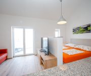
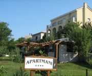
BC Eleven
BC-Better Choice Apartments
Apartments Laura
Art
Videos from this area
These are videos related to the place based on their proximity to this place.
Senj, kręta droga dojazdowa między górskimi pasmami oraz nabrzeże jachtowe. Chorwacja. Dalmacja.
Senj, kręta droga dojazdowa między górskimi pasmami oraz nabrzeże jachtowe. Chorwacja. Dalmacja. https://pl-pl.facebook.com/KlassaSports https://pl-pl.facebook.com/klassateam.
APRILIA RSV 1000 R On board Senj - Karlobag
perfect road on a perfect day on a perfect bike with a shitty camera that let me down and now I have to go there again :-) BTW, the road is really amazing with new tarmac without any cracks....
Tvrđava Nehaj (Senj)
Tvrđava Nehaj (poznata i pod nazivima Kula Nehaj te Nehajgrad) služila je kao vojna utvrda uskocima koji su je koristili kao mjesto s kojeg su branili grad Senj te pripremali napade na Turke...
Videos provided by Youtube are under the copyright of their owners.
Attractions and noteworthy things
Distances are based on the centre of the city/town and sightseeing location. This list contains brief abstracts about monuments, holiday activities, national parcs, museums, organisations and more from the area as well as interesting facts about the region itself. Where available, you'll find the corresponding homepage. Otherwise the related wikipedia article.
Croatian Littoral
Croatian Littoral is a geographical region of Croatia comprising the area between Dalmatia to the south, Mountainous Croatia to the north and east, and Istria and the Kvarner Gulf of the Adriatic Sea to the west. The term "Croatian Littoral" developed relatively recently, since the 18th and 19th centuries, reflecting the complex development of Croatia in historical and geographical terms.
Nehaj
Nehaj is the name of the hill that is found above the center of the town of Senj in Croatia. More famous is the Nehaj Fortress that stands on top of the hill. The name Nehaj comes from the which means Don't care. This name was given to the hill and the Fortress by the Uskoks, who built on the top of this hill the Fortress Nehaj for defensive purposes.


