Safety Score: 2,8 of 5.0 based on data from 9 authorites. Meaning we advice caution when travelling to Croatia.
Travel warnings are updated daily. Source: Travel Warning Croatia. Last Update: 2024-08-13 08:21:03
Touring Kundrići
Kundrići in Plitvička Jezera (Ličko-Senjska Županija) is a town located in Croatia about 67 mi (or 108 km) south of Zagreb, the country's capital place.
Time in Kundrići is now 02:26 AM (Friday). The local timezone is named Europe / Zagreb with an UTC offset of one hour. We know of 9 airports nearby Kundrići, of which two are larger airports. The closest airport in Croatia is Zemunik Airport in a distance of 55 mi (or 89 km), South. Besides the airports, there are other travel options available (check left side).
There are several Unesco world heritage sites nearby. The closest heritage site in Croatia is Plitvice Lakes National Park in a distance of 6 mi (or 10 km), West. Need some hints on where to stay? We compiled a list of available hotels close to the map centre further down the page.
Being here already, you might want to pay a visit to some of the following locations: Korenica, Bihac, Rakovica, Cazin and Saborsko. To further explore this place, just scroll down and browse the available info.
Local weather forecast
Todays Local Weather Conditions & Forecast: 6°C / 43 °F
| Morning Temperature | -0°C / 32 °F |
| Evening Temperature | 3°C / 37 °F |
| Night Temperature | 4°C / 39 °F |
| Chance of rainfall | 0% |
| Air Humidity | 75% |
| Air Pressure | 1027 hPa |
| Wind Speed | Light breeze with 4 km/h (3 mph) from South-West |
| Cloud Conditions | Overcast clouds, covering 90% of sky |
| General Conditions | Overcast clouds |
Saturday, 16th of November 2024
7°C (45 °F)
3°C (38 °F)
Few clouds, light breeze.
Sunday, 17th of November 2024
12°C (53 °F)
9°C (48 °F)
Broken clouds, light breeze.
Monday, 18th of November 2024
10°C (49 °F)
7°C (44 °F)
Moderate rain, light breeze, overcast clouds.
Hotels and Places to Stay
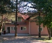
Pansion House Prijeboj
Nova Lika
Videos from this area
These are videos related to the place based on their proximity to this place.
Inside the underground facility KLEK of the exAFB Željava (LYBI)
LYBI team Inside the ex JNA underground facility KLEK of the exAFB Željava (LYBI).
Aerial drone view of exAFB Željava-Bihać and underground facility KLEK (16.10.2014.)
Aerial drone view of exAFB Željava-Bihać and underground facility KLEK (16.10.2014.) Flying hardware: DJI F450,KK2.1 kontroler, SunnySky2212-13 980 Kv motori, Graupner 11x5 props,GLB Gimbal ...
Underground Airbase Željava
Abandoned underground Airbase 'Željava' was a Strategic JNA Air Force Base (1968-1992), situated on the border between Croatia and Bosnia, near Bihać, the most expensive military object of...
Taxiing Željava 2013
Revisiting the area of 'Željava' Air Force Base of the former JNA. Here is the approach to all entrances available (3/4 in Croatia) and a full-throttle dash down one taxiway. For more info...
Licko Petrovo Selo i Zeljava
Poseta Draganu i Jeli u Lickom Petrovom Selu, Bihacu i Zeljavi ex-yu avio vojnoj bazi napustenoj 90-tih jer granica izmedju Hrvatske i Bosne razdvaja vojni komplex.
Željava Airbase - Star command center
Messing around deep inside the belly of underground Željava AFB, sniffing around the command center, the so called "Star".
Videos provided by Youtube are under the copyright of their owners.
Attractions and noteworthy things
Distances are based on the centre of the city/town and sightseeing location. This list contains brief abstracts about monuments, holiday activities, national parcs, museums, organisations and more from the area as well as interesting facts about the region itself. Where available, you'll find the corresponding homepage. Otherwise the related wikipedia article.
Željava Air Base
Željava Airbase, situated on the border between Croatia and Bosnia and Herzegovina under Plješevica Mountain, near the city of Bihać, Bosnia, was the largest underground airport and military airbase in the former Yugoslavia, and one of the largest in Europe. The facilities are shared by the local governments of Bihać and Lika-Senj county in Croatia.
Bugar
Bugar is a village in the municipality of Bihać, Bosnia and Herzegovina.
Izačić
Izačić is a village in the municipality of Bihać, Bosnia and Herzegovina. Its population is a mix of the various Balkan states that border this region.


