Safety Score: 2,8 of 5.0 based on data from 9 authorites. Meaning we advice caution when travelling to Croatia.
Travel warnings are updated daily. Source: Travel Warning Croatia. Last Update: 2024-08-13 08:21:03
Delve into Gornji Dingač
Gornji Dingač in Orebić (Dubrovačko-Neretvanska Županija) is located in Croatia about 211 mi (or 339 km) south of Zagreb, the country's capital town.
Current time in Gornji Dingač is now 09:19 PM (Saturday). The local timezone is named Europe / Zagreb with an UTC offset of one hour. We know of 10 airports close to Gornji Dingač, of which 4 are larger airports. The closest is airport we know is Mostar International Airport in Bosnia and herzegovina in a distance of 35 mi (or 56 km). The closest airport in Croatia is Bol Airport in a distance of 42 mi (or 56 km), North-East. Besides the airports, there are other travel options available (check left side).
There are several Unesco world heritage sites nearby. The closest heritage site is Old Bridge Area of the Old City of Mostar in Bosnia and herzegovina at a distance of 37 mi (or 60 km). The closest in Croatia is Stari Grad Plain in a distance of 40 mi (or 60 km), North-East. If you need a hotel, we compiled a list of available hotels close to the map centre further down the page.
While being here, you might want to pay a visit to some of the following locations: Janjina, Trpanj, Ploce, Gradac and Vlaka. To further explore this place, just scroll down and browse the available info.
Local weather forecast
Todays Local Weather Conditions & Forecast: 11°C / 52 °F
| Morning Temperature | 11°C / 51 °F |
| Evening Temperature | 13°C / 56 °F |
| Night Temperature | 11°C / 52 °F |
| Chance of rainfall | 0% |
| Air Humidity | 43% |
| Air Pressure | 1026 hPa |
| Wind Speed | Fresh Breeze with 14 km/h (9 mph) from South |
| Cloud Conditions | Clear sky, covering 0% of sky |
| General Conditions | Sky is clear |
Sunday, 24th of November 2024
10°C (50 °F)
12°C (54 °F)
Sky is clear, gentle breeze, clear sky.
Monday, 25th of November 2024
12°C (53 °F)
14°C (57 °F)
Sky is clear, light breeze, clear sky.
Tuesday, 26th of November 2024
13°C (55 °F)
15°C (58 °F)
Sky is clear, gentle breeze, clear sky.
Hotels and Places to Stay
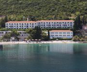
Hotel Faraon
Videos from this area
These are videos related to the place based on their proximity to this place.
Droga do Loviste
Droga do Loviste, z placu widokowego obok budki obserwacyjnej. Jakość Full HD z obniżoną ilością klatek na sekundę i bez dźwięku.
Pferd beim Schwimmen in Trpanj - Kroatien
Das Pferd samt Reiterin war am Camp Vrila in Trpanj (Halbinsel Peljesac - Kroatien) beim Schwimmen.
Camp site Vrila - Trpanja - Peljesac
http://www.avtokampi.si - Auto camp Vrila is located 1km eastern from city Trpanj, where ferry from Ploce is arriving. Camp has found its place in a private bay with pebbled beach and many...
Jackals (sciacalli) in Croazia
Coro di ululati di un branco di sciacalli registrato il 22 giugno 2013 nella penisola di Peljesac, nei pressi di Trpanj, in Croazia. Le immagini sono di repertorio.
Videos provided by Youtube are under the copyright of their owners.
Attractions and noteworthy things
Distances are based on the centre of the city/town and sightseeing location. This list contains brief abstracts about monuments, holiday activities, national parcs, museums, organisations and more from the area as well as interesting facts about the region itself. Where available, you'll find the corresponding homepage. Otherwise the related wikipedia article.
Donja Banda
Donja Banda is a village in Croatia. It is connected by the D414 highway.
Potomje
Potomje is a settlement in Croatia. It is connected by the D414 road.
Pijavičino
Pijavičino is a village in Croatia. It is connected by the D414 highway.
Dingač
Dingač is a wine growing region on the Pelješac Peninsula in the Dalmatian region of Croatia that is part of the larger, Coastal (Primorska) Region. Situated on the southwestern facing slope of the Zabrada mountains between the small villages of Trstenik and Podobuče, it is a highly regarded area for growing the autochthonous Croatian red wine grape, Plavac Mali. Like the neighboring Postup region, the land is very rugged karst with little top soil.


