Safety Score: 3,3 of 5.0 based on data from 9 authorites. Meaning please reconsider your need to travel to Costa Rica.
Travel warnings are updated daily. Source: Travel Warning Costa Rica. Last Update: 2024-08-13 08:21:03
Explore Montelimar
The district Montelimar of in Goicoechea (Provincia de San José) is located in Costa Rica a little north-east of San Jose, the country's capital.
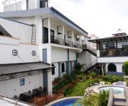
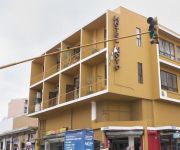
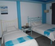
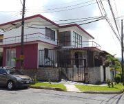
If you need a place to sleep, we compiled a list of available hotels close to the map centre further down the page.
Depending on your travel schedule, you might want to pay a visit to some of the following locations: San Pedro, San Jose, Heredia, Alajuela and Cartago. To further explore this place, just scroll down and browse the available info.
Local weather forecast
Todays Local Weather Conditions & Forecast: 26°C / 78 °F
| Morning Temperature | 17°C / 62 °F |
| Evening Temperature | 19°C / 67 °F |
| Night Temperature | 17°C / 63 °F |
| Chance of rainfall | 5% |
| Air Humidity | 61% |
| Air Pressure | 1013 hPa |
| Wind Speed | Light breeze with 4 km/h (3 mph) from South-West |
| Cloud Conditions | Scattered clouds, covering 43% of sky |
| General Conditions | Light rain |
Friday, 22nd of November 2024
24°C (74 °F)
17°C (63 °F)
Light rain, light breeze, overcast clouds.
Saturday, 23rd of November 2024
19°C (66 °F)
17°C (63 °F)
Light rain, light breeze, overcast clouds.
Sunday, 24th of November 2024
21°C (70 °F)
18°C (64 °F)
Light rain, light breeze, overcast clouds.
Hotels and Places to Stay
Radisson San Jose-Costa Rica
Sleep Inn Hotel Paseo Las Damas
Santo Tomas
EXE SAN JOSE CENTER
Boutique Hotel Jade
Hotel Novo
Hotel Casa Cambranes
Hotel Casa Blanca 506
The Palm House Inn
Casa Voltaire
Videos from this area
These are videos related to the place based on their proximity to this place.
Bar El Retrovisor, San Pedro
Video tomado en el bar El Retrovisor, en San Pedro, en la sección electrónica.
Rata en Supermercado de Guadalupe, Costa Rica
Me encontraba realizando unas compras en un supermercado que se encuentra en el Centro Comercial Guadalupe y fui testigo de este inusual animalito en este local. Esto ocurrió el 30 de mayo...
Palomas Muertas En El Parque De Guadalupe, Costa Rica.
Despues de orden sanitaria a la Municipalidad de Goicochea por la sobrepoblación de palomas de castilla. Inicia la muerte de las palomas en el parque, con cadaveres sobre la zona verde, a...
Cantata de Celebración. 44 aniversario del Templo Bautista Misionero de Guadalupe
Cantata de celebración realizada en Mayo de 2012 con motivo de nuestro 44 aniversario a cargo del director de coros M.A Óscar Leal Méndez. Audio: Juan Carlos Blanco Transmisión: Andrés...
Sacramento de la Confirmación
Video presentado en la Jornada Sacramental de la Parroquia Nuestra Señora de Guadalupe el 20/05/2012.
Apollo 2423-2473 en Calle Blancos. 08/12
Apollo 2423-2473 en Calle Blancos. 08/12 A su regreso de Heredia.
Adoración en Iglesia El Divino Salvador de Calle Blancos.
La Adoración...momento muy importante en el culto, donde podemos estar ante la presencia del Señor.." ADOREMOS EN ESPIRITU Y EN VERDAD, PORQUE EL PADRE TALES...
Cruce de trenes Apolos
Me ubico en San Francisco de Calle Blancos donde la Unidad Apolo 2463-2413, proveniente de la U Latina, se aparte para cruzarse con la Unidad Apolo 2411-2461 proveniente de Heredia.
Instalación del dispositivo z5
Estamos en las instalaciones de Z5 en Calle Blancos, para instalar el dispositivo z5 en un vehículo paso a paso. Esta instalación la puede hacer usted o puede ir a los talleres autorizados...
Videos provided by Youtube are under the copyright of their owners.
Attractions and noteworthy things
Distances are based on the centre of the city/town and sightseeing location. This list contains brief abstracts about monuments, holiday activities, national parcs, museums, organisations and more from the area as well as interesting facts about the region itself. Where available, you'll find the corresponding homepage. Otherwise the related wikipedia article.
Calle de la Amargura
The Calle de la Amargura ("Bitterness Street") is a four-block-long street located in San Pedro de Montes de Oca and is one of the best-known zones in San José, Costa Rica. La Calle, as it is often called, is very close to the University of Costa Rica (UCR) and other important higher education centers.
National Theatre of Costa Rica
The National Theatre of Costa Rica (Spanish: Teatro Nacional de Costa Rica) is the national theatre of Costa Rica. It is located in the central section of San José, Costa Rica. Construction began in 1891, and it opened to the public on 21 October 1897 with a performance of Johann Wolfgang von Goethe's Faust. The National Theatre stood as a cultural asset of the country during a time when coffee exports were a source of its success.
San José (canton)
San José is the name of the first canton in the province of San José in Costa Rica. The canton covers an area of 44.62 km² and has a population of 288,054 (6,455.71 inhabitants per km²). It includes the national capital city of San José. The canton lies on a fertile plain at the southern end of the Central Valley (Meseta Central). The "Río Virilla" and "Río Torres" form the border on the north, while the Río Tiribí marks the southern boundary.
Estadio Ricardo Saprissa Aymá
Estadio Ricardo Saprissa Aymá is one of the main sports stadiums in Costa Rica. It is located in San Juan de Tibás, San José. With a capacity of 24,000, it has one of the highest capacity stadiums in the country. The stadium is the home of Deportivo Saprissa, and was named in honour of the team's founder, Ricardo Saprissa. The stadium is nicknamed the Monster's Cave, due to the team's nickname The Monster.
Estadio Nacional de Costa Rica (2011)
Estadio Nacional de Costa Rica (National Stadium of Costa Rica) is a multi-purpose stadium in La Sabana, San José, Costa Rica. It is the first modern sport and event arena to be built in Central America. The stadium was completed in 2011 and officially opened its doors to the public on Saturday, March 26 of that same year. The stadium replaces the original National Stadium.
Curridabat
Curridabat is a city of the San José Province in Costa Rica. It is situated on the eastern border of the city, San José, above the Desamparados Canton, and below the Montes de Oca Canton. Curridabat has a population of around 34,000 people. This city is part of the canton of Curridabat which has four districts: Curridabat, Granadilla, Sanchez, and Tirrases.
Santo Domingo (canton), Costa Rica
Santo Domingo is the name of the third canton in the province of Heredia in Costa Rica. The canton covers an area of 24.84 km², and has a population of 36,899. The capital city of the canton is also called Santo Domingo. The Río Virilla on the south and the Río Bermúdez on the north establish the boundaries of this elongated province, which then climb up into the Cordillera Central (Central Mountain Range) with the Río Pará Blanca.
Tibas
Tibás is the name of the 13th canton in the province of San José in Costa Rica. The canton covers an area of 8.15 km², and has a population of 76,815. The capital city of the canton is San Juan. The canton forms a northern suburb of the national capital city of San José. It is triangular in shape, with the Río Virilla as its northern boundary. The Quebrada Rivera, a canyon, establishes the southwestern limit of the canton and also a portion of the southeastern boundary.
Goicoechea (canton)
Goicoechea is the name of the eighth canton in the province of San José in Costa Rica. The canton covers an area of 31.5 km, and has a population of 124,704. The capital city of the canton is Guadalupe. The elongated canton snakes its way through the suburban areas just north of San José Centro, climbing steadily into the Cordillera Central (Central Mountain Range) until it reaches it eastern limit between the Río Durazno (on its northern boundary) and the Río Tiribí (on the south).
Merced District
Merced District, the second "distrito" of San José Canton, in Costa Rica, is one of the four administrative units that form San José downtown properly. This division is merely commercial, but covers an important part of "josefino" life and activities.
Catedral District
Catedral District, the fourth "distrito" of San José Canton, Costa Rica, is one of the four administrative units that form San José downtown properly. The district receives its name because of the Cathedral and the catholic Archdiocese of San José, the only archdiocese in the country which lies between its boundaries, along with several other government buildings. The population density is the highest of the four downtown districts.
Zapote District, San José
Zapote District, the fifth "distrito" of San José Canton, Costa Rica, is one of the administrative units surrounding San José downtown. The district is primarily residential, although there are some government buildings, standing out the Presidential House, seat of the government.
San Francisco de Dos Ríos District
San Francisco de Dos Ríos District, the sixth "distrito" of San José Canton, Costa Rica, is one of the administrative units surrounding San José downtown. The district is primarily residential and industrial. It's also famous for the numerous motels between its boundaries.
La Sabana Metropolitan Park
La Sabana Metropolitan Park (Spanish: Parque Metropolitano La Sabana), located in downtown San José, Costa Rica, is the country's biggest and most important urban park. Covering an area of 0.72 km² (72 hectares = 720 000 m2), the park is adjacent to the city's core districts, offering green space and recreation to its residents. Several important institutions and organizations are located inside and in the surroundings of the park.
San Sebastián District
San Sebastian District is one of eight districts of the province Cusco in Peru.
Estadio Nacional de Costa Rica (1924)
Estadio Nacional de Costa Rica (Costa Rica National Stadium) was a multi-use stadium in La Sabana, San José, Costa Rica. It was used mostly for football matches. The stadium held 25,000 and was built in 1924. It was replaced by the current National Stadium. The stadium played host to Amnesty International's Human Rights Now! Benefit Concert on September 13, 1988.
Museo Nacional de Costa Rica
The Museo Nacional de Costa Rica is the national museum of Costa Rica, located in the capital of San José. It is located at Calle 17, between Central and Second Avenue, Cuesta de Moras, in the Bellavista Fortress, a crenallated, ochre colored building opposite the Legislative Assembly of Costa Rica. The fortress was built in 1917 and was originally a military barracks: the exterior walls still have many bullets lodged in them from the country's 1948 civil war.
San José Central Market
San José Central Market is the largest market of the city of San José, Costa Rica. Established in 1880, it occupies an entire block on Avenida Central, 250m northwest of the Parque Central. The market contains a complex of narrow alleys with over 200 shops, stalls, and cheap restaurants called sodas.
Hospital Calderón Guardia
Hospital Calderón Guardia is a hospital in San José, Costa Rica. It is a 622-bed hospital, which is managed by the Costa Rican Social Security System. It has surgical theaters, cardiac and intensive care units and a urology department.
Parroquia San Antonio de Padua
The Parroquia San Antonio de Padua, commonly known as the Iglesia de Curridabat is a church located in Curridabat, Costa Rica.
Parmenio Medina
Parmenio Medina Pérez (January 2, 1939 - July 7, 2001) was a Colombian radio broadcaster and journalist. He was a naturalized citizen of Costa Rica. Medina was a known as a critical journalist widely viewed as inconvenient for organizations accused of abuse or corruption such as the case of the 1979 Vuelta Ciclista a Costa Rica or a 1993 scandal about sport footwear imports. His journalistic work was focused on radio, mostly in journalistic investigations.
El Virilla train accident
The El Virilla train accident occurred in Costa Rica on March 14, 1926 when an overcrowded train carrying mostly farmers and labourers derailed whilst crossing a bridge across the Virilla River Canyon, killing 248 and injuring 93. The train concerned was a Sunday excursion from Alajuela and Heredia to Cartago where most intended to visit the statue of the Le Negrita at the Basílica de Nuestra Señora de Los Ángeles, which supposedly has great healing powers.
Ipís de Goicoechea
Ipís is the fifth district of the Goicoechea county, which is in turn the eighth (08) county of the first province of Costa Rica, San José (1). Its postal code is 10805.
Civil Aviation Direction General (Costa Rica)
The Civil Aviation Direction General (Spanish: Dirección General de Aviación Civil, DGAC) is the civil aviation authority of Costa Rica. It oversees all aspects of civil aviation operations and infrastructure within the country. The body was created by law on 26 October 1949. Its headquarters is in San José.
Chinatown, San José
Not to be confused with the defunct Chinatown of San Jose, California Chinatown in San José, is an urban area located in the capital of Costa Rica. It is the first of its kind in a Central American city. The area began to develop as a commercial center during the last decades of the twentieth century, basically with the advent of supermarkets, shops and some restaurants whose owners are Chinese. The neighborhood was officially opened on Wednesday 5 December 2012.


