Safety Score: 3,3 of 5.0 based on data from 9 authorites. Meaning please reconsider your need to travel to Colombia.
Travel warnings are updated daily. Source: Travel Warning Colombia. Last Update: 2024-08-13 08:21:03
Delve into Miraramar
The district Miraramar of Bogotá in Bogotá D.C. (Bogota D.C.) is a district located in Colombia and is a district of the nations capital.
In need of a room? We compiled a list of available hotels close to the map centre further down the page.
Since you are here already, you might want to pay a visit to some of the following locations: Nocaima, Villavicencio, Tunja, Ibague and Manizales. To further explore this place, just scroll down and browse the available info.
Local weather forecast
Todays Local Weather Conditions & Forecast: 16°C / 60 °F
| Morning Temperature | 10°C / 50 °F |
| Evening Temperature | 13°C / 55 °F |
| Night Temperature | 9°C / 48 °F |
| Chance of rainfall | 8% |
| Air Humidity | 67% |
| Air Pressure | 1015 hPa |
| Wind Speed | Light breeze with 3 km/h (2 mph) from West |
| Cloud Conditions | Overcast clouds, covering 99% of sky |
| General Conditions | Moderate rain |
Tuesday, 19th of November 2024
16°C (60 °F)
10°C (50 °F)
Light rain, gentle breeze, overcast clouds.
Wednesday, 20th of November 2024
16°C (61 °F)
10°C (50 °F)
Moderate rain, light breeze, overcast clouds.
Thursday, 21st of November 2024
16°C (61 °F)
10°C (51 °F)
Moderate rain, light breeze, overcast clouds.
Hotels and Places to Stay
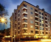
Movich Buro 26
HOTEL 101 PARK HOUSE
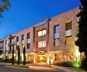
Habitel
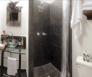
Blue Doors Jazz Apartment
La Colina Hotel Cottage
Courtyard by Marriott Bogota Airport
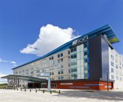
Aloft Bogota Airport
Hotel Suites 108
BEST WESTERN CALLEJA SUITES
100 Wonderful House
Videos from this area
These are videos related to the place based on their proximity to this place.
SALVA EL PLANETA RECICLA ANIMACION EN PLASTILINA
Animacion hecha en plastilina con el mensaje de: recicla, no dejes q los demas hagan lo que tu bedes hacer, cuida el paneta, el nos nesesita cuidemos el planeta.
Corinto Suba es destruida por construccion de apartamentos city tv
En este vídeo se encuentra la publicación de city tv de la problemática que presenta el barrio CORINTO SUBA por cuenta de una construcción de apartamentos llamada MIRADOR CORINTO ...
Hyundai Country Intermunicipal 19 Pasajeros 2005
Hyundai Country Intermunicipal 19 Pasajeros 2005 código 207999 clasificar.com.
Tutorial jugar Resident Evil 5 Online Hamachi Tunngle Windows 7
Pues aqui les dejo un video de como jugar online por hamachi y por tunngle ya que muchos en mis redes me preguntan si todavia tienen dudas con gusto seran resueltas el link del TeknoGods.dll...
Romeo en La Gaitana de Suba
Romeo vive alrededor de un centro de acopio de material de reciclaje en el barrio La Gaitana de Suba.
TERRAZAS DE SUBA - Conjunto Residencial
Conjunto residencial de casas y apartamentos localizado en el sector de Suba en Bogotá D.C., excelente ubicación a 50 metros de la Av. Ciudad de Cali, cerca del Portal de Transmilenio de...
Videos provided by Youtube are under the copyright of their owners.
Attractions and noteworthy things
Distances are based on the centre of the city/town and sightseeing location. This list contains brief abstracts about monuments, holiday activities, national parcs, museums, organisations and more from the area as well as interesting facts about the region itself. Where available, you'll find the corresponding homepage. Otherwise the related wikipedia article.
El Dorado International Airport
El Dorado International Airport is an international airport located in Bogotá, Colombia. It is ranked among the world's 50 busiest airports in terms of: passenger traffic (ranked third in Latin America with 20,427,603 passengers in 2011), cargo traffic (ranked first in Latin America with 648,221 metric tons in 2011) and traffic movements (ranked second in Latin America with 304,330 aircraft movements in 2011).
Engativá
Engativá, which translates to Chieftain of Inga, was a municipality of Cundinamarca, but became a locality of Bogotá, Colombia when Bogotá was made "Special District" (today "Capital District").
Caracol TV
Caracol Televisión is a Colombian private national television network, owned by the Santo Domingo Group.
Gimnasio Campestre
The Gimnasio Campestre is an all-male, traditional and conservative Pre-K to 11th grade private school located in Bogotá, Colombia.
Fontibón
Fontibon is a former municipality located at the westernmost side of Bogotá, Colombia.
Colegio San Carlos
Colegio San Carlos is an all-male, private, bilingual (English and Spanish) school in Bogotá, Colombia. The school has been recognized as the source of many national leaders. The school works under the auspice of the Catholic Benedictine Monasterio de Tibatí. It enrolls 1,400 students in grades Transition through 11th grade which is equivalent to 1st through 12th grades or a combined Primary and Secondary education in the United States.
Barrios Unidos
Barrios Unidos is the 12th locality of Bogotá, capital of Colombia. It is located in the city's north. Barrios Unidos is completely urban, with some light industry and major commercial areas.
Teusaquillo
Teusaquillo is the 13th locality of Bogotá, capital of Colombia. It is located in the geographic center of the city, to the northwest of downtown. It is an urbanized locality with several green zones in its parks, avenues, and the campus of the National University of Colombia. It is located on the former site of an indigenous reserve known as Pueblo Viejo (Old Village), which existed until urbanization in the 20th century.
Escuela Colombiana de Ingeniería
The Escuela Colombiana de Ingeniería (Spanish for Colombian School of Engineering) Julio Garavito is a private engineering-based university. The school is located on a 70-acre campus in a beautiful natural environment in the north part of Bogotá and has approximately 4,600 students in undergraduate and graduate programs.
Usaquén
Usaquén is a residential and commercial locality (district) in northern Bogotá, capital of Colombia. Although it is designated on maps as Bogotá's #1 locality, it was a separate municipality of Cundinamarca until 1954, when it was annexed into the city. Today, Usaquén is home of more than 480.000 inhabitants as projected by 2008. The Cordillera Oriental forms a natural border to the east.
Todelar
Todelar is a system of radio stations that covers all of Colombia, founded in 1953 by Bernardo Tobón de la Roche. Its flagship station is Radio Continental of Bogotá, which joined Todelar in 1957.
Air Command for Military Transportation
Air Command for Military Transportation, (English for Comando Aéreo de Transporte Militar) (CATAM) is major military airfield for the use of the Colombian Air Force. Is located in the outskirts of Bogotá within the vicinity of El Dorado International Airport.
Maloka Museum
The Maloka Museum is an interactive science museum located in Bogotá, Colombia. Visitors interact with a wide variety of exhibits that explore topics in Science and Technology. The museum has 9 rooms, with different science and technology topics; the Telecommunications Room shows interactive games about Binary System, the Computers' language, How does the cellphone work or what's the communication process.
Estadio Compensar
Estadio Compensar is a multi-use stadium in Bogotá, Colombia. It is currently used mostly for football matches and was the home stadium of Academia FC. The stadium holds 4,500 people and opened in 1998.
Cota, Colombia
Cota is a municipality and town of Colombia in the department of Cundinamarca. Jose Nestor Gonzalez Romero is the mayor of Cota. The municipality has 19,664 inhabitants (2005). It is located in the middle interior of the country. Cota is 26 kilometers from the Colombian national capital, Bogota. Cota was founded in 1604 and covers an area of 106 square kilometers, and is situated at an altitude of 2,241 meters.
Guaymaral Airport
Guaymaral Airport is an airport located in Bogotá, Colombia, in the area from which its name was taken, which is located to the north-west of the city, and limits with the towns of Cota and Chía. The airport handles primarily general aviation traffic, type A and B, only VFR. It's the base for private and commercial pilot training schools like Aeroandes and Aeroclub de Colombia
Suba (Bogotá)
Suba is the 11th locality of the Capital District of the Colombian capital city, Bogotá. Suba is located north of the city, limiting to the north with the municipality of Chía in Cundinamarca Department, to the west with the municipality of Cota, to the east with the locality of Usaquén and to the south with the locality of Engativá. its name comes from the Chibcha-Muisca word "Zhuba" meaning "my face" or "my grain"
Alberto Villamizar
Luis Alberto Villamizar Cárdenas (born October 26, 1944 – died July 26, 2007) was a Colombian politician and diplomat. He is best known for his role in fighting the Medellín drug cartel.
Simón Bolívar Park
The Simón Bolívar Metropolitan Park best known as the Simón Bolívar Park is a greenspace and entertainment and sports complex located in the middle of the city of Bogotá, Colombia. The park is named after the Latin American Liberator Simón Bolívar. The park is located in the locality of Teusaquillo and is managed by the District Institute of Recreation and Sport (Instituto Distrital de Recreacion y Deporte - IDRD) . The park is one of the most popular urban parks in the city of Bogotá.
Colombia Masters
The Club Colombia Masters was a golf tournament co-sanctioned by the European Challenge Tour and the Tour de las Américas and was first played in 2007. The event was held at the Country Club de Bogotá, in Bogotá, Colombia. The tournament was organized by the Corporacion Internacional de Golf, managed by German Calle Jr. and Jorge Muñoz. This was the first golf tournament ever to be sanctioned by the European Challenge Tour in Colombia.
Club Campestre El Rancho
The Club Campestre El Rancho is a tennis venue in Bogotá, Colombia. Until 2012, the club was the host of the Copa Colsanitas, a WTA Tour Tier-III event (2001–2008), and from 2009 a WTA International tournament. The club previously hosted an ATP Tour event from 1994-2001. The club has 25 clay courts and a stadium court for 2,500 spectators.
Centro Comercial Santafé
The Centro Comercial Santafé (English: Santafé Shopping Center) is a mall located in the city of Bogotá, Colombia. It is the fourth largest shopping mall in Colombia (the first largest is Centro Mayor in Bogotá), and the fifth in Latin America, surpassed by Leste Aricanduva Mall in São Paulo, Brazil. Opened on May 13, 2006. It is 250,000 square meters, or about 2,700,000 square feet in area.
Colegio Agustiniano Norte
Agustiniano Norte School (also called Colegio Agustiniano Norte, North Augustinian School) is a private, catholic, independent school for men, teaching students from grades kindergarten - 11, located in Bogota, Colombia. Their students and alumni call themselves "Agustinos”.
Luis Carlos Galán Velodrome
The Velódromo Luis Carlos Galán is a velodrome in Bogotá, Colombia, which hosted the 1995 UCI Track Cycling World Championships. The track is 333 metres long and made of concrete.
Bluradio
BluRadio was established in 1976 as Radio Vergante. It transmits from Massino Visconti in the Italian Province of Novara and serves the majority of Northern Italy and Southern Switzerland. It transmits on 102.2FM from San Salvatore as well as several other frequencies such as 88.50 fm, 94.35 fm, 102.9 fm, 101.5 fm and 99.8 fm to accommodate the population of the Italian Alps.


