Safety Score: 3,4 of 5.0 based on data from 9 authorites. Meaning please reconsider your need to travel to China.
Travel warnings are updated daily. Source: Travel Warning China. Last Update: 2024-08-13 08:21:03
Explore Pinglecun
Pinglecun in Heilongjiang is located in China about 649 mi (or 1,044 km) north-east of Beijing, the country's capital.
Local time in Pinglecun is now 01:57 PM (Sunday). The local timezone is named Asia / Shanghai with an UTC offset of 8 hours. We know of 4 airports in the wider vicinity of Pinglecun, of which one is a larger airport. The closest airport in China is Taiping Airport in a distance of 17 mi (or 27 km), West. Besides the airports, there are other travel options available (check left side).
If you need a place to sleep, we compiled a list of available hotels close to the map centre further down the page.
Depending on your travel schedule, you might want to pay a visit to some of the following locations: Harbin, Sheli, Xiangyang, Ashihe and Acheng. To further explore this place, just scroll down and browse the available info.
Local weather forecast
Todays Local Weather Conditions & Forecast: -4°C / 25 °F
| Morning Temperature | -4°C / 24 °F |
| Evening Temperature | -5°C / 23 °F |
| Night Temperature | -7°C / 19 °F |
| Chance of rainfall | 0% |
| Air Humidity | 29% |
| Air Pressure | 1025 hPa |
| Wind Speed | Moderate breeze with 11 km/h (7 mph) from South-East |
| Cloud Conditions | Few clouds, covering 11% of sky |
| General Conditions | Few clouds |
Monday, 18th of November 2024
-7°C (19 °F)
-7°C (19 °F)
Sky is clear, gentle breeze, clear sky.
Tuesday, 19th of November 2024
-1°C (30 °F)
-4°C (26 °F)
Sky is clear, moderate breeze, clear sky.
Wednesday, 20th of November 2024
2°C (35 °F)
-0°C (31 °F)
Few clouds, gentle breeze.
Hotels and Places to Stay
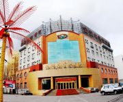
Harbin Jinbaoli Hotel
Videos from this area
These are videos related to the place based on their proximity to this place.
ZD in Harbin.
On the 3rd day he rose.... One must crawl before they walk...one must walk, before they levitate. I have walked to the very end of my path, and to continue my ...
Videos provided by Youtube are under the copyright of their owners.
Attractions and noteworthy things
Distances are based on the centre of the city/town and sightseeing location. This list contains brief abstracts about monuments, holiday activities, national parcs, museums, organisations and more from the area as well as interesting facts about the region itself. Where available, you'll find the corresponding homepage. Otherwise the related wikipedia article.
Unit 731
was a covert biological and chemical warfare research and development unit of the Imperial Japanese Army that undertook lethal human experimentation during the Second Sino-Japanese War (1937–1945) and World War II. It was responsible for some of the most notorious war crimes carried out by Japanese personnel. Unit 731 was based at the Pingfang district of Harbin, the largest city in the Japanese puppet state of Manchukuo.
Pingfang District
Pingfang District is a district in the outskirts of Harbin, China (in the 1930s and 1940s a part of the Japanese puppet state Manchukuo). It was the headquarters of the Japanese Biological Warfare Unit 731 during the Japanese invasion of China and World War II. It had an airport, railway and dungeons. Most of Pingfang was burnt by the Japanese to destroy evidence but the incinerator where the remains of victims were burnt remains and is still in use as part of a factory.


