Safety Score: 3,4 of 5.0 based on data from 9 authorites. Meaning please reconsider your need to travel to China.
Travel warnings are updated daily. Source: Travel Warning China. Last Update: 2024-08-13 08:21:03
Discover Matou
Matou in Beijing Municipality is a place in China about 25 mi (or 40 km) south-east of Beijing, the country's capital city.
Current time in Matou is now 01:10 AM (Friday). The local timezone is named Asia / Shanghai with an UTC offset of 8 hours. We know of 5 airports near Matou, of which 3 are larger airports. The closest airport in China is Beijing Nanyuan Airport in a distance of 23 mi (or 37 km), West. Besides the airports, there are other travel options available (check left side).
There are several Unesco world heritage sites nearby. The closest heritage site in China is Temple of Heaven: an Imperial Sacrificial Altar in Beijing in a distance of 21 mi (or 34 km), West. If you need a hotel, we compiled a list of available hotels close to the map centre further down the page.
While being here, you might want to pay a visit to some of the following locations: Huoxian, Yongledian, Xiji, Gantang and Yujiawu. To further explore this place, just scroll down and browse the available info.
Local weather forecast
Todays Local Weather Conditions & Forecast: 13°C / 55 °F
| Morning Temperature | 7°C / 45 °F |
| Evening Temperature | 11°C / 52 °F |
| Night Temperature | 8°C / 46 °F |
| Chance of rainfall | 0% |
| Air Humidity | 21% |
| Air Pressure | 1025 hPa |
| Wind Speed | Gentle Breeze with 8 km/h (5 mph) from South |
| Cloud Conditions | Clear sky, covering 0% of sky |
| General Conditions | Sky is clear |
Friday, 22nd of November 2024
10°C (50 °F)
7°C (44 °F)
Sky is clear, light breeze, clear sky.
Saturday, 23rd of November 2024
9°C (48 °F)
7°C (44 °F)
Sky is clear, light breeze, clear sky.
Sunday, 24th of November 2024
9°C (49 °F)
8°C (47 °F)
Overcast clouds, light breeze.
Hotels and Places to Stay
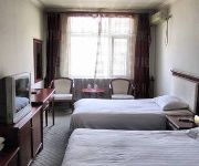
Langfang Xiang'an Hotel Xianghe
Videos from this area
These are videos related to the place based on their proximity to this place.
Chang ge Jamison (Jamison Sings)
Jamison singing at the Children's village shortly after surgery to repair his nose.
Меховая фабрика
наш друг. Леня)) построил новую фабрику. рабочие там работают. питаются и живут. шкуры проходят полный цикл....
Winter in Beijing
In January 2006 I visited Beijing, and also I was more interested in the First City in the World, a new city between Beijing and Tianjin.... After clicked the internet & found the map, I went...
Videos provided by Youtube are under the copyright of their owners.
Attractions and noteworthy things
Distances are based on the centre of the city/town and sightseeing location. This list contains brief abstracts about monuments, holiday activities, national parcs, museums, organisations and more from the area as well as interesting facts about the region itself. Where available, you'll find the corresponding homepage. Otherwise the related wikipedia article.
East Hebei Autonomous Council
The East Hebei Autonomous Council, also known as the East Ji Autonomous Council and the East Hopei Autonomous Anti-Communist Council, was a short-lived late-1930s Japanese puppet state in northern China.
Tungchow Mutiny
The Tungchow Mutiny, sometimes referred to as the Tōngzhōu Incident, was an assault on Japanese civilians and troops by East Hopei Army in Tōngzhōu, China on 29 July 1937 shortly after the Marco Polo Bridge Incident that marked the official beginning of the Second Sino-Japanese War. In early 1937, Tōngzhōu was capital of the East Hopei Government, a Japanese puppet state controlling the strategic eastern district of Beijing.


