Safety Score: 2,8 of 5.0 based on data from 9 authorites. Meaning we advice caution when travelling to Canada.
Travel warnings are updated daily. Source: Travel Warning Canada. Last Update: 2024-08-13 08:21:03
Delve into Burnt Creek
Burnt Creek in Québec is a city located in Canada about 757 mi (or 1,218 km) north-east of Ottawa, the country's capital town.
Current time in Burnt Creek is now 11:23 AM (Friday). The local timezone is named America / Toronto with an UTC offset of -5 hours. We know of 2 airports closer to Burnt Creek. The closest airport in Canada is Schefferville Airport in a distance of 3 mi (or 5 km), East. Besides the airports, there are other travel options available (check left side).
In need of a room? We compiled a list of available hotels close to the map centre further down the page.
To further explore this place, just scroll down and browse the available info.
Hotels and Places to Stay
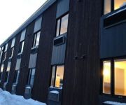
Rodeway Inn Schefferville
Videos from this area
These are videos related to the place based on their proximity to this place.
Canadian Xpress Lockheed C-130 Landing Runway 18 Schefferville (CYKL)
Canadian Xpress Lockheed C-130 Hercules landing runway 18 Lockheed C-130 (CYKL) piloted by CXA001 on a Dell XPS 730X with Microsoft Flight Simulator X. Sorry about the sound quality.
Videos provided by Youtube are under the copyright of their owners.
Attractions and noteworthy things
Distances are based on the centre of the city/town and sightseeing location. This list contains brief abstracts about monuments, holiday activities, national parcs, museums, organisations and more from the area as well as interesting facts about the region itself. Where available, you'll find the corresponding homepage. Otherwise the related wikipedia article.
CFKL-TV
CFKL-TV was a television station based in Schefferville, Quebec. Formerly a private affiliate of CBC Television and Télévision de Radio-Canada, the station was acquired by the Canadian Broadcasting Corporation in 1973 and converted to a rebroadcaster of Montreal's CBMT. The station was owned by the Iron Ore Company of Canada's Aviation subsidiary, and was co-owned with nearby station CJCL-TV in Labrador City.


