Safety Score: 2,8 of 5.0 based on data from 9 authorites. Meaning we advice caution when travelling to Canada.
Travel warnings are updated daily. Source: Travel Warning Canada. Last Update: 2024-08-13 08:21:03
Discover Woodbine Gardens
Woodbine Gardens in Ontario is a place in Canada about 213 mi (or 342 km) south-west of Ottawa, the country's capital city.
Current time in Woodbine Gardens is now 04:53 AM (Saturday). The local timezone is named America / Toronto with an UTC offset of -5 hours. We know of 9 airports near Woodbine Gardens, of which 5 are larger airports. The closest airport in Canada is Billy Bishop Toronto City Centre Airport in a distance of 7 mi (or 12 km), South-West. Besides the airports, there are other travel options available (check left side).
Also, if you like playing golf, there are a few options in driving distance. We encountered 1 points of interest in the vicinity of this place. If you need a hotel, we compiled a list of available hotels close to the map centre further down the page.
While being here, you might want to pay a visit to some of the following locations: Toronto, Milton, Lockport, Buffalo and Albion. To further explore this place, just scroll down and browse the available info.
Local weather forecast
Todays Local Weather Conditions & Forecast: 5°C / 42 °F
| Morning Temperature | 4°C / 39 °F |
| Evening Temperature | 7°C / 44 °F |
| Night Temperature | 5°C / 42 °F |
| Chance of rainfall | 0% |
| Air Humidity | 89% |
| Air Pressure | 1006 hPa |
| Wind Speed | Gentle Breeze with 8 km/h (5 mph) from East |
| Cloud Conditions | Overcast clouds, covering 99% of sky |
| General Conditions | Light rain |
Saturday, 23rd of November 2024
5°C (41 °F)
3°C (37 °F)
Overcast clouds, moderate breeze.
Sunday, 24th of November 2024
5°C (42 °F)
6°C (44 °F)
Broken clouds, moderate breeze.
Monday, 25th of November 2024
6°C (43 °F)
4°C (38 °F)
Moderate rain, fresh breeze, overcast clouds.
Hotels and Places to Stay
Toronto The Westin Prince
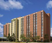
Delta Toronto East
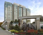
DELSUITES FOREST VIEW
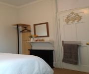
The Percy Bed & Breakfast
Corktown Cottage
Cabbageville Bed and Beverage
Toronto Furnished Living - Forest Manor
Great Gerrard - Mona Lisa Suite
DAYS HOTEL & CONFERENCE CENTRE
Upper Beach Apartment
Videos from this area
These are videos related to the place based on their proximity to this place.
First Multi-Storey Car Park
The earliest known multi-storey car park was built in 1918 for the Hotel La Salle at 215 West Washington Street in the West Loop area of downtown Chicago, Illinois. It was designed by Holabird...
Scarborough Apartments for Rent Video - 2283 Eglinton Avenue
http://www.caprent.com/properties/ontario/toronto/2283_eglinton.aspx for more information on these apartments for rent in Scarborough visit our web page 2283 Eglinton Avenue Apartments 2283...
May 8, 2011 Victoria Park Station
May 08, 2011: Elevators should be up and running by July with luck. The new east entrance is nearing completion. The west walkway is now open. New styleof station signs going up to replace...
View of Victoria Park Bus Terminal
Feb 15-09: A subway train heading westbound departs Victoria Park Station. We can see the soon to be torn dor bus terminal.
Final View of Victoria Park Bus Terminal
March 11-09: We see the last remains of the existing bus terminal looking eastbound from Victoria Park. 2 bus bays are gone with 2 more being torn done. The upper level will start to disappear...
April 9 Victoria Park from the street.
April 09-09: We can see 90% 0f the existing bus deck is gone. We can see the last remaining stair to platform 1 still in place. The remaining section for the north end as well the cover walkway...
Victoria Park Bus Deck from the west
March 23-09: As we arrive east bound at Victoria Park TTC station, we can see about 25% of the existing bus deck gone.
April 9 Victoria Park from the end
April 09-09: The dump truck is blocking the view of the remains of the bus terminal and we can see it almost gone. The remaining walkway and part of the north end should be down by April 17.
April 9 Victoria Park from Top centre
April 09-09: We can see what has happen since the last visit and very little remain of the existing bus terminal.
Videos provided by Youtube are under the copyright of their owners.
Attractions and noteworthy things
Distances are based on the centre of the city/town and sightseeing location. This list contains brief abstracts about monuments, holiday activities, national parcs, museums, organisations and more from the area as well as interesting facts about the region itself. Where available, you'll find the corresponding homepage. Otherwise the related wikipedia article.
Victoria Park (TTC)
Victoria Park is a station on the Bloor–Danforth line of the subway system in Toronto, Canada. It is located at 777 Victoria Park Avenue, one block north of Danforth Avenue. The station itself can be accessed by pedestrians via Victoria Park Avenue, by Albion Avenue, through an automated entrance from Teesdale Place, or via a walkway that leads to the nearby Crescent Town area.
Golden Mile, Toronto
The Golden Mile in the Scarborough district of Toronto, Ontario, Canada, is a stretch of Eglinton Avenue East that is the site of intensive industrial and commercial development. It was one of Canada's first model industrial parks. The original Golden Mile of Industry ran along Eglinton from Pharmacy Avenue east to Birchmount Road.
Clairlea
Clairlea is a neighbourhood of Scarborough, in the city of Toronto, Ontario, Canada. The neighbourhood is located in the western part of Scarborough just east of Victoria Park Avenue. To the north it is bounded by Eglinton Avenue and to the south by Taylor-Massey Creek and the railway tracks. In the 19th century the intersection of St. Clair and Victoria Park was home to a small village named Moffat's Corners, and the rest of the region was rural.
SATEC @ W. A. Porter Collegiate Institute
Scarborough Academy of Technological, Environmental and Computer Education @ W. A. Porter Collegiate Institute (SATEC) is a secondary school located in Scarborough, Toronto, Canada. The school, part of the Toronto District School Board, celebrated its 50th anniversary in 2008, coinciding with the PEO Engineering Education Conference of the same year. In 2010, SATEC became a certified, platinum Eco-School of the TDSB.
List of places on Degrassi
This is a list of notable places seen and featured in the Degrassi universe. As the series occurs in Toronto, these places—some fictional, some not—are located in the aforementioned city.
Providence Healthcare (Toronto)
Providence Healthcare is a health care facility in Toronto, Ontario, Canada, specializing in rehabilitation for patients who have experienced strokes, orthopaedic surgery, or lower limb amputation, or who require specialized geriatric rehabilitation, assessment and treatment. It also provides long-term care and community outreach for individuals with geriatric conditions. It is located in Scarborough near the Warden subway station. The current chair of the hospital is Ms. Gretchen Van Riesen.
Dawes Road Cemetery
Dawes Road Cemetery is a Jewish cemetery in Toronto, Ontario, Canada. It is located in Scarborough, on St. Clair Avenue east of Victoria Park Avenue. Established in 1903, it was the third Jewish cemetery in Toronto. The first cemeteries, the Pape Avenue Cemetery and Jones Avenue Cemetery, had been established in the eastern part of the city. Dawes Road Cemetery was also placed in what was then a rural area on the edge of the city.
Eglinton Square Shopping Centre
Eglinton Square Shopping Centre is a shopping mall in Toronto, Ontario, Canada. It was one of the first malls in Toronto, opening in 1954. It is owned by Primaris REIT. It has approximately 279,000 sq ft . retail space with over 80 retail outlets. Its original anchors were Dominion supermarket and Morgan's department store. It has a food court, bank, and a branch of the Toronto Public Library. As of 2010, the mall has a Toys "R" Us express.
Bermondsey, Toronto
Bermondsey is an industrial area in Toronto, Canada. It covers a rough triangle with the Don Valley to the west, Eglinton Avenue to the northeast and O'Connor Drive to the southeast. It straddles the border of the former cities of North York and East York. The area is named after Bermondsey Drive that runs through the centre of the district.


