Safety Score: 2,8 of 5.0 based on data from 9 authorites. Meaning we advice caution when travelling to Canada.
Travel warnings are updated daily. Source: Travel Warning Canada. Last Update: 2024-08-13 08:21:03
Delve into Ward's Island
Ward's Island in Ontario is a city located in Canada about 218 mi (or 351 km) south-west of Ottawa, the country's capital town.
Current time in Ward's Island is now 05:31 PM (Saturday). The local timezone is named America / Toronto with an UTC offset of -4 hours. We know of 12 airports closer to Ward's Island, of which 5 are larger airports. The closest airport in Canada is Billy Bishop Toronto City Centre Airport in a distance of 2 mi (or 3 km), West. Besides the airports, there are other travel options available (check left side).
Also, if you like playing golf, there are some options within driving distance. We saw 1 points of interest near this location. In need of a room? We compiled a list of available hotels close to the map centre further down the page.
Since you are here already, you might want to pay a visit to some of the following locations: Toronto, Milton, Lockport, Buffalo and Albion. To further explore this place, just scroll down and browse the available info.
Local weather forecast
Todays Local Weather Conditions & Forecast: 7°C / 44 °F
| Morning Temperature | 3°C / 38 °F |
| Evening Temperature | 9°C / 48 °F |
| Night Temperature | 7°C / 45 °F |
| Chance of rainfall | 0% |
| Air Humidity | 52% |
| Air Pressure | 1030 hPa |
| Wind Speed | Gentle Breeze with 7 km/h (4 mph) from South-East |
| Cloud Conditions | Few clouds, covering 15% of sky |
| General Conditions | Few clouds |
Saturday, 2nd of November 2024
9°C (48 °F)
9°C (48 °F)
Broken clouds, gentle breeze.
Sunday, 3rd of November 2024
15°C (59 °F)
16°C (61 °F)
Overcast clouds, gentle breeze.
Monday, 4th of November 2024
19°C (66 °F)
20°C (67 °F)
Light rain, moderate breeze, overcast clouds.
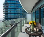
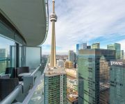
Hotels and Places to Stay
Noel Suites York and Bremner
ONE KING WEST HOTEL AND RESIDENCE
The Percy Bed & Breakfast
Noel suites York and Harbour
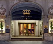
The Omni King Edward Hotel
FAIRMONT ROYAL YORK
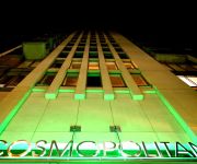
EXECUTIVE COSMOPOLITAN HOTEL
Quiet Urban Chalet - Downtown Toronto
Noel Suites York and Simcoe
Noel Suites York St and Lakeshore Blvd
Videos from this area
These are videos related to the place based on their proximity to this place.
Toronto Downtown Travel Front Street and St.Lawrence Market
Front Street at Downtown Toronto is a nice choice for walking. we started from Union Station and forwarding to the east. our goal was the St. Lawrence Market, but it was closed for renovation,...
Toronto, Distillery District and St. James Cathedral - Canada HD Travel Channel
Toronto - Distillery and St. James Cathedral http://www.myvideomedia.com English see below [dt.] Die Distillery im Südosten von Toronto war einst mit seinen 44 Hallen die größte Whiskey...
St. Lawrence Market, Toronto - Canada HD Travel Channel
St. Lawrence Market, Toronto. Canada http://www.myvideomedia.com english see below [dt.] Der St. Lawrence Market liegt im östlichen Teil der Innenstadt von Toronto, westlich von der Lower...
★ River City Condos Phase 2 | River City Phase 2 | New Developments
http://www.AshleyFray.com 416-917-4007 Call Ashley Fray, Re/max Agent, your expert in Toronto condos, condominiums, lofts, houses, and homes for sale at 416-917-4007. Buying or selling...
Ward's Island
On Ongiara Ferry deck approaching Ward's Island ferry dock. Toronto Island.East End. Taken Feb. 15,2011.
Wards Island Ferry Arrives
Wards island ferry terminal,Ongiara car ferry arrives on warm spring day at Toronto Island.
Hockey game - Toronto Islands, Canada
Kids playing hockey on a sunny day at the Ward Island in Toronto. -20ºC was the temperature at that day with the wind chill.
Toronto Island Time-Lapse
From www.dancelikenooneiswatching.com - Time Lapse video taken on the Toronto Islands at Sunset. This scene was done with a Nikon D80 and the Pclix LT100 to trigger the camera. Most shots are...
How To Take A Toronto Island Bike Tour: Travel Tip Tuesday
http://www.cruisinaltitude.com This week, I take a bike tour of the Toronto Island in Toronto, ON Canada. The tour was compliments of Tourism Canada and given by Toronto Bicycle Tours at http://ww...
Videos provided by Youtube are under the copyright of their owners.
Attractions and noteworthy things
Distances are based on the centre of the city/town and sightseeing location. This list contains brief abstracts about monuments, holiday activities, national parcs, museums, organisations and more from the area as well as interesting facts about the region itself. Where available, you'll find the corresponding homepage. Otherwise the related wikipedia article.
Cherry Beach
Cherry Beach is a lakeside park located at the foot of Cherry Street just south of Unwin Avenue in Toronto, Ontario, Canada. It is on Toronto's outer harbour just east of the Eastern Gap. It was originally named Clarke Beach Park after Harry Clarke, a Toronto alderman who was responsible for creating the park in the early 1930s. In 2003, the city changed it to Cherry Beach which is the local common name.
Polson Pier
Polson Pier, previously known as The Docks Waterfront Entertainment Complex or The Docks, is a multi-purpose entertainment venue in Toronto, Ontario, Canada. It is located in largely industrial Port Lands area of the city along the shore of Toronto Harbour. It includes the Sound Academy, which is a concert hall/nightclub with a capacity of 3,230 occupants over 13,240 square feet of floor space. A balcony is located above.
Victory Soya Mills Silos
Victory Soya Mills Silos in the east end of Toronto's harbourfront is one of the two remaining silos from Toronto's industrial port era. They were built by E.P. Taylor Victory Mills company in 1943 to house the soy beans used by a large plant that reprocessed the soy for a variety of purposes. The abandoned silos have been a temporary home for the homeless and abandoned since the 1980s. Although a heritage site, there are no plans to renovate or reuse the building.
Varekai
Varekai is a Cirque du Soleil touring production that premiered in Montréal in April 2002. Its title means "wherever" in the Romani language, and the show is an "acrobatic tribute to the nomadic soul". The show begins with the Greek myth of Icarus, picking up where the myth leaves off, reimagining the story of what happened to Icarus after he flew too close to the sun and fell from the sky.
Cherry Beach Sound
Cherry Beach Sound is a recording studio in the Port Lands of Toronto, Canada at 33 Villiers Street. It is in Toronto's growing film district and is also a successful audio post-production house; TV, radio, and film commercials and or advertisements are often mixed in stereo or 5.1 surround sound.
Ward's Island Beach and Island Beach
Ward's Island Beach and Island Beach are two of three beaches on Toronto Islands. Ward's Island Beach is located on the island east end near the Eastern Gap. Island Beach is located on the south side of the island and faces out to Lake Ontario. The beach is actually two beaches with the portion west of the Lookout Pier called Manitou Beach. The eastern boundary is near the western end of the boardwalk from Ward's Island.
Cherry Street Strauss Trunnion Bascule Bridge
The Cherry Street Strauss Trunnion Bascule Bridge is a bascule bridge in Toronto, Ontario, Canada. Located in the industrial Port Lands area, it carries Cherry Street over the Toronto Harbour Ship Channel and opens to allow ships to access the channel and the turning basin beyond. The bridge was built in 1931 by the company of Joseph Strauss and the Dominion Bridge Company. The north side of the bridge has 750 ton concrete counterweights that allow the bridge to pivot to open.
Maple Leaf Mills Silos
Maple Leaf Mills Silos was one of two silo complexes that built the area between Spadina Quay and Maple Leaf Quay, on Toronto Harbour, in Toronto, Ontario, Canada. It was also one of three silos that was found along the city's waterfront. Built in 1928, the silos marked an age when goods were being shipped into Toronto. Towards the end, the silos also marked the ports decline and the desire to remove the industrial eyesore along Toronto's waterfront. They were removed in 1983.
East Bayfront
East Bayfront, or the East Bayfront Precinct, is an emerging neighbourhood in Toronto, Ontario, Canada. It is currently undergoing a transformation from industrial use to mixed-use as part of Waterfront Toronto's plans to create a residential and commercial district urban core near the lake. The area is bordered by the Parliament Street to the east, Jarvis Street and the Jarvis Slip to the west, and the rail line and Gardiner Expressway to the north. The area is 15.5 hectares of land.
International Marine Passenger Terminal
The Port of Toronto’s International Marine Passenger Terminal was built in 2005 to accommodate The Spirit of Ontario I a water-jet powered big catamaran fast ferry that was to make several round trips per day between Toronto, Ontario, Canada and Rochester, New York, USA. The terminal is at 8 Unwin Avenue, in the old Portlands, near Cherry Beach. The ground-breaking took place on August 24, 2004. The two storey terminal building's floor space is 38,000 square feet .
Cherry Street (Toronto)
Cherry Street is a north-south roadway in Toronto, Ontario, Canada. Toronto's only two lift-bridges are on Cherry Street, a smaller one where it crosses the Keating Channel and a larger one where it crosses the channel to the turning basin. Its northern terminus is at Eastern Avenue. A co-linear street, named Sumach St. , continues north. It crosses Front St. , Mill St. , Lakeshore Boulevard, Commissioners Street and Unwin Ave.
Cherry Street lift bridge
The Cherry Street lift bridge over the Keating Channel is the smaller of two bascule lift bridges on Cherry Street, in Toronto, Ontario, Canada. In 1995 several changes were made to provide "enhanced safety for cyclists, skaters and pedestrians. " As built the entire deck of the bridge, including the sidewalk, was a steel mesh.


