Safety Score: 2,8 of 5.0 based on data from 9 authorites. Meaning we advice caution when travelling to Canada.
Travel warnings are updated daily. Source: Travel Warning Canada. Last Update: 2024-08-13 08:21:03
Explore Mount Slaven
The district Mount Slaven of Orillia in Ontario is located in Canada about 191 mi west of Ottawa, the country's capital.
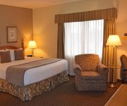
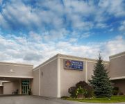
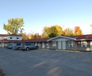
If you need a place to sleep, we compiled a list of available hotels close to the map centre further down the page.
Depending on your travel schedule, you might want to pay a visit to some of the following locations: Toronto, Milton, Lockport, Buffalo and Albion. To further explore this place, just scroll down and browse the available info.
Local weather forecast
Todays Local Weather Conditions & Forecast: -3°C / 27 °F
| Morning Temperature | -7°C / 19 °F |
| Evening Temperature | -2°C / 28 °F |
| Night Temperature | -1°C / 30 °F |
| Chance of rainfall | 1% |
| Air Humidity | 82% |
| Air Pressure | 1027 hPa |
| Wind Speed | Moderate breeze with 12 km/h (7 mph) from North-East |
| Cloud Conditions | Broken clouds, covering 51% of sky |
| General Conditions | Snow |
Wednesday, 4th of December 2024
-1°C (31 °F)
0°C (32 °F)
Snow, fresh breeze, overcast clouds.
Thursday, 5th of December 2024
-1°C (30 °F)
-7°C (19 °F)
Snow, fresh breeze, broken clouds.
Friday, 6th of December 2024
-5°C (24 °F)
-8°C (19 °F)
Snow, moderate breeze, overcast clouds.
Hotels and Places to Stay
Stone Gate Inn
BW PLUS MARIPOSA INN AND CONF
BW PLUS ORILLIA HOTEL
Fern Resort - all inclusive meal plan
Econo Lodge Orillia
Comfort Inn Orillia
Maples Motel
Kings Inn - Orillia
DAYS INN - ORILLIA
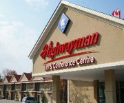
HIGHWAYMAN INN AND CONFERENCE CENTRE
Videos from this area
These are videos related to the place based on their proximity to this place.
Edmonton Crew Heading Home
Brian, Kristy, Nate and Nikita The Dog have packed up and are heading home. Good thing Brian had all that MSE-Ops training to get that trailer out of the driveway! It's going to be a long drive...
Fourtoes Watersports Pyramid
Weekly Ski and Stunt Show at Fern Resort in Orillia. Emma, Hal, Jer, Mark, Laura, Emily, Krista, and Lindsay on top. Wess driving. Someone spotting.
A Dog Walking The Trails
Walking the urban nature trails with A Dog. She's a good dog. She stays right with me all the time. Except when she doesn't, which is rare. Please excuse the sudden camera movements. Mosquitoes...
In Human Form - Sedated Mind (Death Cover)
Sedated Mind playing another awesome Canada Day show ending their set with a little bit of Death.
HD Real Estate Video Tour with Voice Over: Lake-view Penthouse Condo - Wagner Media
http://www.wagnermedia.ca - HD Real Estate Video Tour: Lake-view Penthouse Condo - produced by Wagner Media.
Trip #3 West Street South Orillia Ontario
Dangle down West Street South, from Coldwater Road, having fun with confused Fire Engines. Yes, West Street does run north and south. At the time it was named, it was the most westerly street...
Boat Cruise To Orillia
The first trip to the Port of Orillia aboard the Big Boy. Taken on the Canadian Thanksgiving long weekend, October 9, 2011. Filmed with GoPro camera. +++ More boating fun at http://Boogabooster.com...
PropertyGuys.com Presents 5 Invermara Court #27 Orillia
5 Imvermara Court #27 Orillia, ON Sophie's Landing Go to PropertyGuys.com Sign #256325 for complete details, pictures and seller's contact information. To list your home with PropertyGuys.com...
Videos provided by Youtube are under the copyright of their owners.
Attractions and noteworthy things
Distances are based on the centre of the city/town and sightseeing location. This list contains brief abstracts about monuments, holiday activities, national parcs, museums, organisations and more from the area as well as interesting facts about the region itself. Where available, you'll find the corresponding homepage. Otherwise the related wikipedia article.
Orillia
Orillia is a city located in Simcoe County in Southern (South-Central) Ontario, Canada, between Lake Couchiching and Lake Simcoe, 135 kilometres north of Toronto. Originally incorporated as a village in 1867, the history of what is today the City of Orillia dates back at least several thousand years.
Lake Simcoe
Lake Simcoe is a lake in Southern Ontario, Canada, the fourth-largest lake wholly in the province, after Lake Nipigon, Lac Seul, and Lake Nipissing. At the time of the first European contact in the 17th century the lake was called Ouentironk ("Beautiful Water") by the Huron natives. It was also known as Lake Toronto until it was renamed by John Graves Simcoe, the first Lieutenant-Governor of Upper Canada, in memory of his father.
Lake Couchiching
Lake Couchiching, from the Ojibwe gojijiing meaning "inlet", is a medium-sized lake in Central Ontario separated from Lake Simcoe by a narrow channel. The Trent-Severn Waterway enters Lake Simcoe by the Talbot River and exits this lake by the Severn River which empties into Georgian Bay. The lake is 16 km long, slightly less than 5 km wide and fairly shallow with an average depth of six metres. The city of Orillia is located on the narrow channel connecting this lake with Lake Simcoe.
Casino Rama
Casino Rama is a large casino, hotel and entertainment complex located on the reserve land of Chippewas of Rama First Nation, in the town of Rama, Ontario, Canada. A joint venture between First Nations, commercial operators Penn National Gaming, and the Ontario Lottery and Gaming Corporation, it is Ontario's only First Nations "commercial casino" (as opposed to a lesser class, Charity casino) and the largest First Nations casino in Canada.
Severn Bridge, Ontario
Severn Bridge, Ontario is a small community in the Town of Gravenhurst, Ontario of the District of Muskoka in the province of Ontario, Canada. It is located around 100 kilometres north of Toronto, on the Severn River, roughly halfway between Orillia and Gravenhurst. Its population is around 300. It was founded in the nineteenth century. The village is served by important road, rail, water links and its postal services and rural route are handled in Washago, Ontario.
Washago railway station
Washago railway station is located in the community of Washago, Ontario, Canada. The actual location is south off Simcoe County Road 169 east of Highway 11. It is the first station stop northwest of Toronto Union Station for Via Rail's Canadian. Prior to its discontinuation in 2012, it was also the first stop northwest of Union Station for the Ontario Northland Railway's Northlander. The station is unstaffed with all ticketing and baggage handling services provided by onboard train staff.
Webers
Webers is a hamburger restaurant on Ontario Highway 11 near Orillia, Ontario. Opened in July 1963, Webers grills their burgers over charcoal, with a grill man said to be able to flip up to 800 patties an hour. Long line ups are a common sight at the restaurant, which built a footbridge over the highway to provide access for guests from the southbound side. The restaurant's hamburger patties are also sold at Loblaws outlets.
Mara Provincial Park (Ontario)
Mara Provincial Park is a provincial park in located near Orillia, Ontario, Canada. It is situated on the northern shore of Lake Simcoe, and provides camping, boating, swimming and other recreational activities.
Rama, Ontario
Rama is in Ontario, Canada. Home of the Chippewas of Rama First Nation and Casino Rama. The community sports complex is called the Mnjikaning Arena Sports Ki, which was the home arena of the Couchiching Terriers ice hockey team, once affiliated with the Barrie Colts. The Ramakings lacrosse team also plays at the MASK. The Ontario Provincial Police provides dispatching services for the community, but the officers that police the town of Rama are members of the Mnjikaning Police Service.
Barrie Speedway
Barrie Speedway is a 1/3 mile tri-oval racing track located in Oro-Medonte, Ontario, Canada, north of Barrie. It is a member of the NASCAR Whelen All-American Series for the Ontario Provincial and National (Continental) championships, and hosts a NASCAR Canadian Tire Series race. Past Winners of the NCTS race: 2007 D. J. Kennington 2008 Scott Steckly 2009 Don Thomson, Jr. 2010 D. J.
Orillia Park Street Collegiate
Park Street Collegiate Institute (PSCI) is a secondary school located in Orillia, Ontario, Canada. It was built in 1961 to help with the overflow of students from Orillia District Collegiate & Vocational Institute. In March, 2008, a review process will begin to consolidate Orillia's three public high schools into two buildings as a result of cost of maintenance of the aging buildings and the declining enrolment at PSCI.
Chippewas of Rama First Nation
Chippewas of Rama First Nation, also known as Chippewas of Mnjikaning and Chippewas of Rama Mnjikaning First Nation, is Anishinaabe First Nation located in the province of Ontario in Canada. The name Mnjikaning, or fully vocalized as Minjikaning, refers to the fishing weirs at Atherley Narrows between Lake Simcoe and Lake Couchiching and it means “in/on/at or near the fence”. Rama sits on approximately 2,350 acres of land on eight separate parcels.
Orillia Transit
Orillia Transit is operated by First Student Canada (formerly Laidlaw School Transit) under contract to the City of Orillia in central Ontario, Canada. First Student Canada provides drivers, maintains the vehicles and supplies fuel. Service is provided on four routes throughout the city every day except Sundays and statutory holidays, and one weekday special industrial area service.
Orillia District Collegiate & Vocational Institute
Orillia District Collegiate & Vocational Institute is in Orillia, Ontario in Canada. School Enrolment (2005-2006): 1004
Cumberland, Simcoe County, Ontario
Cumberland is a community in Ontario.
Strawberry Island (Lake Simcoe)
Strawberry Island is an island in Lake Simcoe, Ontario, Canada. It is operated by the Roman Catholic Congregation of St. Basil as a place of retreat. On previous visits to Toronto, Pope John Paul II has stayed here. It is about a one hour drive north of Toronto. The Basilians only use it during the summer holidays.


