Safety Score: 2,8 of 5.0 based on data from 9 authorites. Meaning we advice caution when travelling to Canada.
Travel warnings are updated daily. Source: Travel Warning Canada. Last Update: 2024-08-13 08:21:03
Delve into Corso Italia
Corso Italia in Ontario is a city located in Canada about 220 mi (or 354 km) south-west of Ottawa, the country's capital town.
Current time in Corso Italia is now 03:13 AM (Sunday). The local timezone is named America / Toronto with an UTC offset of -5 hours. We know of 9 airports closer to Corso Italia, of which 5 are larger airports. The closest airport in Canada is Billy Bishop Toronto City Centre Airport in a distance of 4 mi (or 7 km), South-East. Besides the airports, there are other travel options available (check left side).
Also, if you like playing golf, there are some options within driving distance. We saw 2 points of interest near this location. In need of a room? We compiled a list of available hotels close to the map centre further down the page.
Since you are here already, you might want to pay a visit to some of the following locations: Toronto, Milton, Lockport, Buffalo and Albion. To further explore this place, just scroll down and browse the available info.
Local weather forecast
Todays Local Weather Conditions & Forecast: 6°C / 43 °F
| Morning Temperature | 5°C / 40 °F |
| Evening Temperature | 5°C / 42 °F |
| Night Temperature | 4°C / 39 °F |
| Chance of rainfall | 0% |
| Air Humidity | 50% |
| Air Pressure | 1014 hPa |
| Wind Speed | Moderate breeze with 9 km/h (6 mph) from South-East |
| Cloud Conditions | Overcast clouds, covering 100% of sky |
| General Conditions | Overcast clouds |
Sunday, 24th of November 2024
5°C (41 °F)
7°C (44 °F)
Light rain, gentle breeze, overcast clouds.
Monday, 25th of November 2024
5°C (41 °F)
4°C (39 °F)
Rain and snow, moderate breeze, overcast clouds.
Tuesday, 26th of November 2024
6°C (42 °F)
3°C (37 °F)
Broken clouds, moderate breeze.
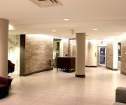
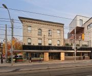
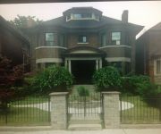
Hotels and Places to Stay
JJ Furnished Apartments Downtown Toronto: King's Luxury Loft
InterContinental Hotels TORONTO YORKVILLE
Holiday Inn TORONTO-YORKDALE
Drake Hotel
Rose Garden Bed and Breakfast
The Garden House B & B
Toronto Escape - The Quartz Townhouse
Dunn House Bed and Breakfast
Spadina 11 Guesthouse
Inverness High Park Bed & Breakfast
Videos from this area
These are videos related to the place based on their proximity to this place.
Toronto Homestay Room- Very Convenient
Room in Toronto- ideal hotel alternative: Clean, Safe, Convenient 1min walk to 24hr TTC bus (32Eglinton and 29Dufferin), 63Ossington 90Vaughan from St Clair West Subway Stn- stops beside the...
Investing In Hillcrest Village Toronto Gut Renovation - Episode #183
We are in Hillcrest Village in Toronto and this is the before renovations video. To see the after video click here: Episode #184 - Investing in Hillcrest Village Toronto Legal Duplex http://beachi...
Investing In Hillcrest Village Toronto Legal Duplex - Episode #184
We are in Hillcrest Village in Toronto and this is a continuation from Episode #183 - Investing in Hillcrest Village Toronto Gut Renovation http://beachinvesting.com/investing-hillcrest-village-tor...
SOLD Davenport Village Toronto
http://homesite.obeo.com/767117?refURL=youtube Contact: Katherine McLaughlin Sutton Group - Quantum Realty Inc., Brokerage 905 822-5000 kmclaughlin@sutton.com http://www.
GO 547 on point for a trip to Union Station
March 23-09: GO Georgetown Line trains heads to Union Station @ Old Weston Rd. We can see construction to the south for the grade separation.
FeastON Farmhouse Tavern
Feast ON - a certified taste of Ontario is for locals and travellers alike that seek out authentic "tastes of place" when travelling. Serving up farmhouse hospitality. Rooted in the charming...
2nd last GO Train crossing Toronto West Diamond
May 23, 2014: This is the 2nd last GO train or any train to cross CP Mainline tracks on Metrolinx Weston Sub track at Toronto West Diamond, 131 years after they went in when Ontario & Quebec...
Last Eastbound VIA Rail Train crossing Old Weston Rd Diamond
May 23, 2014: VIA Rail eastbound train to Toronto Union Station making its last crossing of Old Weston Diamond as well the Toronto West Diamond. The train is on the current Weston Sub and come...
CP track 1 diamond for old Weston Sub being remove after 131 years
June 28, 2014: CP Rail,Mainline Track 1 for the West Toronto Diamond that saw Metrolinx GO Transit Kitchener Line on the Weston Sub cross it be remove after 131 years when it first went in....
St Clair at Old Weston Rd Nov 21-09
Nov 21-09: Was planning on shooting the section between Old Weston Rd and Keele St, but traffic was not moving. We can see TTC has fast process of installing rails west of Old Weston Rd to...
Videos provided by Youtube are under the copyright of their owners.
Attractions and noteworthy things
Distances are based on the centre of the city/town and sightseeing location. This list contains brief abstracts about monuments, holiday activities, national parcs, museums, organisations and more from the area as well as interesting facts about the region itself. Where available, you'll find the corresponding homepage. Otherwise the related wikipedia article.
West Toronto RailPath
The West Toronto RailPath is a multi-use asphalt trail in Toronto, Canada, running from The Junction neighbourhood toward downtown Toronto. The RailPath was developed and funded by the City of Toronto for bicycle and pedestrian use by local area residents and is an example of an urban rails-to-trail project. Construction of Phase 1 of the path, running from Cariboo Avenue to Dundas Street West and Sterling Road, was designed by Scott Torrance Landscape Architect Inc.
Earlscourt
Earlscourt is a neighbourhood in Toronto, Canada. It is centred on St. Clair Avenue West, with Dufferin Street, Davenport Road, and Old Weston Road forming its boundaries. Earlscourt began as a squatter settlement in the early 20th century and annexed by the old City of Toronto in 1910. It was initially settled by British and Scottish immigrants. During World War I, the area had some of the highest enlistment rates in the British Empire.
Corso Italia (Toronto)
Corso Italia is a neighbourhood in Toronto, Ontario, Canada, situated on St. Clair Avenue West, between Westmount Avenue (just east of Dufferin Street) and Lansdowne Avenue. It is contained within the larger city-recognized neighbourhood of Corso Italia-Davenport, which is bounded on the west by the CNR tracks, on the north by a line north of Morrison Avenue, on the east by Westmount Avenue and Oakwood Avenue, and on the south by Davenport Road.
West Toronto Diamond
The West Toronto Diamond is a Canadian railway junction in Toronto, Ontario. Located near the intersection of Keele Street and Dundas Street, it is near the Union Station terminal trackage operated by Toronto Terminal Railway (TTR). It links the tracks of Canadian National Railway with those of Canadian Pacific Railway. CP's West Toronto yard is located immediately to the west.
Vaughan Road Academy
Vaughan Road Academy (VRA) is a Toronto District School Board International Baccalaureate school in the Oakwood-Vaughan neighbourhood of Toronto, in the Canadian province of Ontario. Vaughan Road is situated at the Vaughan Road and Winona Drive intersection close to Oakwood Avenue and southwest of Forest Hill. It works in partnership with J.R. Wilcox and Cedarvale Community Schools, and also offers the IB Diploma Programme for students in grades 11 and 12.
Fairbank, Toronto
Fairbank is a neighbourhood located in the city of Toronto. It covers a large central portion of the former city of York, Ontario centered on the intersection of Dufferin Street and Eglinton Avenue. The western border is the CNR lines. The northern and southern borders are the former borders of York and the eastern border is most often Oakwood Avenue.
Oakwood Collegiate Institute
Oakwood Collegiate Institute (known to students as OCI or Oakwood) is a public high school in Toronto, Ontario, Canada.
Lycée Français de Toronto
The Lycée Français de Toronto is a French non-profit school located at 2327 Dufferin Street, Toronto, Ontario. Founded in 1995, the LFT has 400 students in 2010-2011 with an average of 16 students per classroom.
Carleton Village
Carleton Village is a neighbourhood in the city of Toronto, Ontario, Canada. It is centered along Davenport Road, south of St. Clair Avenue West and surrounded on the other three sides by railway lines. The CNR/CPR mainline to the west, the CNR railway lines to the east, and the CPR east-west railway lines to the south.
Loretto College School
Loretto College School is a Catholic high school for young women in Toronto, Ontario, Canada. It was founded by the Loretto Sisters Institute of the Blessed Virgin Mary in 1915, whose founder, Blessed Mary Ward, advocated excellent education for young women so that they might “do great things”. The name “college” refers to the school's association with Loretto College, a component of the University of St. Michael's College, part of the University of Toronto.
Canadian Aeroplanes Ltd
Canadian Aeroplanes Ltd. was an aircraft manufacturing company located in Toronto, Ontario, Canada that built aircraft for the Royal Flying Corps during the First World War. Formed on December 15, 1916, when the Imperial Munitions Board bought the Curtiss (Canada) aircraft operation in Toronto (opened in 1916 as Toronto Curtiss Aeroplanes) at a 6 acres facility at 1244 Dufferin Street south of Dupont Avenue in April 1917 (Galeria Shopping Centre since 1972 and Wallace Emerson Community Centre).
Wallace Emerson
Wallace Emerson is a neighbourhood in Toronto, Ontario, Canada situated north of Bloor Street between Dufferin Street to the east, the CPR railway lines to the north and the CPR railway lines to the west. The neighbourhood derives its name from the intersection of Wallace Avenue and Emerson Avenue near the centre of the community.


