Safety Score: 2,8 of 5.0 based on data from 9 authorites. Meaning we advice caution when travelling to Canada.
Travel warnings are updated daily. Source: Travel Warning Canada. Last Update: 2024-08-13 08:21:03
Discover Cape St. Marys
Cape St. Marys in Nova Scotia is a town in Canada about 474 mi (or 763 km) east of Ottawa, the country's capital city.
Current time in Cape St. Marys is now 08:10 AM (Monday). The local timezone is named America / Halifax with an UTC offset of -4 hours. We know of 8 airports near Cape St. Marys. The closest airport in Canada is Yarmouth Airport in a distance of 19 mi (or 31 km), South. Besides the airports, there are other travel options available (check left side).
Also, if you like playing golf, there is an option about 34 mi (or 55 km). away. Looking for a place to stay? we compiled a list of available hotels close to the map centre further down the page.
When in this area, you might want to pay a visit to some of the following locations: Machias, Fredericton, Ellsworth, Houlton and Bangor. To further explore this place, just scroll down and browse the available info.
Local weather forecast
Todays Local Weather Conditions & Forecast: 5°C / 41 °F
| Morning Temperature | 3°C / 37 °F |
| Evening Temperature | 6°C / 43 °F |
| Night Temperature | 6°C / 43 °F |
| Chance of rainfall | 2% |
| Air Humidity | 82% |
| Air Pressure | 1005 hPa |
| Wind Speed | Strong breeze with 19 km/h (12 mph) from South-East |
| Cloud Conditions | Overcast clouds, covering 100% of sky |
| General Conditions | Snow |
Monday, 25th of November 2024
7°C (45 °F)
7°C (44 °F)
Light rain, strong breeze, overcast clouds.
Tuesday, 26th of November 2024
6°C (44 °F)
5°C (41 °F)
Moderate rain, strong breeze, few clouds.
Wednesday, 27th of November 2024
6°C (44 °F)
6°C (43 °F)
Light rain, moderate breeze, broken clouds.
Hotels and Places to Stay
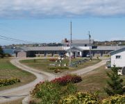
Cape View Motel And Cottages
Videos from this area
These are videos related to the place based on their proximity to this place.
La crucifixion de l'Acadie
Gerard Ardon responsable de Musee des Huits Maisons (Ligne Acadienne d'Archigny) raconte l'histoire des Acadiens faissant allusion au genocide et la crucifixion يحكى تاريخ والناط...
Beausoleil III - LFA34 - Meteghan, NS - Lobster Fishing - May 24, 2010
Lobster fishing aboard Beausoleil III in St. Mary's Bay, Nova Scotia, Canada - 2010.
Beausoleil III - LFA34 - Meteghan, NS - Lobster Fishing - May 9 2009
Lobster fishing aboard Beausoleil III in St. Mary's Bay, Nova Scotia, Canada.
The Amazing Map: Meteghan! - Red White And Blue All Over
This is a preview for the second video in The Amazing Map: Meteghan! series, available from MovieMakers.ca this video highlights the cultures and languages of Meteghan, Nova Scotia. For info...
Flatwater Kayaking on Meteghan River, Nova Scotia - High Definition Video
Flatwater Kayaking on Meteghan River, Nova Scotia.
Nov 24 2013 - Winter Road Conditions in Meteghan, Nova Scotia
Nov 24 2013 - Winter Road Conditions in Meteghan, Nova Scotia - 4pm.
Driving in Nova Scotia: Saint Martin, Meteghan Center, Meteghan - Spring 2013
Driving in Nova Scotia: Saint Martin, Meteghan Center, Meteghan - Spring 2013 - Second Division Rd, Maxwellton Road, Main Road.
Videos provided by Youtube are under the copyright of their owners.
Attractions and noteworthy things
Distances are based on the centre of the city/town and sightseeing location. This list contains brief abstracts about monuments, holiday activities, national parcs, museums, organisations and more from the area as well as interesting facts about the region itself. Where available, you'll find the corresponding homepage. Otherwise the related wikipedia article.
Salmon River, Colchester County (community)
Salmon River is an unincorporated Canadian suburban community in central Nova Scotia's Colchester County. A suburb of the town of Truro, Salmon River is located on the south side of the Salmon River, from which it derives its name. The defining feature in the community is Canadian National Railway's Truro Yard, located in the river flood plain. Newer suburban developments in Salmon River range up the hill along the south side of the valley.
Cape St. Marys, Nova Scotia
Cape St. Marys is a headland located at the western tip of the Nova Scotia peninsula in the Canadian province of Nova Scotia. Cape St. Marys is not the westernmost point in the province as the two islands comprising the Digby Neck, Long Island and Brier Island, lie further west.
Cape St. Mary's, Nova Scotia
Cape St. Mary's is a community in the Canadian province of Nova Scotia, located in the District of Clare in Digby County . {{#invoke:Coordinates|coord}}{{#coordinates:44|5|28.18|N|66|11|49.22|W|region:CA-NS_scale:100000 |primary |name=Cape St. Mary's, Nova Scotia }}
Saint Alphonse de Clare
Saint Alphonse de Clare is an Acadian community in the Canadian province of Nova Scotia, located in the District of Clare in Digby County. Formerly Chéticamp-de-Clare, the name was changed because there is another Chéticamp in Nova Scotia on Cape Breton. The similar names caused confusion for postal and other services. {{#invoke:Coordinates|coord}}{{#coordinates:44|7|22.22|N|66|10|38.46|W|region:CA-NS_scale:100000 |primary |name=Saint Alphonse de Clare, Nova Scotia }}


