Safety Score: 2,8 of 5.0 based on data from 9 authorites. Meaning we advice caution when travelling to Canada.
Travel warnings are updated daily. Source: Travel Warning Canada. Last Update: 2024-08-13 08:21:03
Delve into Coles Island
Coles Island in New Brunswick/Nouveau-Brunswick is a town located in Canada about 550 mi (or 885 km) east of Ottawa, the country's capital town.
Time in Coles Island is now 11:59 AM (Thursday). The local timezone is named America / Moncton with an UTC offset of -4 hours. We know of 8 airports closer to Coles Island, of which one is a larger airport. The closest airport in Canada is Greater Moncton International Airport in a distance of 23 mi (or 37 km), North-West. Besides the airports, there are other travel options available (check left side).
There are several Unesco world heritage sites nearby. The closest heritage site in Canada is Joggins Fossil Cliffs in a distance of 39 mi (or 62 km), East. Also, if you like the game of golf, there are some options within driving distance. In need of a room? We compiled a list of available hotels close to the map centre further down the page.
Since you are here already, you might want to pay a visit to some of the following locations: Charlottetown, Halifax, Fredericton, Machias and Houlton. To further explore this place, just scroll down and browse the available info.
Local weather forecast
Todays Local Weather Conditions & Forecast: 6°C / 43 °F
| Morning Temperature | 5°C / 41 °F |
| Evening Temperature | 5°C / 41 °F |
| Night Temperature | 6°C / 42 °F |
| Chance of rainfall | 0% |
| Air Humidity | 93% |
| Air Pressure | 1006 hPa |
| Wind Speed | Gentle Breeze with 9 km/h (5 mph) from South |
| Cloud Conditions | Overcast clouds, covering 100% of sky |
| General Conditions | Light rain |
Thursday, 21st of November 2024
8°C (46 °F)
7°C (44 °F)
Light rain, gentle breeze, overcast clouds.
Friday, 22nd of November 2024
7°C (44 °F)
3°C (38 °F)
Heavy intensity rain, moderate breeze, overcast clouds.
Saturday, 23rd of November 2024
5°C (40 °F)
3°C (37 °F)
Rain and snow, moderate breeze, overcast clouds.
Hotels and Places to Stay
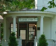
Marshlands Inn
Wandlyn Inn Amherst
Tantramar
COASTAL INN SACKVILLE
Videos from this area
These are videos related to the place based on their proximity to this place.
Crime of the Week: Armed Robbery - Sackville, NB
Crime Stoppers and the Southeast District RCMP, Sackville Detachment, are looking to identify the man responsible for an armed robbery in Sackville, New Brunswick. On March 15th, 2014 at ...
Blizzard: Journey to the Drew - Sackville NB
Daman, his sister and her kids brave the blizzard to go and visit their Dad at the Drew Nursing Home in The Town of Sackville, New Brunswick!
GOLDEN EAGLE and Common Raven on Tantramar Marsh near Sackville, New Brunswick on Jan. 18, 2013
An immature Golden Eagle being harassed by a Common Raven over Folkins Drive in Sackville, New Brunswick on January 18, 2013. This bird was initially discovered by Caroline Arsenault on ...
Crime de la semaine : Vol à main armée - Sackville (N.-B.)
Échec au crime et le District Sud-Est de la GRC, Détachment de Sackville, sont à la recherche de l'homme responsable d'un vol à main armée à Sackville au Nouveau-Brunswick. Le 15 mars...
Matt Anderson - When my angel gets the blues. 2008 Sackville Fall Fair
Matt Anderson - When my angel gets the blues. 2008 Sackville Fall Fair.
The Girly Show - Dr. David Beatty Personal History
Dad tells the story of his 1952 high school grad road trip across the USA with his buddy Doug. One of their first stops was New Orleans in a 1936 Chevy Straight-6. Dad says this visit to...
Murray and the Middle Class - Hard to Handle (Black Crowes Cover)
Murray and the Middle Class performing a cover of Hard to Handle by The Black Crowes at George's Fabulous Roadhouse in Sackville N.B. on Dec 26th 2014 @ the yearly Boxing day bash!!
Roadkill Hunters of the Maritimes Season 2
http://beatler.com/maritimes/roadkill-hunters-season-2-watch-it-here The Maritimes! The Eastern Most Rural Frontier of the Country! One man, his wife and nephew take you through the perilous...
Flooding on the TransCanada - Tropical Storm Hanna
Flooding on the TransCanada outside Sackville, NB caused by Tropical Storm Hanna.
Videos provided by Youtube are under the copyright of their owners.
Attractions and noteworthy things
Distances are based on the centre of the city/town and sightseeing location. This list contains brief abstracts about monuments, holiday activities, national parcs, museums, organisations and more from the area as well as interesting facts about the region itself. Where available, you'll find the corresponding homepage. Otherwise the related wikipedia article.
Tantramar Marshes
The Tantramar Marshes is a tidal saltmarsh around the Bay of Fundy on the Isthmus of Chignecto. At 20,230 hectares, the marsh is one of the largest on the Atlantic coast of North America. The marshes are an important stopover for migrating waterfowl such as semi-palmated Sandpipers and Canada Geese. Now a National Wildlife Area the marshes are the site of two bird sanctuaries.
Fort Beauséjour
Fort Beauséjour (later known as Fort Cumberland) was built by the French during Father Le Loutre's War from 1751–1755; it is located at the Isthmus of Chignecto in present-day Aulac, New Brunswick, Canada. The property is now a National Historic Site of Canada officially known as Fort Beauséjour – Fort Cumberland National Historic Site.
Battle of Fort Beauséjour
The Battle of Fort Beauséjour was fought on the Isthmus of Chignecto and marked the end of Father Le Loutre’s War and the opening of a British offensive in the French and Indian War, which would eventually lead to the end the French Empire in North America. The battle also reshaped the settlement patterns of the Atlantic region, and laid the groundwork for the modern province of New Brunswick.
Battle of Fort Cumberland
The Battle of Fort Cumberland (also known as the Eddy Rebellion) was an attempt by a small number of militia commanded by Jonathan Eddy to bring the American Revolutionary War to Nova Scotia in late 1776. With minimal logistical support from Massachusetts and four to five hundred volunteer militia and Natives, Eddy attempted to besiege and storm Fort Cumberland in central Nova Scotia (near the present-day border between Nova Scotia and New Brunswick) in November 1776.
Aulac, New Brunswick
Aulac is a Canadian community in Westmorland County, New Brunswick.
CKCX-SW
CKCX were the call letters used for the Canadian Broadcasting Corporation's shortwave transmitter complex near Sackville, New Brunswick at the Tantramar Marshes. The Sackville Relay Station was operated by Radio Canada International and broadcast its programming around the world as well as relay transmissions from several foreign shortwave broadcasters.
Upper Sackville, New Brunswick
Upper Sackville is a Canadian rural community in Westmorland County, New Brunswick. Located in the Sackville Parish approximately 6 kilometres northwest of
Sackville Parish, New Brunswick
Westmorland is a Canadian parish in Westmorland County, New Brunswick.


