Safety Score: 2,8 of 5.0 based on data from 9 authorites. Meaning we advice caution when travelling to Canada.
Travel warnings are updated daily. Source: Travel Warning Canada. Last Update: 2024-08-13 08:21:03
Delve into Willingdon Heights
Willingdon Heights in British Columbia is located in Canada about 2,194 mi (or 3,531 km) west of Ottawa, the country's capital town.
Current time in Willingdon Heights is now 02:11 PM (Saturday). The local timezone is named America / Vancouver with an UTC offset of -8 hours. We know of 11 airports close to Willingdon Heights, of which 4 are larger airports. The closest airport in Canada is Vancouver Harbour Water Aerodrome in a distance of 5 mi (or 8 km), West. Besides the airports, there are other travel options available (check left side).
There is one Unesco world heritage site nearby. The closest heritage site is Olympic National Park in United states at a distance of 108 mi (or 173 km). Also, if you like playing golf, there are some options within driving distance. We encountered 10 points of interest near this location. If you need a hotel, we compiled a list of available hotels close to the map centre further down the page.
While being here, you might want to pay a visit to some of the following locations: Bellingham, Friday Harbor, Victoria, Chilliwack and Mount Vernon. To further explore this place, just scroll down and browse the available info.
Local weather forecast
Todays Local Weather Conditions & Forecast: 7°C / 44 °F
| Morning Temperature | 8°C / 46 °F |
| Evening Temperature | 6°C / 42 °F |
| Night Temperature | 5°C / 41 °F |
| Chance of rainfall | 8% |
| Air Humidity | 83% |
| Air Pressure | 1007 hPa |
| Wind Speed | Light breeze with 3 km/h (2 mph) from West |
| Cloud Conditions | Overcast clouds, covering 100% of sky |
| General Conditions | Moderate rain |
Saturday, 23rd of November 2024
5°C (41 °F)
3°C (37 °F)
Light rain, light breeze, overcast clouds.
Sunday, 24th of November 2024
3°C (38 °F)
4°C (38 °F)
Light snow, calm, overcast clouds.
Monday, 25th of November 2024
4°C (40 °F)
4°C (39 °F)
Overcast clouds, calm.
Hotels and Places to Stay
Crystal's View Bed & Breakfast
Delta Burnaby Hotel & Conference Center
Ocean Breeze B&B
Holiday Inn & Suites NORTH VANCOUVER
Element Vancouver Metrotown
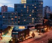
Hilton Vancouver Metrotown
ACCENT INN BURNABY
Pinnacle Hotel at the Pier
Commercial Drive Accommodations
DAYS INN VANCOUVER METRO
Videos from this area
These are videos related to the place based on their proximity to this place.
Crows in Burnaby
This is where all of the crows from Metro Vancouver (the greater Vancouver area, including surrounding cities) go every evening at dusk. The location is in Burnaby, on Still Creek, just north...
Track Cycling Training - Burnaby Velodrome
Burnaby Cycling Club .Here's a nice bike-cam that gives some idea of what it's like to motor pace at 45 km/h on a 200-meter indoor velodrome. This was a 10-minute session where we were free...
Rain City Recorders
Produced by First-Year Television & Video Production Students for Rain City Recorders.
Watching Barnaby Village Museum Carousel in Vancouver
The restored 1912 C.W. Parker Carousel is located on the grounds of the Burnaby Village Museum & Carousel. This is one of the most well run carousels I've visited. They do a safety lesson...
Master Gee's - Burnaby Martial Arts Training 604.294.5425
http://BurnabyMartialArts.com 604.294.KICK (5425) 5508 Hastings Street, Burnaby, BC V5B 1R3 Safe, family friendly martial arts training in Burnaby for children, women and men. Master Gee's...
Riding Barnaby Village Museum Carousel in Vancouver
The restored 1912 C.W. Parker Carousel is located on the grounds of the Burnaby Village Museum & Carousel. This is one of the most well run carousels I've visited. They do a safety lesson...
BURNABY CAR CRASH ROLL OVER RESCUE LOUGHEED HWY & GILMORE AVE MAY 21 2011.mov
BURNABY CAR CRASH ROLL OVER RESCUE LOUGHEED HWY & GILMORE AVE MAY 21 2011 BY BCNEWSVIDEO BRITISH COLUMBIA CANADA.
Burnaby North Secondary - Harlem Shake
Burnaby North had a Harlem Shake because... well... why not? **DON'T FORGET to watch our Gangnam Style Flash Mob!** www.youtube.com/watch?v=0RfGtr8ZnRE ...
Videos provided by Youtube are under the copyright of their owners.
Attractions and noteworthy things
Distances are based on the centre of the city/town and sightseeing location. This list contains brief abstracts about monuments, holiday activities, national parcs, museums, organisations and more from the area as well as interesting facts about the region itself. Where available, you'll find the corresponding homepage. Otherwise the related wikipedia article.
Brentwood Town Centre Station
Brentwood Town Centre Station (sometimes abbreviated as Brentwood Station) is located on an elevated portion of the Millennium Line. The station is a part of Metro Vancouver's SkyTrain rapid transit system, and is one of the busier stations on the Millennium Line. The station is located near the intersection of Lougheed Highway and Willingdon Avenue in Burnaby.
Gilmore Station
Gilmore Station is a station on the Millennium Line of the SkyTrain system in Burnaby, British Columbia, Canada. The station is located at Gilmore Avenue and Dawson Street. The station is adjacent to several new high rise condominium complexes which are a component of the Brentwood Town Centre Development Plan, responsible for overseeing the area transformed from light industrial/lower occupancy commercial, into an urbanized centre. It is also next to the Vancouver Film Studios.
Alpha Secondary School
Alpha Secondary is a public high school in Burnaby, British Columbia part of School District 41 Burnaby.
Brentwood Town Centre
Brentwood Town Centre (most often referred to as Brentwood Mall) is a shopping mall in Burnaby, British Columbia. It is located in North Burnaby, at the intersection of Willingdon Avenue and the Lougheed Highway, approximately 1.5 kilometres from Vancouver city limits. It is also very close to the British Columbia Institute of Technology (BCIT) campus. Its characteristic white domes and peaks were designed to imitate the snow-capped North Shore Mountains in the background.
The Bridge Studios
The Bridge Studios is a Canadian film studio in Burnaby, British Columbia. It operates the largest effects stage in North America. Its eight studios, ranging in size from 40,000 square feet to 4,600 square feet, are located on a 15 acres lot at 2400 Boundary Road, in Burnaby. The studios' name derives from the lot's use by Dominion Bridge Company, a steel bridge constructor, from 1930 until the mid 1970s. The site was first used for filming after the departure of Dominion Bridge.
Burnaby Heights
Burnaby Heights, officially known as Vancouver Heights and commonly referred to as The Heights, is a quiet, prestigious residential neighbourhood in North Burnaby between Boundary Road to the west, Gamma Avenue to the east and bounded by Hastings Street to the south. Its northern edge facing the North Shore Mountains comes down rather steeply to the shores of Burrard Inlet. Many community events, such as Hats Off Day http://www. burnabyheights.
Stunts Canada
Stunts Canada is a Canadian association which provides the film and TV industry with stunt performers, stunt coordinators, 2nd Unit directors, and action actors. Being neither a corporation nor a union, it represents a group of individual professionals, created to support its members and assist the film industry. Founded in 1970, it is the oldest and largest association of its type in Canada.
Burnaby Refinery
The Burnaby Refinery is an oil refinery located in the city of Burnaby, British Columbia, Canada owned by Chevron. The facility refines crude and synthetic oil into gasoline, diesel, jet fuels, asphalts, heating fuels, heavy fuel oils, butanes, and propane. Crude is supplied to the facility from Northern British Columbia and Alberta through the 1,200-kilometre Kinder Morgan Pipe Line.


