Safety Score: 2,8 of 5.0 based on data from 9 authorites. Meaning we advice caution when travelling to Canada.
Travel warnings are updated daily. Source: Travel Warning Canada. Last Update: 2024-08-13 08:21:03
Delve into Victoria-Fraserview
Victoria-Fraserview in British Columbia is a town located in Canada about 2,198 mi (or 3,537 km) west of Ottawa, the country's capital town.
Time in Victoria-Fraserview is now 07:30 AM (Thursday). The local timezone is named America / Vancouver with an UTC offset of -8 hours. We know of 10 airports closer to Victoria-Fraserview, of which 4 are larger airports. The closest airport in Canada is Vancouver Harbour Water Aerodrome in a distance of 6 mi (or 9 km), North. Besides the airports, there are other travel options available (check left side).
There is one Unesco world heritage site nearby. The closest heritage site is Olympic National Park in United states at a distance of 104 mi (or 168 km). Also, if you like the game of golf, there are some options within driving distance. We saw 10 points of interest near this location. In need of a room? We compiled a list of available hotels close to the map centre further down the page.
Since you are here already, you might want to pay a visit to some of the following locations: Friday Harbor, Bellingham, Victoria, Coupeville and Mount Vernon. To further explore this place, just scroll down and browse the available info.
Local weather forecast
Todays Local Weather Conditions & Forecast: 8°C / 46 °F
| Morning Temperature | 7°C / 44 °F |
| Evening Temperature | 7°C / 44 °F |
| Night Temperature | 7°C / 44 °F |
| Chance of rainfall | 2% |
| Air Humidity | 78% |
| Air Pressure | 1013 hPa |
| Wind Speed | Light breeze with 5 km/h (3 mph) from North |
| Cloud Conditions | Broken clouds, covering 61% of sky |
| General Conditions | Light rain |
Thursday, 21st of November 2024
4°C (39 °F)
7°C (44 °F)
Moderate rain, gentle breeze, overcast clouds.
Friday, 22nd of November 2024
7°C (45 °F)
6°C (43 °F)
Light rain, gentle breeze, overcast clouds.
Saturday, 23rd of November 2024
6°C (42 °F)
5°C (41 °F)
Light rain, gentle breeze, overcast clouds.
Hotels and Places to Stay
Premiere Suites at Marine Gateway
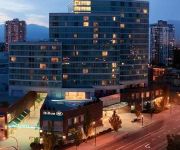
Hilton Vancouver Metrotown
DAYS INN - VANCOUVER AIRPORT
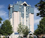
TRAVELODGE HTL VANCOUVER ARPRT
Commercial Drive Accommodations
SANDMAN HOTEL VANCOUVER AIRPOR
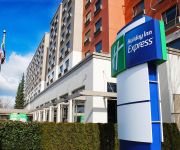
Holiday Inn Express VANCOUVER AIRPORT - RICHMOND
BW PLUS ABERCORN INN
Accent Inn Vancouver Airport
Holiday Inn VANCOUVER AIRPORT- RICHMOND
Videos from this area
These are videos related to the place based on their proximity to this place.
Vancouver, Canada Travel Guide - Must-See Attractions
http://bookinghunter.com Vancouver is a coastal seaport city on the mainland of British Columbia, Canada. The 2011 census recorded 603502 people in the city, making it the eighth largest...
To Build a Better City - a 1964 City of Vancouver/CMHC film
There was a time when old poor neighbourhoods were considered an urban blight and needed to be razed to make way for modern concrete towers. This is from 50 years ago, but the very ideology...
Vancouver City Guide - Lonely Planet travel videos
Learn more about Vancouver: http://www.lonelyplanet.com/canada/vancouver.
Vancouver, Canadá: Camino al trabajo
En este video te muestro algo que hago de lunes a viernes: ir a trabajar. Vivo en la zona oeste de Vancouver y mi trabajo está en Downtown. Primero, camino unas cuantas cuadras y cruzo un...
Line brawl 11 min ver. Calgary Flames vs Vancouver Canucks 1/18/14 NHL Hockey.
Line brawl 5 min version. Calgary Flames vs Vancouver Canucks 1/18/14 NHL Hockey. 1ST PERIOD 00:02 CGY Ladislav Smid Fighting (maj) against Kevin Bieksa 00:02 CGY Chris Butler...
Dj Eclectik Vancouver Red Bull Thre3style 2013 @ Fortune Sound Club
About the Red Bull Thre3tyle: Thre3style started in British Columbia, Canada in 2007 (Mat the Alien won the Vancouver round that year - which also included local heavyweights Flipout, P-Luv,...
Vancouver, British Columbia, Canada - Part 2
Another aerial video of Vancouver, Canada. Locations: Downtown Vancouver, Canada Place, Burrard Bridge, Queen Elizabeth Park, Knight Bridge, YVR Vancouver International Airport, New ...
Vancouver Marijuana Vending Machine
Marijuana vending machine located at BC Pain Society, 2908 Commercial Drive Vancouver BC, featuring Purple Kush, Bubba Kush, sativa and indica strains of medical marijuana, we carry Phoenix...
Gay Travel: Vancouver, BC
Vancouver, BC is an LGBT friendly travel destination and Josh Rimer joins Gayosphere to take you on quick tour of some unique attractions in the city. Visit http://gayosphere.com/destinations/vanc...
Videos provided by Youtube are under the copyright of their owners.
Attractions and noteworthy things
Distances are based on the centre of the city/town and sightseeing location. This list contains brief abstracts about monuments, holiday activities, national parcs, museums, organisations and more from the area as well as interesting facts about the region itself. Where available, you'll find the corresponding homepage. Otherwise the related wikipedia article.
Knight Street Bridge
The Knight Street Bridge is a cantilever bridge which spans the North Arm of the Fraser River in British Columbia, connecting Vancouver and Richmond, and serving as a feeder route for Highways 91 and 99 to its south. It is located to the east of the Oak Street Bridge. Besides spanning the river, the bridge also provides access to Mitchell Island.
Killarney Secondary School
Killarney Secondary School is a public secondary school in Vancouver, British Columbia, Canada. The school is named for the area in which it resides. It is the largest public secondary school in the city by area.
Mitchell Island
Mitchell Island is an island in the North Arm of the Fraser River in British Columbia, Canada, located between the cities of Vancouver and Richmond and is incorporated as part of the latter city. It is crossed by, and has on and off ramps for, the Knight Street Bridge, which is one of the main bridges connecting Vancouver to its suburbs. Originally agricultural, its land is now mainly used for industrial purposes. The island is host to a number of auto wreckers.
East Vancouver
East Vancouver (also "East Van" or the "East Side") is a region within the City of Vancouver, British Columbia, Canada. Geographically, East Vancouver is bordered to the north by Burrard Inlet, to the south by the Fraser River, and to the east by the city of Burnaby. East Vancouver is divided from Vancouver's "West Side" (not to be confused with the "West End" of Downtown Vancouver or with West Vancouver) by Ontario Street.
John Oliver Secondary School
John Oliver Secondary School is a public secondary school located in Vancouver, British Columbia, Canada, at East 41st Avenue and Fraser Street. It is named after John Oliver, the Premier of British Columbia from 1918-1927.
Sir William Osler Elementary School
Sir William Osler Elementary is a public elementary school in Vancouver, British Columbia, part of School District 39 Vancouver.
Khalsa Diwan Society Vancouver
The Khalsa Diwan Society Vancouver is a Sikh society based at a gurdwara in Vancouver, British Columbia, Canada. The current site is located at 8000 Ross St, Vancouver, BC. It was the largest gurdwara in North America. A gurdwara (Punjabi: ਗੁਰਦੁਆਰਾ, gurdu'ārā or ਗੁਰਦਵਾਰਾ, gurdvārā), meaning "the doorway to the Guru", is the Sikh place of worship and may be referred to as a Sikh temple.
David Thompson Secondary School (Vancouver)
David Thompson Secondary School is a public secondary school located in the Victoria-Fraserview neighbourhood of Vancouver, British Columbia, Canada. It opened in 1958. The school served as a filming location for the 2009 film New Moon.


