Safety Score: 2,8 of 5.0 based on data from 9 authorites. Meaning we advice caution when travelling to Canada.
Travel warnings are updated daily. Source: Travel Warning Canada. Last Update: 2024-08-13 08:21:03
Explore Victoria
Victoria in British Columbia with it's 289,625 inhabitants is a city in Canada about 2,223 mi (or 3,577 km) west of Ottawa, the country's capital.
Local time in Victoria is now 01:00 AM (Thursday). The local timezone is named America / Vancouver with an UTC offset of -8 hours. We know of 11 airports in the vicinity of Victoria, of which 4 are larger airports. The closest airport in Canada is Victoria Harbour Seaplane Base in a distance of 1 mi (or 2 km), South-West. Besides the airports, there are other travel options available (check left side).
There is one Unesco world heritage site nearby. The closest heritage site is Olympic National Park in United states at a distance of 61 mi (or 97 km). Also, if you like golfing, there are multiple options in driving distance. We found 8 points of interest in the vicinity of this place. If you need a place to sleep, we compiled a list of available hotels close to the map centre further down the page.
Depending on your travel schedule, you might want to pay a visit to some of the following locations: Port Angeles, Friday Harbor, Port Townsend, Coupeville and Bellingham. To further explore this place, just scroll down and browse the available info.
Local weather forecast
Todays Local Weather Conditions & Forecast: 7°C / 45 °F
| Morning Temperature | 7°C / 44 °F |
| Evening Temperature | 7°C / 45 °F |
| Night Temperature | 7°C / 44 °F |
| Chance of rainfall | 0% |
| Air Humidity | 70% |
| Air Pressure | 1013 hPa |
| Wind Speed | Gentle Breeze with 8 km/h (5 mph) from South |
| Cloud Conditions | Broken clouds, covering 80% of sky |
| General Conditions | Light rain |
Thursday, 21st of November 2024
6°C (43 °F)
6°C (42 °F)
Moderate rain, moderate breeze, overcast clouds.
Friday, 22nd of November 2024
7°C (45 °F)
7°C (44 °F)
Light rain, gentle breeze, overcast clouds.
Saturday, 23rd of November 2024
7°C (44 °F)
5°C (40 °F)
Light rain, moderate breeze, overcast clouds.
Hotels and Places to Stay
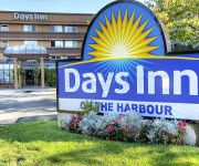
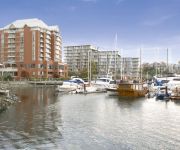
DAYS INN - VICTORIA ON THE HAR
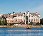
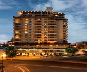
Delta Hotels Victoria Ocean Pointe Resort
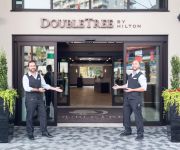
DoubleTree by Hilton Hotel - Suites Victoria
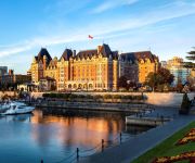
Fairmont Empress
COAST VICTORIA HOTEL AND MARINA BY APA
Magnolia Hotel And Spa
Chateau Victoria Hotel and Suites
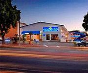
Vacation Inn Hotel & Convention Center
Dominion Grand Hotel
Island Travel Inn
Videos from this area
These are videos related to the place based on their proximity to this place.
3480 Ripon Road, Uplands, Victoria British Columbia
Property Video shoot of 3480 Ripon Road, Uplands, Victoria British Columbia by PlatinumHD http://www.platinumhd.tv for Sotheby's International Realty Canada.
Birds of a Feather Victoria Oceanfront Bed and Breakfast
Birds of a Feather bed and breakfast in Victoria, British Columbia is a 5 star accommodation on the ocean with private entrances, private dock, canoes, kayaks and bicycles. Heated floors, fireplace...
garden city scooter run 2013
filmed over one day,saturday may 20th 2013 at the garden city scooter run.hosted by the capitol city scooter club,victoria bc canada ,may long weekend.
Author Grant McKenzie (1) on the long journey of a novel and being your own champion
Suspense novelist Grant McKenzie speaks about the long journey of getting his novel published and on the necessity of writers being champions of their own work. Interviewed by author coach...
Victoria, BC Trip
Quick trip to Victoria while visiting family in Seattle. Just 4 days after leaving NM. Check out my blog for more details.
Day Trip In Victoria
This was a fun day trip I went on with my friends, it was so much fun and i love getting to now you all better, it was my good friend Mia last day in Canada, be for ...
[Day 18] 그래픽 디자이너 in 밴쿠버 / 빅토리아 여행 / Victoria trip
Korean Designer in Vancouver [Day 18] - 한국 디자이너 어학연수 in 밴쿠버 / 빅토리아 여행 / Trip to Victoria.
Introducing Jaylen! My ftm journey
jaylensftmjourney Introducing myself and putting myself out there to be a positive resource to folks looking for information about ftm transitioning Drop a comment ...
Videos provided by Youtube are under the copyright of their owners.
Attractions and noteworthy things
Distances are based on the centre of the city/town and sightseeing location. This list contains brief abstracts about monuments, holiday activities, national parcs, museums, organisations and more from the area as well as interesting facts about the region itself. Where available, you'll find the corresponding homepage. Otherwise the related wikipedia article.
Capital Regional District
This article is for the regional district government encompassing the agglomeration of municipalities and rural areas around Victoria, British Columbia, Canada. For the region itself, see Greater Victoria, British Columbia.
Johnson Street Bridge
The Johnson Street Bridge is a bascule bridge that spans the harbour of Victoria, ;British Columbia. It is commonly referred to as the "Blue Bridge" because of its distinctive blue colour. The bascule spans were designed by the Strauss Bascule Company Limited and were fabricated in Ontario. The sub-structure was built by the City of Victoria Engineering Department and required 9,144 cubic metres of concrete. The bridge was completed in January 1924 at a cost of C$918,000.
The Canadian Scottish Regiment (Princess Mary's)
The Canadian Scottish Regiment (Princess Mary's) is a Primary Reserve infantry regiment of the Canadian Forces based on Vancouver Island British Columbia. The regiment is located in Victoria, Nanaimo, and Courtenay, British Columbia. It is part of 39 Canadian Brigade Group, the headquarters for all of the army reserves in British Columbia. One of four infantry regiments in British Columbia, the Canadian Scottish is the largest reserve unit in Western Canada.
Galloping Goose Regional Trail
|} The Galloping Goose Regional Trail is a 55-kilometre rail trail between Victoria, British Columbia, Canada, and the ghost town of Leechtown, north of Sooke, where it meets the old Sooke Flowline. The trail is a popular route both for commuting and recreation, including within the urban areas of central Victoria, which it penetrates in part. It is frequented by people walking, running, cycling, skateboarding and (in places) riding horses.
Chinatown, Victoria
The Chinatown in Victoria, British Columbia is the oldest in Canada and second in age only to San Francisco's in North America, with its beginnings in the mass influx of miners from California to what is now British Columbia in 1858. Its history goes back to the mid nineteenth century. It remains an active place for Chinese-Canadians, Victoria residents and tourists. Victoria's Chinatown is now surrounded by cultural, entertainment venues as well as being a venue itself.
Sail and Life Training Society
S.A.L.T.S. Sail and Life Training Society, founded in 1974, is a non-profit Christian organization based in Victoria, British Columbia, which provides sail training for 2000 young people per year.
Fan Tan Alley
Fan Tan Alley is an alley in Victoria, British Columbia's Chinatown. It runs south from Fisgard Avenue to Pandora Avenue in the block between Government Street and Store Street. It was originally a gambling district with restaurants, shops, and opium dens. Today it is a tourist destination as it contains many small shops including a barber shop, art gallery, Chinese cafe and apartments. It is most famous for being the narrowest street in Canada. At its narrowest point it is only 0.9 metres wide.
McPherson Playhouse
The McPherson Playhouse, known as The Mac, is a theatre and concert hall in Victoria, British Columbia, Canada. Part of the Centennial Square complex on the north side of downtown Victoria, adjacent to the intersection of Pandora and Government streets, it was originally built as a Pantages Theatre in 1914. In the 1960s it was donated, with supporting funding for its renovation, to the people of Victoria by Thomas Shanks McPherson.
Bay Street Armoury
Bay Street Armoury is located on Bay Street in Victoria, British Columbia. The Bay Street Drill Hall was completed in 1915 and designated a historic building in 1989. It is a two-storey drill hall with Tudor Revival elements, built during the 1896 to 1918 period when over 100 drill halls and armouries were erected across Canada; its scale reflects the dramatic increase in military participation following Canada’s performance during the Second Boer War.
Victoria City Hall, British Columbia
Victoria City Hall is the city hall for Victoria, British Columbia, Canada at Douglas Street and Pandora Avenue. It was completed in 1890. It was designated a National Historic Site of Canada in 1977 and was also designated as a heritage site by the municipality in 1979.
Centennial Square
Centennial Square is a plaza in Victoria, British Columbia, Canada. It is named for the centenary of Queen Victoria's birth. The Victoria Police Station, city hall and McPherson Playhouse are adjacent to the square. There is a fountain in the square. In the summer, the city hires musicians to perform every weekday, charging no admission fee.
Victoria, British Columbia railway station
The Victoria, British Columbia railway station was in downtown Victoria, British Columbia on the east end of the Johnson Street Bridge. The station was the southern terminus for Via Rail's Victoria – Courtenay train dayliner service. Events: March 19, 2011: Service was suspended. March 31, 2011: The rail portion of the bridge was closed. August 7, 2011: The service's temporary bus replacement was discontinued. August 12, 2011: The station closed.






!['[Day 18] 그래픽 디자이너 in 밴쿠버 / 빅토리아 여행 / Victoria trip' preview picture of video '[Day 18] 그래픽 디자이너 in 밴쿠버 / 빅토리아 여행 / Victoria trip'](https://img.youtube.com/vi/CjRHvkqHw9Q/mqdefault.jpg)


