Safety Score: 2,8 of 5.0 based on data from 9 authorites. Meaning we advice caution when travelling to Canada.
Travel warnings are updated daily. Source: Travel Warning Canada. Last Update: 2024-08-13 08:21:03
Touring Sullivan Heights
Sullivan Heights in British Columbia is a town located in Canada about 2,190 mi (or 3,524 km) west of Ottawa, the country's capital place.
Time in Sullivan Heights is now 01:11 PM (Saturday). The local timezone is named America / Vancouver with an UTC offset of -8 hours. We know of 11 airports nearby Sullivan Heights, of which 4 are larger airports. The closest airport in Canada is Vancouver Harbour Water Aerodrome in a distance of 10 mi (or 16 km), West. Besides the airports, there are other travel options available (check left side).
There is one Unesco world heritage site nearby. The closest heritage site is Olympic National Park in United states at a distance of 105 mi (or 169 km). Also, if you like the game of golf, there are several options within driving distance. We collected 10 points of interest near this location. Need some hints on where to stay? We compiled a list of available hotels close to the map centre further down the page.
Being here already, you might want to pay a visit to some of the following locations: Bellingham, Friday Harbor, Victoria, Chilliwack and Mount Vernon. To further explore this place, just scroll down and browse the available info.
Local weather forecast
Todays Local Weather Conditions & Forecast: 7°C / 45 °F
| Morning Temperature | 8°C / 46 °F |
| Evening Temperature | 6°C / 43 °F |
| Night Temperature | 5°C / 41 °F |
| Chance of rainfall | 8% |
| Air Humidity | 80% |
| Air Pressure | 1007 hPa |
| Wind Speed | Light breeze with 4 km/h (3 mph) from South-West |
| Cloud Conditions | Overcast clouds, covering 100% of sky |
| General Conditions | Moderate rain |
Saturday, 23rd of November 2024
5°C (40 °F)
3°C (37 °F)
Overcast clouds, light breeze.
Sunday, 24th of November 2024
3°C (38 °F)
4°C (39 °F)
Overcast clouds, calm.
Monday, 25th of November 2024
4°C (40 °F)
4°C (39 °F)
Overcast clouds, calm.
Hotels and Places to Stay
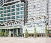
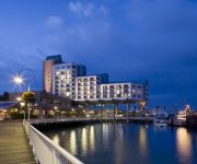
Civic Hotel Autograph Collection
EXECUTIVE PLAZA COQUITLAM
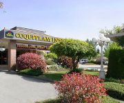
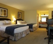
BEST WESTERN PLUS COQUITLAM
RAMADA COQUITLAM
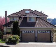
Arundel Mansion
Towle Houses
INN AT THE QUAY
BEST WESTERN PLUS BURNABY HTL
Eagle Mountain Bed and Breakfast
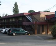
Coquitlam Sleepy Lodge
Videos from this area
These are videos related to the place based on their proximity to this place.
Burnaby Home Invasion Death Carrigan Ct September 15 2014 Bcnewsvideo
Burnaby RCMP, Fire Department & EHS responded to a report of a home invasion, in this high-rise apartment building on Carrigan Ct. They found a dead male on the ground that was thrown from...
Burnaby Plumbers - (604) 837-2507 Plumbing Burnaby, BC
Get a FREE estimate from this Burnaby plumber for plumbing services in Burnaby, BC. Call (604) 837-2507 and mention this ad! As a residential and commercial plumbing, sewer and drain service,...
Forest Hills & Lake City Industrial - Burnaby - Get To Know Real Estate
Directly south of Burnaby Mountain and Simon Fraser University are the Forest Hills and Lake City Industrial neighbourhoods. Lougheed Town Centre is a short drive away for shopping and dining,...
Burnaby Car Accident Hwy 1 West of North Rd January 17 2015
January 17 2015 Burnaby car accident on Hwy 1 West Bond, west of North Rd British, Columbia, Canada www.Bcnewsvideo.com.
2503-9888 Cameron St Burnaby BC
New 1 bedroom + den for rent in Sillouette in Burnaby BC. More information at http://www.cbmre.ca.
Train Cars Derail In Burnaby - Coal Spills In Silver Creek
Jan 13, 2014 Burnaby, B.C. Canada. Two days after the train derailment, I went to see if there was any environmental impact from the coal that had entered into the creek when the train had...
9835 Sullivan St., Burnaby, BC
Amazing Lot and Home! Location, great layout for family home, investor or developer. This meticulously maintained home has had the same owner for 26 years. Beautiful gardens, original hardwood...
New Westminster Knife Call
New Westminster Police responded to the report of a female holding two children with a knife. See my photos; https://www.flickr.com/photos/61426268@N06/ Follow me on Twitter; https://twitter.com/...
New Westminster Pursuit
New Westminster Police chased a vehicle for unknown reasons today. The driver was reported to be driving up to 70 kph and into oncoming lanes at some times during the pursuit. A nearby RCMP...
Videos provided by Youtube are under the copyright of their owners.
Attractions and noteworthy things
Distances are based on the centre of the city/town and sightseeing location. This list contains brief abstracts about monuments, holiday activities, national parcs, museums, organisations and more from the area as well as interesting facts about the region itself. Where available, you'll find the corresponding homepage. Otherwise the related wikipedia article.
Lougheed Town Centre Station
Lougheed Town Centre Station (sometimes abbreviated as Lougheed Station) is a station on the Millennium Line, part of the SkyTrain rapid transit system in Metro Vancouver, British Columbia.
Production Way – University Station
Production Way – University Station is a railway station on the Millennium Line, a part of Metro Vancouver's SkyTrain rapid transit system. It is located at the intersection of Lougheed Highway and Production Way in Burnaby, British Columbia. The station was intended to be a major transfer point to Simon Fraser University, so as well as having local suburban bus connections, it is the terminus to the #145 bus running to SFU, which carries just over half of all bus traffic to the university.
Burnaby Mountain Secondary School
Burnaby Mountain Secondary School is a school that serves grades 8 to 12, in Burnaby, British Columbia, Canada. It is three stories tall and located at 8800 Eastlake Drive, at the intersection with Beaverbrook Drive. It is named after nearby Burnaby Mountain, which is also home to Simon Fraser University. It is served by the Production Way-University SkyTrain station.
Lougheed Town Centre
Lougheed Town Centre (sometimes abbreviated as Lougheed Mall) is a shopping mall in Burnaby, British Columbia. It is located in the northeast corner of the city, near the border with Coquitlam. By the number of stores, Lougheed Town Centre is the second largest mall in Burnaby (after Metropolis at Metrotown, the largest mall in the province) with 160 stores and services. Notable retailers include The Bay, Walmart, Sport Chek, London Drugs and Safeway.
Burquitlam Station
Burquitlam Station is a planned SkyTrain station along the Evergreen Line, which is currently under planning in Coquitlam, a suburb of Vancouver, Canada. It will be in the Burquitlam area of Coquitlam. Its expected date of completion is summer 2016. Construction of the station will start in early 2014 but guideway construction in the radius of the station will start in the Summer of 2013.
Vancouver Golf Club
Vancouver Golf Club, located in the Canadian city of Coquitlam, British Columbia, is the oldest golf club in the Lower Mainland. Established in 1910 and opened in 1911 on a former sheep farm on the west side of Blue Mountain, the suburban club was originally considered to be far outside of the major population centre of Vancouver, requiring a trip on the British Columbia Electric Railway and often an overnight stay at the club.
Burquitlam, British Columbia
Burquitlam is a settlement in British Columbia. {{#invoke:Coordinates|coord}}{{#coordinates:49.259|N|122.893|W|region:CA_type:city_source:GNS-enwiki|||| |primary |name= }} 30px This article about a location in British Columbia, Canada is a stub. You can help Wikipedia by expanding it. vte This is the small area located after Port Moody's Large winding Clarke road hill and before North Gate Village.
Standing Stones of Lougheed
The Standing Stones of Lougheed are a group of five stones located beside the SkyTrain station at Lougheed Town Centre in Burnaby, which is near the city of Vancouver. This protected array of ancient boulders lies within Musqueam and Kwikwetlem territory, First Nations of the Coast Salish. It is currently surrounded by iron fencing in order to prevent vandalism and disturbance of the stones. Gravel has been added to prevent the growth of weeds and grass.


