Safety Score: 2,8 of 5.0 based on data from 9 authorites. Meaning we advice caution when travelling to Canada.
Travel warnings are updated daily. Source: Travel Warning Canada. Last Update: 2024-08-13 08:21:03
Delve into Squilax
Squilax in British Columbia is located in Canada about 2,028 mi (or 3,264 km) west of Ottawa, the country's capital town.
Current time in Squilax is now 03:04 AM (Tuesday). The local timezone is named America / Vancouver with an UTC offset of -8 hours. We know of 8 airports close to Squilax. The closest airport in Canada is Salmon Arm Airport in a distance of 21 mi (or 34 km), South-East. Besides the airports, there are other travel options available (check left side).
Also, if you like playing golf, there are some options within driving distance. If you need a hotel, we compiled a list of available hotels close to the map centre further down the page.
While being here, you might want to pay a visit to some of the following locations: Republic, Okanogan, Colville, Chilliwack and Waterville. To further explore this place, just scroll down and browse the available info.
Local weather forecast
Todays Local Weather Conditions & Forecast: 5°C / 42 °F
| Morning Temperature | -2°C / 28 °F |
| Evening Temperature | -1°C / 31 °F |
| Night Temperature | -3°C / 27 °F |
| Chance of rainfall | 0% |
| Air Humidity | 69% |
| Air Pressure | 1022 hPa |
| Wind Speed | Gentle Breeze with 6 km/h (4 mph) from East |
| Cloud Conditions | Broken clouds, covering 66% of sky |
| General Conditions | Broken clouds |
Tuesday, 5th of November 2024
3°C (37 °F)
-2°C (29 °F)
Overcast clouds, light breeze.
Wednesday, 6th of November 2024
2°C (36 °F)
-1°C (30 °F)
Overcast clouds, light breeze.
Thursday, 7th of November 2024
4°C (38 °F)
1°C (35 °F)
Overcast clouds, light breeze.
Hotels and Places to Stay
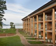
QUAAOUT LODGE
Videos from this area
These are videos related to the place based on their proximity to this place.
CP 8950 at Chase (24AUG2013)
Canadian Pacific 8950, CP 8723 (Train 100 -- Vancouver to Montreal) (450 axles) Shuswap Subdivision Chase, British Columbia.
Ziplining in Chase, British Columbia (Tree Top Flyers)
Ziplining in Chase, British Columbia (Tree Top Flyers)
Chase Creek Falls
Chase Creek, BC, Canada in Autumn For travel photos around Canada, Japan, and Barbados please visit my personal site: www.kearwood.com This is my first video on YouTube; I hope you like it!
Dreamcatcher Shuswap
A video for youth, Protecting Mother Earth and surviving on the land, in the city and through our prophecies. You can see more at www.ice-network.ca or 613-628-6209.
Hey Joe Harmonica Hound rehearsal take I, II and III
Three takes of Hey Joe with harmonica and slide acoustic guitar. take one and two were played between the first and second period of the Canada Germany World Junior hockey game in Russia. Take.
Cute *HAPPY DONKEYS* at the Turtle Valley Donkey Refuge
Happy playful donkeys at the Turtle Valley Donkey Refuge. Biting, kicking and just being mischievous! Donkeys bray when they are happy or just want to communicate with other donkeys. Every...
Roam Adams River (Sockeye Run)
The sockeye salmon run through the Adams River near Chase, BC is one of the most spectacular natural wonders in the world. Nearly 2 million sockeye entered the Adams the year Jordan visits!...
Road trip from Vancouver to Salmon Arm - Trans-Canada Highway to Shuswap
Road trip from Vancouver to Salmon Arm - Trans-Canada Highway to Shuswap.
Videos provided by Youtube are under the copyright of their owners.
Attractions and noteworthy things
Distances are based on the centre of the city/town and sightseeing location. This list contains brief abstracts about monuments, holiday activities, national parcs, museums, organisations and more from the area as well as interesting facts about the region itself. Where available, you'll find the corresponding homepage. Otherwise the related wikipedia article.
Roderick Haig-Brown Provincial Park
Roderick Haig-Brown Provincial Park is a provincial park in British Columbia, Canada, located northeast of Kamloops and northwest of Salmon Arm. It stretches along the banks of the Adams River, between the south end of Adams Lake and the western portion of Shuswap Lake. It's known for one of the largest sockeye salmon run in North America. The Park is named after Roderick Haig-Brown, a Canadian writer and conservationist.
Little Shuswap Lake
Little Shuswap Lake is a small lake in the Thompson River basin of the southern Interior of British Columbia, Canada, which sits at the transition between the Thompson Country to the west and the Shuswap Country to the east. It is fed by the Little River, which flows from Shuswap Lake, and is the main source of water for the South Thompson River, which begins at the lake's outlet at its southwestern end.
Squilax, British Columbia
Squilax is a settlement in British Columbia. {{#invoke:Coordinates|coord}}{{#coordinates:50.872|N|119.586|W|region:CA_type:city_source:GNS-enwiki|||| |primary |name= }} 30px This article about a location in British Columbia, Canada is a stub. You can help Wikipedia by expanding it. vte Squilax, also spelt "Skw'lax" is close to the Secwepmec word for Black Bear. Almost everyone is the area is family or grew up together.


