Safety Score: 2,8 of 5.0 based on data from 9 authorites. Meaning we advice caution when travelling to Canada.
Travel warnings are updated daily. Source: Travel Warning Canada. Last Update: 2024-08-13 08:21:03
Delve into Valleycliffe
Valleycliffe in Squamish-Lillooet Regional District (British Columbia) is located in Canada about 2,194 mi (or 3,531 km) west of Ottawa, the country's capital town.
Current time in Valleycliffe is now 04:23 AM (Sunday). The local timezone is named America / Vancouver with an UTC offset of -8 hours. We know of 11 airports close to Valleycliffe, of which 4 are larger airports. The closest airport in Canada is Vancouver Harbour Water Aerodrome in a distance of 28 mi (or 45 km), South. Besides the airports, there are other travel options available (check left side).
Also, if you like playing golf, there are some options within driving distance. We encountered 4 points of interest near this location. If you need a hotel, we compiled a list of available hotels close to the map centre further down the page.
While being here, you might want to pay a visit to some of the following locations: Bellingham, Friday Harbor, Chilliwack, Victoria and Mount Vernon. To further explore this place, just scroll down and browse the available info.
Local weather forecast
Todays Local Weather Conditions & Forecast: 5°C / 42 °F
| Morning Temperature | 7°C / 44 °F |
| Evening Temperature | 4°C / 39 °F |
| Night Temperature | 2°C / 36 °F |
| Chance of rainfall | 3% |
| Air Humidity | 83% |
| Air Pressure | 1014 hPa |
| Wind Speed | Gentle Breeze with 7 km/h (4 mph) from South |
| Cloud Conditions | Overcast clouds, covering 100% of sky |
| General Conditions | Rain and snow |
Sunday, 24th of November 2024
4°C (40 °F)
3°C (37 °F)
Light rain, light breeze, overcast clouds.
Monday, 25th of November 2024
5°C (41 °F)
4°C (40 °F)
Broken clouds, gentle breeze.
Tuesday, 26th of November 2024
5°C (41 °F)
3°C (38 °F)
Light snow, light breeze, overcast clouds.
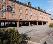
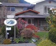
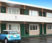
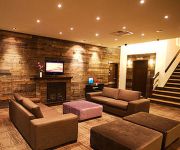
Hotels and Places to Stay
Hotel Squamish
Mountain Retreat Hotel
Meadowbrook Bed & Breakfast
Squamish Budget Inn
August Jack Motor Inn
Howe Sound Inn & Brewing Company
Sea to Sky Hotel & Conference Centre
SANDMAN HOTEL SQUAMISH
ARAWAK BEACH INN
Executive Suites Hotel and Res
Videos from this area
These are videos related to the place based on their proximity to this place.
Squamish Atom A1 Exhibition Game #3 vs Sunshine Coast
3rd exhibition game for the Squamish Eagles Atom A1 team. Played at home at Brennan Park Arena, Squamish BC. September 30th, 2012.
Squamish Super Spartan Race 2012 - Poi Apeles
I participated in my first Spartan Race. I went balls out because I did the Super Spartan. I liked it, a lot of trail running around Squamish. The running I was OK with. The obstacle coures,...
Squamish Eagles vs Vancouver Thunderbirds
2nd of three games over five days for the Squamish Eagles Atom Team Played at Brennan Park Arena Oct 21st, 2012.
Squamish Atom A1 Exhibition Game #4 vs Whistler A1
First Meeting of these Sea-To-Sky Rivals for the 2012/13 season, as well as 4th exhibition game for the Squamish Eagles Atom A1 team. Played at home at Brennan Park Arena, Squamish BC. October ...
Jetboat Mamquam.avi
Mamquam River from just below the kayak course down to the Squamish River in a 17' Ali-Craft Explorer. July 6, 2010.
A Walk Through Garibaldi Park
Join me for a walk through Garibaldi Provincial Park. The Park comprises of 194650 hectares within the coast mountains and is located 13 km north of Squamish, 97 km north of Vancouver along...
Talon at Eaglewind
Located on a spectacular 25 acre property in Downtown Squamish, Eaglewind is a remarkable master-planned community designed to se a bold new standard in Squamish. With its stunning mountain.
Eaglewind Squamish, BC
Located on a spectacular 25 acre property in Downtown Squamish, Eaglewind is a remarkable master-planned community designed to se a bold new standard in Squamish. With its stunning mountain.
Squamish 3 The Chief Top Of First Peak
Finally made it to the top of First Peak of The Chief, Squamish, B.C. On our way up, people kept telling us "The view is worth it!" It sure is!
Videos provided by Youtube are under the copyright of their owners.
Attractions and noteworthy things
Distances are based on the centre of the city/town and sightseeing location. This list contains brief abstracts about monuments, holiday activities, national parcs, museums, organisations and more from the area as well as interesting facts about the region itself. Where available, you'll find the corresponding homepage. Otherwise the related wikipedia article.
Squamish, British Columbia
Squamish is a community and a district municipality in the Canadian province of British Columbia, located at the north end of Howe Sound on the Sea to Sky Highway. The population of the Squamish census agglomeration – including Indian Reserves of the Squamish Nation not governed by the municipality – is 15,256. The town of Squamish had its beginning during the construction of the Pacific Great Eastern Railway in the 1910s. It was the first southern terminus of that railway (now a part of CN).
Quest University
Quest University Canada is a private non-profit liberal arts and sciences university in Squamish, British Columbia, Canada. The university opened in September 2007 with an enrolment of 74 students; its current enrolment is 430. Quest University is located on a 60-acre mountain-top campus on the edge of Garibaldi Provincial Park. It is approximately 73 km from Vancouver and 57 km from Whistler.
Stawamus Chief
The Stawamus Chief (often referred to as simply The Chief, or erroneously as the Squamish Chief) is a granite dome located adjacent to the town of Squamish, British Columbia. It towers over 700 m above the waters of nearby Howe Sound. It is often claimed to be the "second largest granite monolith in the world. " The Sḵwxwú7mesh, indigenous people from this area, consider the Chief to be a place of spiritual significance.
West Coast Railway Association
The West Coast Railway Association is a heritage railway and museum located on Government Road in Squamish, British Columbia near Vancouver, whose purpose is to collect, preserve and restore railway cars and artifacts and operate a licensed railway. To this end, the Association acquired the Royal Hudson #2860 steam locomotive from the cash strapped BC Rail and in 2006 restored it to operation.
Stawamus Squaw
Slhanay, formerly known as The Squaw is a large dome of granitic rock located adjacent to the town of Squamish, British Columbia. Although the Slhanay is indeed an impressive geological formation, it tends to be overshadowed by the Stawamus Chief, a much larger granitic dome located immediately south-west. The use of the term "squaw" as a name for the dome is controversial.
Shannon Falls Provincial Park
Shannon Falls Provincial Park is a provincial park in British Columbia, Canada. It is located 58 kilometers from Vancouver and 2 kilometers south of Squamish along the Sea to Sky Highway. Shannon Falls is the third highest waterfall in British Columbia. The park covers an area of 87 hectares . The main point of interest is Shannon Falls, the third highest waterfall in BC, where water falls from a height of 335 meters .
Howe Sound Secondary School
Howe Sound Secondary is a public Secondary school in Squamish, British Columbia part of School District 48 Howe Sound. It is the largest school in the district, and is the only school in Squamish to offer grades 11 and 12. Notable alumni include Neal Kindree (national mountain bike racer); Mike Sweeney; Jeff Yim and Mike Carney (Olympic ski racer).
Ring Creek
Ring Creek is a creek in southwestern British Columbia, Canada. It flows west and southwest into the Mamquam River, and east of the Squamish River.


