Safety Score: 2,8 of 5.0 based on data from 9 authorites. Meaning we advice caution when travelling to Canada.
Travel warnings are updated daily. Source: Travel Warning Canada. Last Update: 2024-08-13 08:21:03
Discover South Wellington
South Wellington in Regional District of Nanaimo (British Columbia) is a city in Canada about 2,235 mi (or 3,598 km) west of Ottawa, the country's capital city.
Local time in South Wellington is now 02:46 AM (Tuesday). The local timezone is named America / Vancouver with an UTC offset of -8 hours. We know of 10 airports in the vicinity of South Wellington, of which 4 are larger airports. The closest airport in Canada is Nanaimo Airport in a distance of 3 mi (or 5 km), South. Besides the airports, there are other travel options available (check left side).
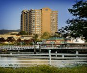
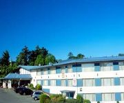
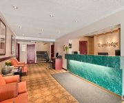
There is one Unesco world heritage site nearby. The closest heritage site is Olympic National Park in United states at a distance of 112 mi (or 180 km). Also, if you like golfing, there are a few options in driving distance. We discovered 3 points of interest in the vicinity of this place. Looking for a place to stay? we compiled a list of available hotels close to the map centre further down the page.
When in this area, you might want to pay a visit to some of the following locations: Victoria, Friday Harbor, Port Angeles, Bellingham and Coupeville. To further explore this place, just scroll down and browse the available info.
Local weather forecast
Todays Local Weather Conditions & Forecast: 7°C / 45 °F
| Morning Temperature | 6°C / 44 °F |
| Evening Temperature | 5°C / 42 °F |
| Night Temperature | 4°C / 39 °F |
| Chance of rainfall | 0% |
| Air Humidity | 78% |
| Air Pressure | 1025 hPa |
| Wind Speed | Moderate breeze with 12 km/h (8 mph) from South-East |
| Cloud Conditions | Overcast clouds, covering 100% of sky |
| General Conditions | Overcast clouds |
Tuesday, 5th of November 2024
7°C (45 °F)
4°C (40 °F)
Overcast clouds, light breeze.
Wednesday, 6th of November 2024
7°C (45 °F)
6°C (43 °F)
Broken clouds, light breeze.
Thursday, 7th of November 2024
9°C (48 °F)
8°C (46 °F)
Light rain, gentle breeze, overcast clouds.
Hotels and Places to Stay
Marinaside Resort
THE COAST BASTION HOTEL
BEST WESTERN DORCHESTER
HOWARD JOHNSON HOTEL - NANAIMO
Buccaneer Inn
The Port-O-Call Inn & Suites
The Bluebird Motel
Colonial Motel
Vancouver Island University Residences
NANAIMO VANCOUVER ISLAND TRAVE
Videos from this area
These are videos related to the place based on their proximity to this place.
Floatplane Vancouver to Victoria
Come along on my recent trip by float plane from Vancouver harbour to Victoria harbour. Via Lions Gate Bridge and Active Pass we flew over all of Salt Spring Island. I could see my house at...
Inside Passage Video 10, Rowing Dodds Narrows, Docks in Naniamo
Row the canoe through Dodds Narrows, then make camp just outside of Naniamo. Wheelchair rowing canoe. www.wheelsafloat.com.
Living Forest Heli flight over oceanfront sites
Beautiful late summer evening flight above Living Forest Oceanside Campground & RV on Vancouver Island, with a great eagle view of our park, the ocean and mountains and Islands beyond. Under...
Approaching Dodd Narrows
Leaving Maple Bay on a Saturday morning John Gourlay and I were able to sail most of the way to Dodd Narrows, just south of Nanaimo. As we were drifting along I decided to try out my new Canon...
Easter egg hunt at Living Forest Oceanside Campground & RV
Easter weekend is very busy at the park- and here's part of why. This short clip shoes 'the main event'. We always have let the wee ones start a few minutes earlier and egg hunt in a separate...
Mudge Snow Flakes
Mudge Island folks see snow for the first time! Well dry snow, that goes up your nose and other places.
Kayaking on the Nanaimo River
October 2010 from the Living Forest Oceanside Campground and RV in Nanaimo BC.
Baby Deer shot with 400 mm lens on beta cam
Here are some nice shots of our friends, the deer. Check out Bambi....If you see a fawn alone in the forest, leave it be. chances are mom is nearby feeding. The fawn has no scent to attract...
Videos provided by Youtube are under the copyright of their owners.
Attractions and noteworthy things
Distances are based on the centre of the city/town and sightseeing location. This list contains brief abstracts about monuments, holiday activities, national parcs, museums, organisations and more from the area as well as interesting facts about the region itself. Where available, you'll find the corresponding homepage. Otherwise the related wikipedia article.
Cedar, British Columbia
Cedar is a small community in the Canadian province of British Columbia. It is located near the east coast of Vancouver Island — about 8 kilometers southeast of Nanaimo. Its geographical coordinates are {{#invoke:Coordinates|coord}}{{#coordinates:49|07|N|123|51|W||| | |name= }}. Near Cedar are DeCourcy Island and Ruxton Island, which were once home to the mystical rake Brother XII.
Starks railway station
The Starks railway station is located in Starks, British Columbia. The station was a flag stop on Via Rail's Victoria – Courtenay train service, which ended in 2011. The station is on the Southern Railway of Vancouver Island mainline.
South Wellington railway station
The South Wellington railway station is located in South Wellington, British Columbia. The station was a stop on Via Rail's Victoria – Courtenay train service, which ended in 2011. The station is on the Southern Railway of Vancouver Island mainline.
Cassidy railway station
The Cassidy railway station is located in Cassidy, British Columbia. The station was a flag stop on Via Rail's Victoria – Courtenay train service, which ended in 2011. The station is on the Southern Railway of Vancouver Island mainline. The Cassidy railway station was established on March 31, 1924 being named after Thomas Cassidy, a local farmer who homesteaded in the area and delivered milk and supplies to the railway.


