Safety Score: 2,8 of 5.0 based on data from 9 authorites. Meaning we advice caution when travelling to Canada.
Travel warnings are updated daily. Source: Travel Warning Canada. Last Update: 2024-08-13 08:21:03
Touring Promonotory
The district Promonotory of Promontory in British Columbia is a subburb located in Canada about 2,149 mi west of Ottawa, the country's capital place.
Need some hints on where to stay? We compiled a list of available hotels close to the map centre further down the page.
Being here already, you might want to pay a visit to some of the following locations: Chilliwack, Bellingham, Mount Vernon, Everett and Coupeville. To further explore this place, just scroll down and browse the available info.
Local weather forecast
Todays Local Weather Conditions & Forecast: 10°C / 51 °F
| Morning Temperature | 5°C / 41 °F |
| Evening Temperature | 7°C / 45 °F |
| Night Temperature | 6°C / 43 °F |
| Chance of rainfall | 0% |
| Air Humidity | 62% |
| Air Pressure | 1024 hPa |
| Wind Speed | Light breeze with 3 km/h (2 mph) from South-West |
| Cloud Conditions | Clear sky, covering 5% of sky |
| General Conditions | Sky is clear |
Thursday, 5th of December 2024
9°C (48 °F)
8°C (46 °F)
Light rain, calm, overcast clouds.
Friday, 6th of December 2024
9°C (47 °F)
9°C (48 °F)
Moderate rain, calm, overcast clouds.
Saturday, 7th of December 2024
11°C (51 °F)
6°C (43 °F)
Heavy intensity rain, light breeze, overcast clouds.
Hotels and Places to Stay
Vedder River Inn
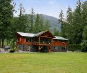
Forest Echoes Cabins
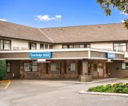
Chilliwack Travelodge
Chilliwack Riverfront Sanctuary
Royal Hotel
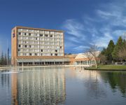
Hampton Inn by Hilton Chilliwack BC
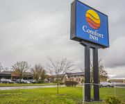
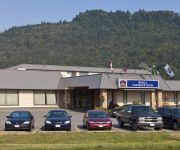
Comfort Inn Chilliwack
Rainbow Motor Inn
BEST WESTERN RAINBOW CNTRY INN
COAST CHILLIWACK HOTEL
Videos from this area
These are videos related to the place based on their proximity to this place.
46306 Valleyview Rd Sardis Chilliwack BC - Real Estate Virtual Tour - Curt Derksen
View http://www.seevirtual360.com/28682 to see PRICE and more PHOTOS. Welcome home! Your new home is beauty & affordability. Built in 2001 your new home boasts big bright windows to let in...
Let's Play Dragon Age 2 - Part 188: Journey's End
Alright a bit more post game ranting because i get a little hyper when I finish games. XD Hope everyone enjoyed watching me LP DA2. +-+-+-+-+-+-+-+-+-+-+-+-+-+-+-+-+-LINKS-+-+-+-+-+-+-+-+-+-+-+-+.
6891 Centennial Dr Sardis BC - Real Estate Virtual Tour - Sabrina vandenBrink
View http://www.seevirtual360.com/28363 to see PRICE and more PHOTOS. LIFE AT THE PARK.. When your looking for the perfect place to raise a family and location is important this is the home...
Let's Play Tales of the Abyss - Part 20: City of Sand
We're on a boat! Progressing the story with some serious plot elemets, and our first encounter with the city of trade! Fun times with sidequests. +-+-+-+-+-+-+-+-+-+-+-+-+-+-+-+-+-LINKS-+-+-+-+-+-...
#1 Best Place To Buy Contact Lenses In Chilliwack BC - My Testimonial
Sardis Optical Location #6-6014 Vedder Road, Chilliwack BC V2R 5M4 49.11192 -121.95698 Tel: (604) 393-3745 Website: sardisoptical.ca I'm Lorna Olitch and this is my testimonial for Sardis...
#1 Best Place To Buy New Eyeglasses In Chilliwack BC - My Testimonial
Hi I'm Lorna Olitch and this is my testimonial for Sardis Optical who, in my opinion, is the #1 place to get new eyeglasses in Chilliwack.” [Viewing wall of frame samples] “Sardis...
46254 Greenwood Dr Chilliwack - Real Estate Virtual Tour - Wendy Petrick
View http://www.seevirtual360.com/28512 to see PRICE and more PHOTOS. Fabulous 4 bdrm, 2.5 bath split situated on .31 acre on one of the most desirable streets in Sardis Park! Gorgeous fenced...
Divine Wines Chilliwack | (604) 824-9602 | Vineyard quality wines at a fraction of the cost.
Divine Wines Chilliwack/ Sardis BC http://www.divineWines.ca At Divine Wines, we are always happy to give you help and advice about making your own wine either in our store or at home....
Inside a Volvo Articulated Dump Truck Selling at Auction
http://www.rbauction.com Join Vicki on her trip across the Ritchie Bros. auction ramp inside a Volvo articulated dump truck at the Ritchie Bros. auction facility in Chilliwack, BC.
45759 Thomas Vedder Crossing Chilliwack BC - Real Estate Virtual Tour - Sabrina vandenBrink
View http://www.seevirtual360.com/28591 to see PRICE and more PHOTOS. Loaded with Modern and Beautiful upgrades!! Great convenient location steps away from schools, Garrison crossing, ...
Videos provided by Youtube are under the copyright of their owners.
Attractions and noteworthy things
Distances are based on the centre of the city/town and sightseeing location. This list contains brief abstracts about monuments, holiday activities, national parcs, museums, organisations and more from the area as well as interesting facts about the region itself. Where available, you'll find the corresponding homepage. Otherwise the related wikipedia article.
Chilliwack (city)
Chilliwack is a Canadian city in the Province of British Columbia. It has long been a predominantly agricultural community, but with an estimated population of 80,000 people, it has become more suburban. Chilliwack is the second largest city in the Fraser Valley Regional District after Abbotsford. The city is surrounded by mountains and recreational areas such as Cultus Lake and Chilliwack Lake Provincial Parks.
Greendale, Chilliwack
Greendale is a primarily agricultural settlement within Chilliwack, British Columbia, Canada, located 92 kilometres east of the city of Vancouver. Greendale is located on the west side of Chilliwack, bordering the east side of the city of Abbotsford. The Vedder River forms the border between Greendale and Yarrow which lies to the South. Greendale, originally called Sumas until 1951, was once a 10,000 acre (40 km²) lake at the base of Sumas Mountain. Sumas Lake was drained in the early 1920s.
Prospera Centre
The Prospera Centre is a 5,000-seat multi-purpose arena in Chilliwack, British Columbia, Canada, built in 2004. It is the home of the Chilliwack Chiefs of the British Columbia Hockey League (BCHL) after the Quesnel Millionaires were moved from Quesnel, British Columbia for the start of the 2011–12 BCHL season.
Chehalis River (British Columbia)
The Chehalis River /ʃəˈheɪlɨs/ is located in the southwest corner of British Columbia, Canada near the city of Chilliwack. It flows south-eastward out of the Douglas Ranges of the Coast Mountains, draining into the Harrison River. Though the river's valley is heavily logged—earlier in the 20th century the area was covered by a dense network of logging railways—the river itself flows through a small canyon before a short relatively flat stretch leading to its confluence with the Harrison.
Chilliwack River Provincial Park
Chilliwack River Provincial Park is a provincial park in British Columbia, Canada.
Kilby Provincial Park
Kilby Provincial Park is a provincial park in British Columbia, Canada. Kilby Park is located in Harrison Mills, on the Harrison River overlooking Harrison Bay in the Upper Fraser Valley of southwestern British Columbia. It comprises 3 hectares with 22 camp sites and a boat launch. The park offers a sandy summer beach and fall/winter viewing of bald eagles and migrating trumpeter swans from Alaska.
Rosedale, Chilliwack
Rosedale is a farming-based community located in Chilliwack, British Columbia. This small community is based alongside the Fraser River. It serves as a base for many tourists, both in summer and winter. The hills and valleys of British Columbia are popular skiing, snowboarding and dogsledding locations. In summer, rockclimbing and whitewater rafting are the primary activities in the Fraser Valley.
Cultus Lake, British Columbia
Cultus Lake Park is a lake, associated community and provincial park in the Fraser Valley region of British Columbia, Canada. It is the source of the Sweltzer River. The lake itself is warm, and the area has become a popular recreation destination with ample opportunities for fishing, water skiing, wind surfing, and hiking. Cultus Lake is located 11 kilometers south of the Chilliwack River, near the city of Chilliwack and approximately 80 kilometers east of Vancouver.
Yarrow, British Columbia
Yarrow is a small community located 90 kilometres east of Vancouver and 12 km southwest of downtown Chilliwack, in British Columbia, Canada. It is in the Fraser Valley at the foot of Vedder Mountain. The village was first settled by Mennonites in the late 1920s, following the draining of Sumas Lake and the reclamation of the former lake bed for agriculture. Yarrow is located within the City of Chilliwack.
Harrison Mills, British Columbia
Harrison Mills, formerly Carnarvon and also Harrison River, is an agricultural farming and tourism-based community in the District of Kent west of Agassiz, British Columbia. The community is a part of the Fraser Valley Regional District. Harrison Mills is home to the British Columbia Heritage Kilby Museum and Campground.
Mountain Institution
Mountain Institution is a medium security federal penitentiary operated by the Correctional Service of Canada (CSC). It is located in the town of Agassiz, District of Kent, British Columbia, approximately 115 kilometres east of Vancouver.
CFUN-FM
CFUN-FM (identified on-air as Sonic) is a Canadian radio station. Officially licenced to Chilliwack, British Columbia and operating at 107.5 FM and 640 watts in that city, the station's main studios and listening area are in Metro Vancouver, where its rebroadcasting transmitter (CFUN-FM-2) operates at 104.9 FM on 31,000 watts of power. Rogers Communications owns the station. It currently falls behind Bell Media's CFBT-FM (The Beat 94.5).
Sumas Lake
Sumas Lake was a body of water between Sumas and Vedder mountains, midway between the present-day cities of Chilliwack and Abbotsford, British Columbia. Its name means "a big level opening" and is a reference to the site of the lake, which lay between Sumas Mountain and its American counterpart, Sumas Mountain, Washington, part of the foothills of the Cascade Mountains.
Kent Institution
Kent Institution is a Correctional Service of Canada (CSC) facility located in Kent, British Columbia. Opened in 1979, Kent is the only maximum security federal penitentiary in the CSC's Pacific region, which includes the province of British Columbia and the Yukon territory. The majority of prisoners at the facility are sentenced in other provinces. Educational programs, as well as socialization and employment, play a significant role at the institution. The facility employs over 300 people.
Elk Mountain (British Columbia)
Elk Mountain is located within the Fraser Valley in South Western British Columbia. It is part of the Cascade mountain range. Its highest point reaches up to 1,432 m. It is often frequented by paragliders.
CFB Chilliwack
Canadian Forces Base Chilliwack (also CFB Chilliwack) was a Canadian Forces Base located in Chilliwack, British Columbia. On 2 September 1997, (ASU) Area Support Unit Chilliwack was opened on the former CFB Chilliwack properties that was retained by the Canadian Forces.
Exhibition Stadium (Chilliwack)
Exhibition Stadium is a multi-purpose stadium located in Chilliwack, British Columbia. It is the home of the Chilliwack Huskers of the Canadian Junior Football League. It is one of the few stadiums with covered seating in the country that has a playing field with no running track around it. The stadium seats 2,500.
Vedder Mountain
Vedder Mountain is located in the Fraser Valley between the village of Yarrow and the village of Cultus Lake. The mountain stands 924 m high and is tree covered to its summit with some open areas. A hiking trail crosses the mountain. Old logging roads are also present.
Lake Errock (British Columbia)
Lake Errock is a lake at the community of the same name, located between Chehalis and Deroche in the Upper Fraser Valley of the Lower Mainland region of British Columbia, Canada. It lies southwest of Harrison Bay, a sidewater of the Harrison River west of Chehalis, and is separated from the nearby Fraser River by a large rocky hill. Originally named Squakum Lake, the name was adapted to that of the Lake Errock Post Office in 1964.
Scowlitz First Nation
The Scowlitz First Nation or Scowlitz Indian Band is the band government of Skaulits subgroup of the Sto:lo people located on Harrison Bay in the Upper Fraser Valley region between Chehalis (E) and Lake Errock, British Columbia, Canada (W). They are a member government of the Stó:lō Tribal Council.
Grass Indian Reserve No. 15
Grass Indian Reserve No. 15 is an Indian Reserve in the area of the City of Chilliwack, British Columbia, Canada, located 3.5 miles southeast of that city's downtown area. 64.80 ha. in size, it is shared by nine bands of the Sto:lo people. These are : Aitchelitz First Nation Kwaw-kwaw-Apilt First Nation Shxwhá:y Village Skowkale First Nation Skwah First Nation Soowahlie First Nation Squiala First Nation Tzeachten First Nation Yakweakwioose First Nation
Harrison Hill
Harrison Hill (622m) is a small mountain located at the confluence of the Harrison and Fraser Rivers in the Lower Mainland region of British Columbia, Canada. Harrison Knob (~225m) is a prominent shoulder to the east of the main peak of Harrison Hill.
Chilliwack railway station
Chilliwack railway station is in Chilliwack, British Columbia, Canada. The station consists solely of a signpost and paved low-level platform located on the north side of the tracks at Nowell Street. The station is served by Via Rail's The Canadian three times per week as a flag stop (48 hours advance notice required). The station is only served by westbound train to Abbotsford and Vancouver. Eastbound trains call at the Agassiz railway station.
Harrison Bay
Harrison Bay is a lake-like expansion of the Harrison River, located west of its main course adjacent to the communities of Chehalis and Harrison Mills. Extremely shallow, the bay outlets to the Fraser at Harrison Mills, where in pre-gold rush times there had been a "riffle", which was dredged to enable easier steamer traffic to Harrison Lake and Port Douglas.
Leq' a: mel First Nation
The Leq' a: mel First Nation, formerly known as the Lakahahmen First Nation, is a First Nations band government whose community and offices are located in the area near Deroche, British Columbia, Canada, about 12 kilometres east of the District of Mission. They are a member government of the Sto:lo Nation tribal council, which is one of two tribal councils of the Sto:lo (though many bands are independent of either).


