Safety Score: 2,8 of 5.0 based on data from 9 authorites. Meaning we advice caution when travelling to Canada.
Travel warnings are updated daily. Source: Travel Warning Canada. Last Update: 2024-08-13 08:21:03
Discover Naramata
Naramata in British Columbia is a city in Canada about 2,039 mi (or 3,282 km) west of Ottawa, the country's capital city.
Local time in Naramata is now 06:41 AM (Thursday). The local timezone is named America / Vancouver with an UTC offset of -8 hours. We know of 9 airports in the vicinity of Naramata, of which one is a larger airport. The closest airport in Canada is Penticton Airport in a distance of 9 mi (or 15 km), South. Besides the airports, there are other travel options available (check left side).
Also, if you like golfing, there are a few options in driving distance. Looking for a place to stay? we compiled a list of available hotels close to the map centre further down the page.
When in this area, you might want to pay a visit to some of the following locations: Okanogan, Republic, Colville, Waterville and Ephrata. To further explore this place, just scroll down and browse the available info.
Local weather forecast
Todays Local Weather Conditions & Forecast: 2°C / 36 °F
| Morning Temperature | -1°C / 30 °F |
| Evening Temperature | 0°C / 32 °F |
| Night Temperature | -2°C / 29 °F |
| Chance of rainfall | 0% |
| Air Humidity | 80% |
| Air Pressure | 1021 hPa |
| Wind Speed | Calm with 2 km/h (1 mph) from South-East |
| Cloud Conditions | Overcast clouds, covering 91% of sky |
| General Conditions | Overcast clouds |
Thursday, 21st of November 2024
2°C (36 °F)
1°C (33 °F)
Snow, light breeze, overcast clouds.
Friday, 22nd of November 2024
3°C (38 °F)
0°C (32 °F)
Light snow, calm, overcast clouds.
Saturday, 23rd of November 2024
-1°C (29 °F)
-3°C (26 °F)
Light snow, light breeze, overcast clouds.
Hotels and Places to Stay
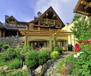
Apple D'or
E'Laysa Guesthouse and Vineyard Retreat
The Village Motel
Summerland Motel
Pleasant View Motel
Rosedale Motel
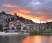
SUMMERLAND WATERFRONT RESORT
Videos from this area
These are videos related to the place based on their proximity to this place.
2015-03-22 Penticton Vees vs Vernon Vipers
VEES 2 / Vipers 0 The Vees win the BCHL Interior Conference Final!
Explore Penticton 2015
Penticton is the gateway to the Southern Okanagan region, and is a growing community of over 33000. A four season destination for vacationers and business travellers alike, Penticton is cradled...
Penticton Farmers' Market 2014
Direct From The Farm Every Saturday http://pentictonfarmersmarket.org 2014 Video Directed / Edited by David Ehrenreich Cinematography by Liam Mitchell The Penticton Farmers' Market is...
CHALLENGE PENTICTON
The historic long distance triathlon. The first ultra-distance event was staged in 1983 with a field of 23, but has grown to thousands of participants from throughout the world. What remains...
2010 Ironman Canada Penticton, BC Swim Start
Competitors race into the fridged waters of Lake Okanagan for the start of a long race called Ironman. 2010 Ironman Canada at Penticton, BC on August 29, 2010 @ 0700am.
Videos provided by Youtube are under the copyright of their owners.
Attractions and noteworthy things
Distances are based on the centre of the city/town and sightseeing location. This list contains brief abstracts about monuments, holiday activities, national parcs, museums, organisations and more from the area as well as interesting facts about the region itself. Where available, you'll find the corresponding homepage. Otherwise the related wikipedia article.
River delta
A river delta is a landform that is formed at the mouth of a river, where the river flows into an ocean, sea, estuary, lake, or reservoir. Deltas are formed from the deposition of the sediment carried by the river as the flow leaves the mouth of the river. Over long periods of time, this deposition builds the characteristic geographic pattern of a river delta. Contrary to popular belief, this usage of the word delta was not coined by Herodotus.


