Safety Score: 2,8 of 5.0 based on data from 9 authorites. Meaning we advice caution when travelling to Canada.
Travel warnings are updated daily. Source: Travel Warning Canada. Last Update: 2024-08-13 08:21:03
Discover Mount Lehman
Mount Lehman in British Columbia is a town in Canada about 2,169 mi (or 3,490 km) west of Ottawa, the country's capital city.
Current time in Mount Lehman is now 06:15 AM (Thursday). The local timezone is named America / Vancouver with an UTC offset of -8 hours. We know of 11 airports near Mount Lehman, of which 4 are larger airports. The closest airport in Canada is Abbotsford Airport in a distance of 6 mi (or 10 km), South. Besides the airports, there are other travel options available (check left side).
There is one Unesco world heritage site nearby. The closest heritage site is Olympic National Park in United states at a distance of 95 mi (or 153 km). Also, if you like playing golf, there are a few options in driving distance. We discovered 1 points of interest in the vicinity of this place. Looking for a place to stay? we compiled a list of available hotels close to the map centre further down the page.
When in this area, you might want to pay a visit to some of the following locations: Bellingham, Chilliwack, Mount Vernon, Friday Harbor and Coupeville. To further explore this place, just scroll down and browse the available info.
Local weather forecast
Todays Local Weather Conditions & Forecast: 7°C / 44 °F
| Morning Temperature | 2°C / 36 °F |
| Evening Temperature | 4°C / 40 °F |
| Night Temperature | 4°C / 39 °F |
| Chance of rainfall | 0% |
| Air Humidity | 71% |
| Air Pressure | 1013 hPa |
| Wind Speed | Gentle Breeze with 6 km/h (4 mph) from South-West |
| Cloud Conditions | Scattered clouds, covering 32% of sky |
| General Conditions | Scattered clouds |
Thursday, 21st of November 2024
4°C (39 °F)
5°C (40 °F)
Rain and snow, moderate breeze, overcast clouds.
Friday, 22nd of November 2024
6°C (44 °F)
5°C (41 °F)
Light rain, light breeze, overcast clouds.
Saturday, 23rd of November 2024
3°C (38 °F)
2°C (35 °F)
Rain and snow, gentle breeze, overcast clouds.
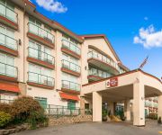
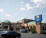
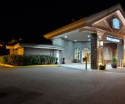
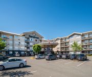
Hotels and Places to Stay
BW PLUS MISSION CITY LODGE
Brookside Inn Boutique Hotel
Abbotsford Hotel
BEST WESTERN PLUS REGENCY INN
SANDMAN ABBOTSFORD AIRPORT
Sandman Hotel Abbotsford
Videos from this area
These are videos related to the place based on their proximity to this place.
Historic Motor Races
My trip to vintage motor racing mission bc. triumph gt6 race car , alfa romeo, historic mustang rawlson cr11 fv ff camero lotus. fly by north american havard aircraft. https://sites.google.com/sit...
#408 Chasing Chrome 2013 07 22
When you own two railways, it is appropriate to have a private train aboard which you can entertain and educate customers and just enjoy the property. Dennis Washington is such an owner and...
Mission Vintage Racing Group 4 cars, August 2008
Mission Vintage Racing group 4 cars stage and take to the track. Swift DB2, Rawlson CR11, Johnston JM3.
#156 A Sparkling Day Pt.2
We are having and unusual start to December. So, friend Chris and I were out chasing trains in brilliant sunshine and somewhat crisp temperatures. Here's part Two of clips from around the rural...
Keyster
Keyster has been adopted and went to his new home on Sept 11/11. **********************************************************************************************************************************...
#127 3080 Townline Rd Abbotsford - Real Estate Virtual Tour - Stan Sturwold
View http://www.seevirtual360.com/29207 to see PRICE and more PHOTOS. THE GABLES , a sought after family friendly community! Bright & spacious, level entry rancher with fully finished basement....
Cane Walking
It was a good job I did I'm proud of myself. Brain injury patient re-learns how to walk using a few different types of canes. My journey through my 4 phases of re-learning how to walk - link...
Car Crash Rollover Death Vehicle Caught Fire Hwy #1 Langley BC Canada
DV-422-1 JULY 27 2004 LANGLEY CITY This vehicle was traveling North on the trans Canada Hwy, The suv lost control rolled and caught on fire. the driver was pronounced dead at the scene....
NHRA Drag Racing Pro Mods & Doorslammers - Mission, BC - June 27/09 part 4 of 4
CanadaMotorSports - Drag racing at Mission Raceway Park, Mission BC, part 2 of 4. June 27, 2009 NHRA Drag Racing, featuring 8 second door-slammers, pro-mods, pro streets. Look for Rick ...
Videos provided by Youtube are under the copyright of their owners.
Attractions and noteworthy things
Distances are based on the centre of the city/town and sightseeing location. This list contains brief abstracts about monuments, holiday activities, national parcs, museums, organisations and more from the area as well as interesting facts about the region itself. Where available, you'll find the corresponding homepage. Otherwise the related wikipedia article.
Lower Mainland
The Lower Mainland is a name commonly applied to the region surrounding and including Vancouver, British Columbia, Canada. As of 2011, 2,590,921 people (59% of British Columbia's total population), lived in the region; sixteen of the province's thirty most populous municipalities are located there. While the term Lower Mainland has been recorded from the earliest period of non-native settlement in British Columbia, it has never been officially defined in legal terms.
Mount Lehman, Abbotsford
Mount Lehman or Mt. Lehman (49°07'00"N, 122°23'00"W) is a small rural community located in the Fraser Valley of southwestern British Columbia, Canada. The community was established in 1864 but was incorporated into the present day city of Abbotsford, British Columbia in 1995. Mount Lehman is situated on an area of upraised land (hence, where the "Mount" comes into the name), that lies between the flat plains of Matsqui Prairie to the east and Glenn Valley to the west.
Silverdale, British Columbia
Silverdale is a semi-rural neighbourhood of the District of Mission, British Columbia, Canada c. 40 km east of Vancouver on the west bank of the Stave River at its confluence with the Fraser. Noted for its historic Italian Canadian community, its economy was farming, fishing and logging based until the general suburbanization of Fraser Valley life in the 1960s and '70s.
Bradner, Abbotsford
Bradner is a community within the City of Abbotsford, British Columbia, Canada, located in a rural northwest region of that city which also includes Mount Lehman. Bradner occupies a height of land above the Fraser River, immediately across which is the community of Silverdale, a part of the District of Mission, and Ruskin, on the border between Mission and Maple Ridge.
Mennonite Educational Institute
Mennonite Educational Institute (MEI) is an independent school consisting of four day schools — a preschool, elementary, middle, and secondary school — in the city of Abbotsford, British Columbia, Canada. Founded in 1944 as a private high school by a group of Mennonite churches, governance, at a board level, is provided by representatives of 14 Society churches.


