Safety Score: 2,8 of 5.0 based on data from 9 authorites. Meaning we advice caution when travelling to Canada.
Travel warnings are updated daily. Source: Travel Warning Canada. Last Update: 2024-08-13 08:21:03
Discover Walnut Grove
The district Walnut Grove of Milner in British Columbia with it's 25,683 citizens Walnut Grove is a district in Canada about 2,180 mi west of Ottawa, the country's capital city.
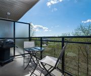
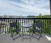
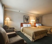
Looking for a place to stay? we compiled a list of available hotels close to the map centre further down the page.
When in this area, you might want to pay a visit to some of the following locations: Bellingham, Chilliwack, Friday Harbor, Mount Vernon and Coupeville. To further explore this place, just scroll down and browse the available info.
Local weather forecast
Todays Local Weather Conditions & Forecast: 8°C / 46 °F
| Morning Temperature | 7°C / 45 °F |
| Evening Temperature | 6°C / 43 °F |
| Night Temperature | 6°C / 42 °F |
| Chance of rainfall | 1% |
| Air Humidity | 85% |
| Air Pressure | 1007 hPa |
| Wind Speed | Light breeze with 3 km/h (2 mph) from South-West |
| Cloud Conditions | Overcast clouds, covering 95% of sky |
| General Conditions | Light rain |
Sunday, 24th of November 2024
5°C (40 °F)
1°C (35 °F)
Rain and snow, gentle breeze, overcast clouds.
Monday, 25th of November 2024
3°C (38 °F)
4°C (38 °F)
Light snow, light breeze, overcast clouds.
Tuesday, 26th of November 2024
4°C (39 °F)
3°C (38 °F)
Overcast clouds, calm.
Hotels and Places to Stay
Premiere Suites at Elements
Premiere Suites at Hawthorne
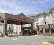
RAMADA SURREY LANGLEY
Econo Lodge Maple Ridge
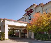
Hampton Inn & Suites by Hilton Langley-Surrey
BEST WESTERN PLUS LANGLEY INN
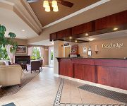
TRAVELODGE LANGLEY CITY
Westward Inn & Suites
Econo Lodge
Langley Hwy Hotel
Videos from this area
These are videos related to the place based on their proximity to this place.
#39 20350 68 Ave Langley BC - Real Estate Virtual Tour - Katronis Team
View http://www.katronisrealestate.com/Properties.php/Details/637/tab_689 to see PRICE and more PHOTOS. Sunridge with a walk out back yard and large deck. Ve...
19859 69A Ave Langley BC - Real Estate - Susan Parsons - Royal LePage Wolstencroft
View http://www.seevirtual360.com/26165 to see PRICE and more PHOTOS. "WILLOUGHBY" MASTER BDRM ON MAIN - Well maintained, 3 bedroom, 3 bathroom approximately 1858 sq finished, ...
Langley City Abandoned House Fire 82nd Ave January 24 2015
British Columbia Canada www.Bcnewsvideo.com.
FIELD TRIP, JESUS = 888
1. God is perfect. 2. God speaks English. 3. Therefore, English is perfect mathematically, to Glorify Him at all times, day and night. That is what we reveal in all of these videos. And then—fro...
FIELD TRIP, JESUS = 888
1. God is perfect. 2. God speaks English. 3. Therefore, English is perfect mathematically, to Glorify Him at all times, day and night. That is what we reveal in all of these videos. And then—fro...
VALUE VILLAGE solved!! Fast Quality
1. God is perfect. 2. God speaks English. 3. Therefore, English is perfect mathematically, to Glorify Him at all times, day and night. That is what we reveal in all of these videos. And then—fro...
New middle school supports growing Langley community
It's a new school named after the creek that flows through the neighbouring Langley communities of Walnut Grove and Willoughby Slope. It was time to celebrate a new chapter in the Langley...
6869 210 St Langley BC - Real Estate Virtual Tour - Janine Mazzalupi
View http://janine-mazzalupi.myrealpagewebsite.com/mylistings.html/videos-45012823 to see PRICE and more PHOTOS. A private 2700 sqft. executive rancher & workshop on 1.14 Acres in the heart...
M2U00327, JESUS = 888
1. God is perfect. 2. God speaks English. 3. Therefore, English is perfect mathematically, to Glorify Him at all times, day and night. That is what we reveal in all of these videos. And then—fro...
M2U00360, JESUS = 888
1. God is perfect. 2. God speaks English. 3. Therefore, English is perfect mathematically, to Glorify Him at all times, day and night. That is what we reveal in all of these videos. And then—fro...
Videos provided by Youtube are under the copyright of their owners.
Attractions and noteworthy things
Distances are based on the centre of the city/town and sightseeing location. This list contains brief abstracts about monuments, holiday activities, national parcs, museums, organisations and more from the area as well as interesting facts about the region itself. Where available, you'll find the corresponding homepage. Otherwise the related wikipedia article.
Pitt Meadows
Pitt Meadows is a city in southwestern British Columbia, Canada and a member municipality in Metro Vancouver. Incorporated in 1914, it has a land area of 85.38 square kilometres and a population of 17,736 (as of 2011).
Trinity Western University
Trinity Western University (TWU) is a private Christian liberal arts university in Langley, British Columbia, Canada. Founded in 1962, it enrolls approximately 3,500 students and sits on a rural 157-acre campus near the historic village of Fort Langley, British Columbia. Trinity Western is Canada's largest privately funded Christian university.
Langley, British Columbia (city)
The City of Langley is a municipality in Metro Vancouver. It lies directly east of the City of Surrey, adjacent to Cloverdale, and surrounded on the north, east and south by Township of Langley.
Golden Ears Bridge
The Golden Ears Bridge is a six-lane extradosed bridge in Metro Vancouver, British Columbia. It spans the Fraser River, connecting Langley on the south side with Pitt Meadows and Maple Ridge on the north side. The bridge opened to traffic on June 16, 2009. The bridge replaced a previous ferry service several kilometers upstream and will be run by a private consortium, the Golden Crossing General Partnership, until June 2041.
Fort Langley, British Columbia
Fort Langley is a village with a population of 2,700 and forms part of the Township of Langley. It is the home of Fort Langley National Historic Site, a former fur trade post of the Hudson's Bay Company.
Canadian Museum of Flight
The Canadian Museum of Flight (formally the Canadian Museum of Flight Association since 1998) is an aviation museum at the Langley Regional Airport in Langley, British Columbia, Canada. The museum has over 25 civilian and military jets, piston driven engine aircraft, gliders, and helicopters on display, six of which have been restored to flying condition. Other displays include an aviation art gallery and aviation artefacts.
Barnston Island (British Columbia)
Barnston Island is an unincorporated island located in the Greater Vancouver metropolitan area of British Columbia, Canada. Most of the island is part of the Greater Vancouver Electoral Area A; the remainder is Barnston Island Indian Reserve No. 3, which is outside Electoral Area A limits and is under the governance of the Katzie First Nation, headquartered across the river at their main reserve in Pitt Meadows.
Fort Langley National Historic Site
Fort Langley is a former trading post of the Hudson's Bay Company, now located in the village of Fort Langley, British Columbia. Commonly referred to as "the birthplace of British Columbia", it is designated a National Historic Site of Canada and administered by Parks Canada.
R. E. Mountain Secondary School
R.E. Mountain Secondary is a public high school in northern Langley, British Columbia and is a part of School District 35 Langley.
Arthur Peake Centre
Arthur Peake Centre is an adult learning centre in Maple Ridge part of School District 42 Maple Ridge-Pitt Meadows. It is located on 116th Ave. , across from Thomas Haney Secondary School.
Pitt Meadows Secondary School
Pitt Meadows Secondary School ("PMS")is a public high school in Pitt Meadows, British Columbia, part of School District 42 Maple Ridge-Pitt Meadows. The school was founded in 1961 and celebrated its 50th anniversary with an open house on September 30, 2011.
Thomas Haney Secondary School
Thomas Haney Secondary School is a public high school in Maple Ridge, British Columbia, Canada, under the authority of School District 42 Maple Ridge-Pitt Meadows. Athletic organizations within the school are known as the Thomas Haney Thunder.
McMillan Island
McMillan Island is an island in the Fraser River. Located to the north of Fort Langley and south of Maple Ridge.
Bedford Channel
The Bedford Channel is a small side channel of the Fraser River near the north end of the Township of Langley, on the south side of McMillan Island. The pair of islands--Brae Island and McMillan Island that protect the riverfront of Fort Langley, British Columbia are reached by the bridge that crosses the Bedford Channel on the way to the now-closed Albion Ferry terminal and the main reserve community of the Kwantlen First Nation on McMilland Island.
Haney, British Columbia
Haney, British Columbia was historically a town in Southern British Columbia and is now part of the larger district municipality of Maple Ridge, British Columbia.
Pitt Meadows Station
Pitt Meadows Station is a station on the West Coast Express commuter rail line connecting Vancouver to Mission, British Columbia, Canada. The station is located on the south side of the Canadian Pacific Railway (CPR) tracks in Pitt Meadows, just off Harris Road. The station opened in 1995, when the West Coast Express began operating. 140 park and ride spots are available. All services are operated by TransLink.
Maple Meadows Station
Maple Meadows Station is a station on the West Coast Express commuter rail line connecting Vancouver to Mission, British Columbia, Canada. The station is located on the north side of the Canadian Pacific Railway (CPR) tracks in Maple Ridge, just off Maple Meadows Way and Hammond Road. The station opened in 1995, when the West Coast Express began operating. 467 park and ride spaces are available. All services are operated by TransLink.
Katzie First Nation
The Katzie First Nation or Katzie Nation is the band government of the Katzie people of the Lower Fraser Valley region of British Columbia, Canada.
Kanaka Creek Regional Park
Kanaka Creek Regional Park is a regional park of the Metro Vancouver regional district, located in the District of Maple Ridge, British Columbia, flanking both sides of Kanaka Creek from its confluence with the Fraser River just east of Haney and extending approximately 11 km (7 mi) up the creek to just south of the community of Webster's Corners. The 400 ha. park has three main areas.
Port Kells
Port Kells is a neighbourhood of the City of Surrey in British Columbia, Canada, located at the northeastern end of that city adjacent to the Fraser River and west of the neighbourhood of Walnut Grove (part of the Township of Langley).
Langley Events Centre
The Langley Events Centre is a 260,483-square-foot multipurpose facility in the Township of Langley. The LEC debuted in April 2009, hosting the 2009 BC Gymnastics Championships. It boasts an arena bowl with a 5,500 capacity for sports, including 24 individual suites.
Port Hammond
Port Hammond, commonly known as Hammond, is a community on the Fraser River within the municipality of Maple Ridge, British Columbia, Canada, near its border with the City of Pitt Meadows and just east of the Golden Ears Bridge.
Milner, British Columbia
Milner is a rural village and locality in the Township of Langley in the Fraser Valley of British Columbia, Canada. It is located along the British Columbia Electric Railway line (now the Southern Railway of B.C. northeast of the City of Langley and just southwest of Fort Langley. Local business attractions include Milner Downs Equestrian Center, Milner Gardens, and Milner Valley Cheese. and Milner Feed and Pet Supply Ldt.
Langley Education Centre
Langley Education Centre (LEC) is a public high school in Langley, British Columbia, part of School District 35 Langley. LEC offers secondary school (Gr. 10-12) options for teens and adults to continue and complete a secondary education or upgrade their courses. The courses are offered one of two ways: 1.
Associated Canadian Theological Schools
The Associated Canadian Theological Schools (ACTS Seminaries) are a multi-denominational consortium of five Protestant Christian seminaries in Canada, which partner with Trinity Western University to jointly grant master's and Doctor of Ministry degrees to graduates. ACTS is an accredited member of the Association of Theological Schools.


