Safety Score: 2,8 of 5.0 based on data from 9 authorites. Meaning we advice caution when travelling to Canada.
Travel warnings are updated daily. Source: Travel Warning Canada. Last Update: 2024-08-13 08:21:03
Delve into Maple Bay
Maple Bay in British Columbia is a town located in Canada about 2,228 mi (or 3,585 km) west of Ottawa, the country's capital town.
Time in Maple Bay is now 01:12 AM (Sunday). The local timezone is named America / Vancouver with an UTC offset of -8 hours. We know of 8 airports closer to Maple Bay, of which 4 are larger airports. The closest airport in Canada is Victoria International Airport in a distance of 15 mi (or 24 km), South-East. Besides the airports, there are other travel options available (check left side).
There is one Unesco world heritage site nearby. The closest heritage site is Olympic National Park in United states at a distance of 89 mi (or 143 km). Also, if you like the game of golf, there are some options within driving distance. We saw 10 points of interest near this location. In need of a room? We compiled a list of available hotels close to the map centre further down the page.
Since you are here already, you might want to pay a visit to some of the following locations: Victoria, Friday Harbor, Port Angeles, Coupeville and Port Townsend. To further explore this place, just scroll down and browse the available info.
Local weather forecast
Todays Local Weather Conditions & Forecast: 4°C / 39 °F
| Morning Temperature | 6°C / 42 °F |
| Evening Temperature | 3°C / 38 °F |
| Night Temperature | 3°C / 38 °F |
| Chance of rainfall | 7% |
| Air Humidity | 93% |
| Air Pressure | 1014 hPa |
| Wind Speed | Gentle Breeze with 7 km/h (4 mph) from West |
| Cloud Conditions | Overcast clouds, covering 100% of sky |
| General Conditions | Rain and snow |
Sunday, 24th of November 2024
3°C (37 °F)
2°C (36 °F)
Snow, light breeze, overcast clouds.
Monday, 25th of November 2024
5°C (42 °F)
3°C (38 °F)
Broken clouds, calm.
Tuesday, 26th of November 2024
5°C (41 °F)
4°C (39 °F)
Light rain, calm, overcast clouds.
Hotels and Places to Stay
Valley View Bed and Breakfast
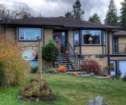
Seasons Above the Bay B & B
TRAVELODGE SILVER BRIDGE INN
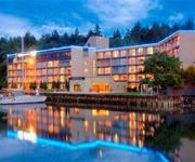
Wessex Inn By The Sea
OCEANFRONT SUITES AT COWICHAN BAY
Thunderbird Motor Inn
SUPER 8 DUNCAN
Videos from this area
These are videos related to the place based on their proximity to this place.
Sansum Narrows Part17 Round Salt Spring Race 2011 Salt Spring Island BC
Sansum Narrows Round Salt Spring Race 2011. The yacht race is a circumnavigation of Salt Spring Island BC. Scott Simmons Salt Spring Island.
Blizzard 2008 Vancouver Island
WHOA! This is British Columbia! I don't know where all that snow is from.
Mt Erskine Salt Spring Island hike on a Sunday afternoon
The easy hike up Mt. Erskine on Salt Spring Island. It's real easy if you are 12 and in great shape. If you are close to 50 or so it is a challenging hike. Scott Simmons One Percent Realty...
The best keep secret on the West coast Crofton BC
Interactive map http://saltspringrealestateagent.com/?page_id=463 Crofton is going to be one of the best sea side towns on Vancouver Island. I really think Crofton will become this quaint...
LIVE STREAM | 2015 Season Opening! Crofton Wiffle Ball Association April 18 2015
2015 Season Opening! Crofton Wiffle Ball Association http://www.croftonwiffleball.com April 18 2015 The Rockies will face the 2014 CWA Champion North Stars in the early game, with the Sea...
Crofton Seawalk
Located along the ocean front in Crofton, this pleasureable raised walkway allows you views of Crofton Harbour, looking across to Salt Spring Island.
Tugboat off Crofton BC towing barge part 2
Tug boat off Crofton towing a gravel barge I think. If anyone know what type of Barge this is please comment. Scott Simmons Salt Spring agent for One Percent Realty Vancouver Island.
Tug boat off Crofton BC Part 1
Interactive map http://saltspringrealestateagent.com/?page_id=463 Tug boat off Crofton towing a gravel barge I think. If anyone know what type of Barge this is please comment. Scott Simmons...
Beginner Fling Crofton August 2011
Abby's first Beginner competition - 6 years old - in rose nesbit kilt. Class of 10. Placed first in Fling, Sword and Flora and won the aggregate!
Videos provided by Youtube are under the copyright of their owners.
Attractions and noteworthy things
Distances are based on the centre of the city/town and sightseeing location. This list contains brief abstracts about monuments, holiday activities, national parcs, museums, organisations and more from the area as well as interesting facts about the region itself. Where available, you'll find the corresponding homepage. Otherwise the related wikipedia article.
Maple Bay, British Columbia
Maple Bay is a picturesque seaside community located in the Cowichan Valley of southern Vancouver Island, British Columbia, Canada. A narrow inlet and surrounded by smooth, pebbled beaches, Maple Bay is home to marine activity all year round. The sheltered haven of Maple Bay is situated halfway up Sansum Narrows, which separates Vancouver Island from Saltspring Island, the largest and nearest of the southern Gulf Islands.


