Safety Score: 2,8 of 5.0 based on data from 9 authorites. Meaning we advice caution when travelling to Canada.
Travel warnings are updated daily. Source: Travel Warning Canada. Last Update: 2024-08-13 08:21:03
Delve into Malahat
Malahat in British Columbia is located in Canada about 2,230 mi (or 3,588 km) west of Ottawa, the country's capital town.
Current time in Malahat is now 11:56 PM (Friday). The local timezone is named America / Vancouver with an UTC offset of -8 hours. We know of 11 airports close to Malahat, of which 4 are larger airports. The closest airport in Canada is Victoria International Airport in a distance of 9 mi (or 15 km), North-East. Besides the airports, there are other travel options available (check left side).
There is one Unesco world heritage site nearby. The closest heritage site is Olympic National Park in United states at a distance of 72 mi (or 116 km). Also, if you like playing golf, there are some options within driving distance. We encountered 8 points of interest near this location. If you need a hotel, we compiled a list of available hotels close to the map centre further down the page.
While being here, you might want to pay a visit to some of the following locations: Victoria, Port Angeles, Friday Harbor, Port Townsend and Coupeville. To further explore this place, just scroll down and browse the available info.
Local weather forecast
Todays Local Weather Conditions & Forecast: 8°C / 46 °F
| Morning Temperature | 4°C / 39 °F |
| Evening Temperature | 6°C / 43 °F |
| Night Temperature | 6°C / 43 °F |
| Chance of rainfall | 0% |
| Air Humidity | 86% |
| Air Pressure | 1006 hPa |
| Wind Speed | Gentle Breeze with 6 km/h (3 mph) from West |
| Cloud Conditions | Overcast clouds, covering 100% of sky |
| General Conditions | Light rain |
Saturday, 23rd of November 2024
3°C (38 °F)
1°C (33 °F)
Snow, moderate breeze, overcast clouds.
Sunday, 24th of November 2024
2°C (36 °F)
-0°C (32 °F)
Snow, gentle breeze, overcast clouds.
Monday, 25th of November 2024
4°C (39 °F)
2°C (36 °F)
Broken clouds, calm.
Hotels and Places to Stay
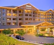
Victoria The Westin Bear Mountain Golf Resort & Spa
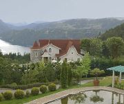
Prancing Horse Retreat
Videos from this area
These are videos related to the place based on their proximity to this place.
Luxury Condo Vacation - Bear Mountain
A luxury vacation condo on Bear Mountain near Victoria, BC. Golfing and exploring the sights of Vancouver Island. Come visit this pristine location on Vancouver Island. http://www.vrbo.com/389376.
Victoria Calling commercial
Victoria is calling Washington residents this summer! Check out our TV ad that will be running on King 5 this July. Or visit VictoriaCalling.com to unlock exclusive travel deals.
1456 White Pine Terrace, Victoria, BC V9B 6J3
http://1456whitepineterrace.epropertysites.com?rs=youtube Incredible setting. Open for sun, bordering Gowlland Tod Park (2500 acres) for privacy still only 10 minutes from Millstream...
All British Slalom 2008 on board
On board my MGB GT for my fastest run of the day at the All British Slalom 08 put on by the Victoria MG Club.
Curiousity and Openness
Follow the trails of the atheletes in Club Mud as they run through the Southern Vancouver Island Highlands and Gowan Todd Park.
Victoria BC Canada Goldstream Salmon Run 2008 No.6
Salmon spawning Goldstream Park 30 minutes drive from downtown Victoria BC Vancouver Island from autumn/ fall, Halloween to December, early winter. 2008/11/11.
GFC-Ghetto Fight Club- Adam vs. Tim
tim and bogart duke it out. the old timers stamina loses it for him in the end.
Videos provided by Youtube are under the copyright of their owners.
Attractions and noteworthy things
Distances are based on the centre of the city/town and sightseeing location. This list contains brief abstracts about monuments, holiday activities, national parcs, museums, organisations and more from the area as well as interesting facts about the region itself. Where available, you'll find the corresponding homepage. Otherwise the related wikipedia article.
Malahat-Juan de Fuca
Malahat-Juan de Fuca was a provincial electoral district for the Legislative Assembly of British Columbia, Canada from 1991 to 2009.
Malahat, British Columbia
Malahat is an unincorporated area in the Cowichan Valley, with municipal-type services delivered by the Cowichan Valley Regional District. The locality has no community nexus. Rather, there are a small number of scattered commercial establishments mainly catering to drivers travelling along Highway 1.
Bamberton, British Columbia
Bamberton is located on the Saanich Inlet, just south of Mill Bay, 45 kilometers north of Victoria on Vancouver Island. Bamberton is named for H.K.G. Bamber, a cement manufacturer from Gravesend, England, who was original owner of the land upon which Bamberton is located and was the managing director of British Portland Cement Manufacturers Ltd.
Spectacle Lake Provincial Park
Spectacle Lake Provincial Park is a provincial park in British Columbia, Canada, comprising c. 54 ha. and located southeast of Shawnigan Lake on southern Vancouver Island.


