Safety Score: 2,8 of 5.0 based on data from 9 authorites. Meaning we advice caution when travelling to Canada.
Travel warnings are updated daily. Source: Travel Warning Canada. Last Update: 2024-08-13 08:21:03
Discover Luxton
Luxton in British Columbia is a place in Canada about 2,230 mi (or 3,589 km) west of Ottawa, the country's capital city.
Current time in Luxton is now 09:24 AM (Tuesday). The local timezone is named America / Vancouver with an UTC offset of -8 hours. We know of 11 airports near Luxton, of which 4 are larger airports. The closest airport in Canada is Victoria Harbour Seaplane Base in a distance of 7 mi (or 11 km), East. Besides the airports, there are other travel options available (check left side).
There is one Unesco world heritage site nearby. The closest heritage site is Olympic National Park in United states at a distance of 65 mi (or 105 km). Also, if you like playing golf, there are a few options in driving distance. We encountered 5 points of interest in the vicinity of this place. If you need a hotel, we compiled a list of available hotels close to the map centre further down the page.
While being here, you might want to pay a visit to some of the following locations: Victoria, Port Angeles, Friday Harbor, Port Townsend and Coupeville. To further explore this place, just scroll down and browse the available info.
Local weather forecast
Todays Local Weather Conditions & Forecast: 7°C / 45 °F
| Morning Temperature | 4°C / 38 °F |
| Evening Temperature | 4°C / 39 °F |
| Night Temperature | 4°C / 39 °F |
| Chance of rainfall | 0% |
| Air Humidity | 79% |
| Air Pressure | 1026 hPa |
| Wind Speed | Light breeze with 4 km/h (3 mph) from South-West |
| Cloud Conditions | Scattered clouds, covering 25% of sky |
| General Conditions | Scattered clouds |
Tuesday, 3rd of December 2024
8°C (46 °F)
3°C (38 °F)
Sky is clear, light breeze, clear sky.
Wednesday, 4th of December 2024
5°C (41 °F)
6°C (42 °F)
Light rain, light breeze, overcast clouds.
Thursday, 5th of December 2024
7°C (45 °F)
8°C (46 °F)
Heavy intensity rain, light breeze, overcast clouds.
Hotels and Places to Stay
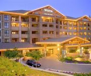
Victoria The Westin Bear Mountain Golf Resort & Spa
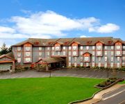
Four Points by Sheraton Victoria Gateway
Misty Meadows Bed and Breakfast
Cycle-Inn Bed & Breakfast
Holiday Inn Express & Suites VICTORIA - COLWOOD
Videos from this area
These are videos related to the place based on their proximity to this place.
Linkin park robot boy by shaun and brendan
my old buddy shaun and brendan covering robot boy and addin a little to it :) rate comment thanks.
3253 Willshire Drive, Langford, bc V9C 2V4
http://3253willshiredrive.epropertysites.com?rs=youtube Open House Saturday and Sunday Oct. 30 and 31...Super cul de sac location just minutes from everything a family needs. This is the perfect...
Seahawk Adventures - Fishing Langford Lake .mp4
Don and Jordan From Seahawk Adventures tried to do a little afternoon fishing when they had to rescue a 60 year old man from the water in the middle of Langford Lake, BC, Canada. He somehow...
Halo: The Master Chief Collection Walkthrough - Part 25 - The Great Journey
Halo: The Master Chief Collection Walkthrough - Part 25 - The Great Journey Next: http://www.youtube.com/watch?v=CWU-G4m8FRk Previous: http://www.youtube.com/watch?v=i8TB6MqKm8o Playlist: ...
Rugby Canada Trains in Langford - Shaw TV Victoria
It may not be as popular as hockey, but rugby is rapidly becoming a big sport in Canada. Shaw TV's Nikki Ewanyshyn heads out to Langford where both the men's and women's national teams are ...
Halo 2 Walkthrough - Part 32 - The Great Journey Part 2
Halo 2 Walkthrough - Part 32 - The Great Journey Part 2 Next: http://www.youtube.com/watch?v=x9KWKSu3yII Previous: http://www.youtube.com/watch?v=toWKE0yx5MU Playlist: ...
Halo 2 Walkthrough - Part 31 - The Great Journey Part 1
Halo 2 Walkthrough - Part 31 - The Great Journey Part 1 Next: http://www.youtube.com/watch?v=PHi7rNEQ6UY Previous: http://www.youtube.com/watch?v=IWJj59f4F8A Playlist: ...
Langford Lake Aerator Installation
A large Kamov helicopter hovered over Langford Lake on Sunday, August 19, 2012 long enough to lower a new, five-tonne hypolimnetic aerator onto Langford Lake. The new aerator adds oxygen...
Kamov Langford Lake aerator
VIH installs 50 ft. pneumatic aerator in Langford Lake for City of Langford, BC, Aug. 2012.
Videos provided by Youtube are under the copyright of their owners.
Attractions and noteworthy things
Distances are based on the centre of the city/town and sightseeing location. This list contains brief abstracts about monuments, holiday activities, national parcs, museums, organisations and more from the area as well as interesting facts about the region itself. Where available, you'll find the corresponding homepage. Otherwise the related wikipedia article.
Goldstream Provincial Park
Goldstream Provincial Park is a provincial park in British Columbia, Canada. It is known for the annual fall salmon runs in the Goldstream River, and the large numbers of bald eagles that congregate to feed at that time. The total size of the park is 3.79 square kilometres. It is located in the city of Langford, British Columbia. Huge trees stand on the Goldstream River floodplain. Among them are Douglas-fir and western red cedar up to 600 years old.
Bear Mountain (resort)
Bear Mountain is a golf resort and adjacent community straddling the boundary between the City of Langford and the District of Highlands, in the Western Communities of Greater Victoria, British Columbia, Canada. It is located on and adjacent to Skirt Mountain.
Bear Mountain Stadium
Bear Mountain StadiumCoordinates {{#invoke:Coordinates|coord}}{{#coordinates:48|26|35|N|123|31|10|W|type:landmark |primary |name= }}Opened 2009Owner Langford, British ColumbiaOperator Langford, British ColumbiaSurface FieldTurfConstruction cost C$3 millionCapacity 1600Tenants Rugby CanadaWestshore Rebels (2009-Present)Victoria Highlanders (2009-2011) Bear Mountain Stadium is a multi-purpose stadium in Langford, British Columbia.
Albert Head, Metchosin
Albert Head is a neighbourhood in Metchosin, British Columbia, Canada, part of the Western Communities area of Greater Victoria, British Columbia, Canada. It is located on, and named after, the headland of Albert Head. CFB Esquimalt operates the Albert Head Air Cadet Summer Training Centre in the same vicinity. Albert Head Lagoon, at the south end of Royal Roads, derives its name from the headland that was named by the Royal Navy for Prince Albert.
Sooke Flowline
The Sooke Flowline is an abandoned 44-kilometre concrete aqueduct that snakes through the Sooke Hills from Sooke Lake to the Humpback Reservoir near Mt. Wells Regional Park. From this reservoir, a buried, riveted steel pressure main transported water to Victoria. In between 1994 and 2007, this main was replaced since it was long past its useful life. The flowline was vital to the continued growth of the City of Victoria as it provided a reliable water supply.
Langford, British Columbia railway station
The Langford railway station is located in Langford, British Columbia. The station is a flag stop on Via Rail's Victoria – Courtenay train service, which ended in 2011.
Redeemer Lutheran Church (Victoria, British Columbia)
Redeemer Lutheran Church is the church for the Lutheran parish of Langford, a community on the west shore of Victoria, British Columbia. The parish forms a part of the Alberta-British Columbia district of the Lutheran Church–Canada. The current pastor is Rev. Phillip Washeim, a graduate of Concordia Lutheran Theological Seminary in St. Catharines, Ontario; approximately 40 people usually attend Sunday services.


