Safety Score: 2,8 of 5.0 based on data from 9 authorites. Meaning we advice caution when travelling to Canada.
Travel warnings are updated daily. Source: Travel Warning Canada. Last Update: 2024-08-13 08:21:03
Explore Willoughby
The district Willoughby of Langley in British Columbia is located in Canada about 2,182 mi west of Ottawa, the country's capital.
If you need a place to sleep, we compiled a list of available hotels close to the map centre further down the page.
Depending on your travel schedule, you might want to pay a visit to some of the following locations: Bellingham, Friday Harbor, Chilliwack, Mount Vernon and Coupeville. To further explore this place, just scroll down and browse the available info.
Local weather forecast
Todays Local Weather Conditions & Forecast: 9°C / 48 °F
| Morning Temperature | 4°C / 39 °F |
| Evening Temperature | 6°C / 43 °F |
| Night Temperature | 4°C / 40 °F |
| Chance of rainfall | 0% |
| Air Humidity | 70% |
| Air Pressure | 1025 hPa |
| Wind Speed | Light breeze with 3 km/h (2 mph) from West |
| Cloud Conditions | Broken clouds, covering 68% of sky |
| General Conditions | Broken clouds |
Wednesday, 6th of November 2024
8°C (46 °F)
3°C (38 °F)
Sky is clear, light breeze, clear sky.
Thursday, 7th of November 2024
8°C (46 °F)
6°C (43 °F)
Few clouds, light breeze.
Friday, 8th of November 2024
10°C (49 °F)
11°C (51 °F)
Light rain, light breeze, broken clouds.
Hotels and Places to Stay
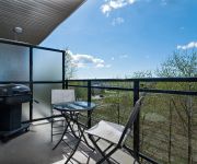
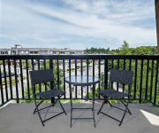
Premiere Suites at Elements
Premiere Suites at Hawthorne
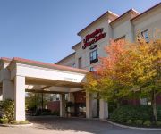
Hampton Inn & Suites by Hilton Langley-Surrey
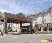
RAMADA SURREY LANGLEY
BEST WESTERN PLUS LANGLEY INN
Holiday Inn & Suites SURREY EAST - CLOVERDALE
Westward Inn & Suites
Langley Hwy Hotel
Canadas Best Value Inn - Langley / Vancouver
Clydesdale Inn
Videos from this area
These are videos related to the place based on their proximity to this place.
CARP Flag Raising for National Seniors Day In Langley B.C. Oct 1 2012 .wmv
Municipal & Provincial Diginitaries, CARP board members and the local media attended this morning to help raise the Chapter #48 South Fraser B.C. CARP Flag on the Township of Langley's flag...
South Fraser CARP Inaugural Meeting Highlights - May 10, 2012
Guest speakers Rhonda Latrielle, Nathan Pachal & April Lewis at The South Fraser CARP Inaugural Meeting held May 10, 2012 at the Township of Langley 4th floor presentation center/council...
#39 20350 68 Ave Langley BC - Real Estate Virtual Tour - Katronis Team
View http://www.katronisrealestate.com/Properties.php/Details/637/tab_689 to see PRICE and more PHOTOS. Sunridge with a walk out back yard and large deck. Ve...
South Fraser CARP Meeting Closing Comments - May 10, 2012
Moderator Frank Bucholtz & South Fraser CARP chair Kim Richter summarize the evening and give their closing comments & thanks. The South Fraser CARP Inaugura...
Wings Restaurants & Pubs - Langley Tour
A walk-through tour of our Wings restaurant in Langley. Just off Hwy 1, this location is destined to become a new hotspot in Langley come take advantage of our patio, or watch the game on...
Best Langley Pubs - Samz Pubs - Top Surrey Pubs
Best Langley Pubs - Top Surrey Pubs - Samz Neighbourhood Pub, Beer Stores and Liquor Stores have been a go-to destination with amazing selection so you won't need to visit your traditional...
Valley First Aid Training Langley
Valley First Aid Training is a WorkSafe BC and Canadian Red Cross training agency based in Langley with several offices throughout the Lower Mainland. The school has been providing quality...
2279 Willoughby Ct, Langley
For more details click here: http://www.visualtour.com/showvt.asp?t=3049236 2279 Willoughby Ct Langley, BC V2Y 1C4 $424900, 4 bed, 2.0 bath, 1955 SF, MLS# ...
My North Langley on Pacific Commuter's Inaugural Trip
We were asked to come along on the inaugural trip of a new transit service coming to Langley called Pacific Commuter. Darian Kovacs and Chris Geoghegan think they have found a way to make...
New Balance Langley
New Balance Vancouver is a group of full-line New Balance stores located in the Greater Vancouver, with stores in downtown Vancouver, Delta, and Langley. The stores carry a great selection...
Videos provided by Youtube are under the copyright of their owners.
Attractions and noteworthy things
Distances are based on the centre of the city/town and sightseeing location. This list contains brief abstracts about monuments, holiday activities, national parcs, museums, organisations and more from the area as well as interesting facts about the region itself. Where available, you'll find the corresponding homepage. Otherwise the related wikipedia article.
Langley, British Columbia (district municipality)
The Township of Langley is a district municipality immediately east of the City of Surrey in southwestern British Columbia, Canada. It extends south from the Fraser River to the U.S. border, and west of the City of Abbotsford. Langley Township is not to be confused with the City of Langley, which is adjacent to the township but politically is a separate entity. Langley is located in the eastern part of Metro Vancouver.
Trinity Western University
Trinity Western University (TWU) is a private Christian liberal arts university in Langley, British Columbia, Canada. Founded in 1962, it enrolls approximately 3,500 students and sits on a rural 157-acre campus near the historic village of Fort Langley, British Columbia. Trinity Western is Canada's largest privately funded Christian university.
CKNW
CKNW owned by Corus Entertainment, is the second highest-rated talk radio station in Vancouver, British Columbia, Canada. It broadcasts on AM 980. The station's content is based on news and current events. It features call-in shows with mostly Vancouver-based hosts.
Langley, British Columbia (city)
The City of Langley is a municipality in Metro Vancouver. It lies directly east of the City of Surrey, adjacent to Cloverdale, and surrounded on the north, east and south by Township of Langley.
Golden Ears Bridge
The Golden Ears Bridge is a six-lane extradosed bridge in Metro Vancouver, British Columbia. It spans the Fraser River, connecting Langley on the south side with Pitt Meadows and Maple Ridge on the north side. The bridge opened to traffic on June 16, 2009. The bridge replaced a previous ferry service several kilometers upstream and will be run by a private consortium, the Golden Crossing General Partnership, until June 2041.
Cloverdale, British Columbia
Cloverdale is an historic town and designated town centre of Surrey, British Columbia, Canada, located near Langley, which is east of Vancouver. The town was founded initially as a small farm community in 1870 for its fertile land and temperate climate, and has since become enveloped by suburban sprawl from Surrey, making it a small town in the suburbs. Cloverdale is known by some as the historic centre of Surrey, B.C. , and is home to many heritage sites.
Pacific Academy
Pacific Academy is a private Christian school in Surrey, British Columbia, Canada that spans from preschool to Grade 12. The school generally has 3 or 4 classes per grade, and has over 200 staff members as well as 1500 students. It was started by Jim Pattison, a billionaire who donated money to create Pacific Academy. Pacific Academy also has an outreach program (PAOS) that spans the far reaches of the globe. For example it supports the Kibaale community schools in Uganda.
Canadian Museum of Flight
The Canadian Museum of Flight (formally the Canadian Museum of Flight Association since 1998) is an aviation museum at the Langley Regional Airport in Langley, British Columbia, Canada. The museum has over 25 civilian and military jets, piston driven engine aircraft, gliders, and helicopters on display, six of which have been restored to flying condition. Other displays include an aviation art gallery and aviation artefacts.
Brookswood, Langley
Brookswood is a community (pop. approx. 13,336) in Langley, British Columbia, Canada, located on the west side of that municipality to the south of the Nicomekl River. It is largely a residential area with several commercial areas, a Civic Centre with a hockey area and curling rink. Next to the Civic Centre is a skate park and a BMX track. The Brookswood frisbee golf course at Langley Passive Park is another popular hang out for local teens.
Barnston Island (British Columbia)
Barnston Island is an unincorporated island located in the Greater Vancouver metropolitan area of British Columbia, Canada. Most of the island is part of the Greater Vancouver Electoral Area A; the remainder is Barnston Island Indian Reserve No. 3, which is outside Electoral Area A limits and is under the governance of the Katzie First Nation, headquartered across the river at their main reserve in Pitt Meadows.
Brookswood Secondary School
Brookswood Secondary School is located in the community of Brookswood in Langley, British Columbia. Among other resources, the school has an automechanics workshop, two gymnasiums, a theatre, a dark room, and a television studio. The school also offers a French Immersion program as well as Spanish and German.
Lord Tweedsmuir Secondary School
Lord Tweedsmuir Secondary (sometimes shortened to Tweedy) is a public high school in the Vancouver suburb of Surrey, British Columbia, Canada and is part of School District 36 Surrey. In September 1993, staff and students from Cloverdale Junior Secondary and Lord Tweedsmuir Senior Secondary joined together to form Lord Tweedsmuir Secondary, and moved into the new building.
R. E. Mountain Secondary School
R.E. Mountain Secondary is a public high school in northern Langley, British Columbia and is a part of School District 35 Langley.
Pitt Meadows Secondary School
Pitt Meadows Secondary School ("PMS")is a public high school in Pitt Meadows, British Columbia, part of School District 42 Maple Ridge-Pitt Meadows. The school was founded in 1961 and celebrated its 50th anniversary with an open house on September 30, 2011.
Stetson Bowl
Stetson Bowl is a stadium in Surrey, British Columbia, Canada built in 1948. Located in the Cloverdale Fairgrounds, it was upgraded for minor league baseball and was the home field of the Surrey Glaciers of the Western Baseball League for the 1995 season. As a ballpark, the Stetson Bowl had a capacity of 5,000 people. Today, it is the main venue of the Cloverdale Rodeo and Country Fair. "The Stetson Bowl Stadium is home to most of the Cloverdale Rodeo performances each year.
Pitt Meadows Station
Pitt Meadows Station is a station on the West Coast Express commuter rail line connecting Vancouver to Mission, British Columbia, Canada. The station is located on the south side of the Canadian Pacific Railway (CPR) tracks in Pitt Meadows, just off Harris Road. The station opened in 1995, when the West Coast Express began operating. 140 park and ride spots are available. All services are operated by TransLink.
Maple Meadows Station
Maple Meadows Station is a station on the West Coast Express commuter rail line connecting Vancouver to Mission, British Columbia, Canada. The station is located on the north side of the Canadian Pacific Railway (CPR) tracks in Maple Ridge, just off Maple Meadows Way and Hammond Road. The station opened in 1995, when the West Coast Express began operating. 467 park and ride spaces are available. All services are operated by TransLink.
Katzie First Nation
The Katzie First Nation or Katzie Nation is the band government of the Katzie people of the Lower Fraser Valley region of British Columbia, Canada.
Port Kells
Port Kells is a neighbourhood of the City of Surrey in British Columbia, Canada, located at the northeastern end of that city adjacent to the Fraser River and west of the neighbourhood of Walnut Grove (part of the Township of Langley).
Barnston Island Ferry
The Barnston Island Ferry is a ferry across Parson's Channel on the south side of the Fraser River to Barnston Island in British Columbia, Canada. The ferry is actually a barge that is pushed across the Fraser River using a small tugboat attached to it. Having limited space, it can carry up to 6 vehicles and 52 passengers (when 6 vehicles are aboard, only 28 passengers will be carried). The crossing time is usually five minutes.
Langley Events Centre
The Langley Events Centre is a 260,483-square-foot multipurpose facility in the Township of Langley. The LEC debuted in April 2009, hosting the 2009 BC Gymnastics Championships. It boasts an arena bowl with a 5,500 capacity for sports, including 24 individual suites.
Port Hammond
Port Hammond, commonly known as Hammond, is a community on the Fraser River within the municipality of Maple Ridge, British Columbia, Canada, near its border with the City of Pitt Meadows and just east of the Golden Ears Bridge.
Milner, British Columbia
Milner is a rural village and locality in the Township of Langley in the Fraser Valley of British Columbia, Canada. It is located along the British Columbia Electric Railway line (now the Southern Railway of B.C. northeast of the City of Langley and just southwest of Fort Langley. Local business attractions include Milner Downs Equestrian Center, Milner Gardens, and Milner Valley Cheese. and Milner Feed and Pet Supply Ldt.
Langley Education Centre
Langley Education Centre (LEC) is a public high school in Langley, British Columbia, part of School District 35 Langley. LEC offers secondary school (Gr. 10-12) options for teens and adults to continue and complete a secondary education or upgrade their courses. The courses are offered one of two ways: 1.
Associated Canadian Theological Schools
The Associated Canadian Theological Schools (ACTS Seminaries) are a multi-denominational consortium of five Protestant Christian seminaries in Canada, which partner with Trinity Western University to jointly grant master's and Doctor of Ministry degrees to graduates. ACTS is an accredited member of the Association of Theological Schools.


