Safety Score: 2,8 of 5.0 based on data from 9 authorites. Meaning we advice caution when travelling to Canada.
Travel warnings are updated daily. Source: Travel Warning Canada. Last Update: 2024-08-13 08:21:03
Touring Koksilah
Koksilah in British Columbia is a town located in Canada about 2,232 mi (or 3,591 km) west of Ottawa, the country's capital place.
Time in Koksilah is now 02:18 AM (Sunday). The local timezone is named America / Vancouver with an UTC offset of -8 hours. We know of 10 airports nearby Koksilah, of which 4 are larger airports. The closest airport in Canada is Victoria International Airport in a distance of 14 mi (or 23 km), South-East. Besides the airports, there are other travel options available (check left side).
There is one Unesco world heritage site nearby. The closest heritage site is Olympic National Park in United states at a distance of 88 mi (or 141 km). Also, if you like the game of golf, there are several options within driving distance. We collected 10 points of interest near this location. Need some hints on where to stay? We compiled a list of available hotels close to the map centre further down the page.
Being here already, you might want to pay a visit to some of the following locations: Victoria, Port Angeles, Friday Harbor, Port Townsend and Coupeville. To further explore this place, just scroll down and browse the available info.
Local weather forecast
Todays Local Weather Conditions & Forecast: 4°C / 40 °F
| Morning Temperature | 6°C / 43 °F |
| Evening Temperature | 4°C / 39 °F |
| Night Temperature | 4°C / 38 °F |
| Chance of rainfall | 7% |
| Air Humidity | 97% |
| Air Pressure | 1014 hPa |
| Wind Speed | Light breeze with 4 km/h (3 mph) from South-West |
| Cloud Conditions | Overcast clouds, covering 100% of sky |
| General Conditions | Rain and snow |
Sunday, 24th of November 2024
3°C (38 °F)
3°C (37 °F)
Snow, calm, overcast clouds.
Monday, 25th of November 2024
6°C (43 °F)
3°C (37 °F)
Overcast clouds, calm.
Tuesday, 26th of November 2024
5°C (42 °F)
4°C (39 °F)
Light rain, calm, overcast clouds.
Hotels and Places to Stay
TRAVELODGE SILVER BRIDGE INN
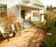
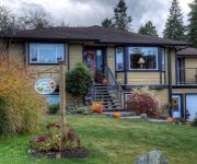
Valley View Bed and Breakfast
Holmesdale House Bed & Breakfast
Seasons Above the Bay B & B
BEST WESTERN COWICHAN VLLY INN
Wessex Inn By The Sea
SUPER 8 DUNCAN
Thunderbird Motor Inn
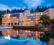
OCEANFRONT SUITES AT COWICHAN BAY
Videos from this area
These are videos related to the place based on their proximity to this place.
Free Range Turkeys - Cowichan Valley Farms, Duncan, B.C. Canada
Located in Duncan, B.C. Canada. On beautiful Vancouver Island. These are our free range turkeys grazing on their open pasture. The greenhouse shelter is also visible. They have open access...
The Sport of Pigeon Racing - Shaw TV Duncan
They have a reputation of being city birds, but as Shaw TV's Jen Muranetz discovers, pigeons make great racers. There's a group of pigeon enthusiasts on Vancouver Island who are involved in...
go! Island vists Volume One Bookstore - Shaw TV Duncan
Shaw TV's James Green does a little afternoon reading while visiting Volume One Bookstore in Duncan, which has been open 41 years. go! Island airs daily on ShawTV Channel 4. Connect with...
Medieval Chaos Episode #1 - Shaw TV Duncan
Shaw TV's Meg Cuthbert headed out to Duncan to meet an interesting group of individuals. This group of almost 300 members gather together for "heavy action role playing" or "HARPing," a game...
Tribal Welder - Shaw TV Duncan
Shaw TV's Paul Beilstein visits a class at Vancouver Island University in Duncan filled with smoke, bright arcing light and dreams. This is a school where both male and female aboriginal students,...
The Return of the Western Bluebird - Shaw TV Duncan
Western Bluebirds have been absent from Vancouver Island for decades. Now, thanks to a five-year project in the Cowichan Valley, the birds are making a comeback. Shaw TV's Jen Muranetz reports.
Live Edge Furniture - Shaw TV Duncan
Shaw TV's Teri Church looks at some unique furniture made from imperfect wood.
How to age, cut and eat steak at the Duncan Meat Market - Shaw TV Duncan
Shaw TV's Paul Bielstein heads to the Duncan Meat Market to learn about aging, cutting and how to eat steak.
Videos provided by Youtube are under the copyright of their owners.
Attractions and noteworthy things
Distances are based on the centre of the city/town and sightseeing location. This list contains brief abstracts about monuments, holiday activities, national parcs, museums, organisations and more from the area as well as interesting facts about the region itself. Where available, you'll find the corresponding homepage. Otherwise the related wikipedia article.
Duncan, British Columbia
Duncan (pop. 4,932) is a city on southern Vancouver Island in British Columbia, Canada.
BC Forest Discovery Centre
The BC Forest Discovery Centre, located in Duncan, chronicles the history of logging in British Columbia, Canada. Its mission is to be British Columbia's foremost interpreter and presenter of the forest community – past, present and future. It is a 100 acre site with 3 km of operational narrow gauge railway.
St. Clare's Monastery
St. Clare's Monastery is a monastery of the Order of St. Clare in Duncan, British Columbia, Canada. The nuns of the order also go by the name "Poor Clares". They are a contemplative community of women who live the charism of Saint Clare of Assisi and form the Second Order in the movement started by Saint Francis of Assisi. In 1912, three nuns came to Victoria, British Columbia from New Orleans, Louisiana.
Hayward railway station
The Hayward railway station is located in Hayward, North Cowichan, British Columbia. The station was a stop on Via Rail's Victoria – Courtenay train service, which ended in 2011. It is located at the cossing of Drinkwater Road, about 600 metres west of the BC Forest Discovery Centre.
Duncan railway station
The Duncan railway station is located in Duncan, British Columbia. The station was a stop on Via Rail's Victoria – Courtenay train service, which ended in 2011. It is located on the Southern Railway of Vancouver Island mainline. The station was originally established as Duncan's Crossing, named after William Chalmers Duncan, who farmed in the region, that original farm land later become the city of Duncan, in 1939. The station was designated a Heritage Railway Stations in 1993.
Cowichan railway station
The Cowichan railway station is located in Cowichan, British Columbia. The station was a flag stop on Via Rail's Victoria – Courtenay train service, which ended in 2011.


