Safety Score: 2,8 of 5.0 based on data from 9 authorites. Meaning we advice caution when travelling to Canada.
Travel warnings are updated daily. Source: Travel Warning Canada. Last Update: 2024-08-13 08:21:03
Delve into Barrowtown
Barrowtown in British Columbia is located in Canada about 2,156 mi (or 3,470 km) west of Ottawa, the country's capital town.
Current time in Barrowtown is now 04:13 AM (Thursday). The local timezone is named America / Vancouver with an UTC offset of -8 hours. We know of 12 airports close to Barrowtown, of which 4 are larger airports. The closest airport in Canada is Abbotsford Airport in a distance of 13 mi (or 21 km), South-West. Besides the airports, there are other travel options available (check left side).
There is one Unesco world heritage site nearby. The closest heritage site is Olympic National Park in United states at a distance of 96 mi (or 154 km). Also, if you like playing golf, there are some options within driving distance. If you need a hotel, we compiled a list of available hotels close to the map centre further down the page.
While being here, you might want to pay a visit to some of the following locations: Chilliwack, Bellingham, Mount Vernon, Coupeville and Friday Harbor. To further explore this place, just scroll down and browse the available info.
Local weather forecast
Todays Local Weather Conditions & Forecast: 6°C / 44 °F
| Morning Temperature | 3°C / 38 °F |
| Evening Temperature | 5°C / 42 °F |
| Night Temperature | 3°C / 38 °F |
| Chance of rainfall | 0% |
| Air Humidity | 67% |
| Air Pressure | 1013 hPa |
| Wind Speed | Gentle Breeze with 7 km/h (4 mph) from South-West |
| Cloud Conditions | Clear sky, covering 0% of sky |
| General Conditions | Light rain |
Thursday, 21st of November 2024
4°C (40 °F)
5°C (41 °F)
Moderate rain, moderate breeze, overcast clouds.
Friday, 22nd of November 2024
6°C (43 °F)
5°C (41 °F)
Light rain, light breeze, broken clouds.
Saturday, 23rd of November 2024
2°C (35 °F)
1°C (34 °F)
Light rain, gentle breeze, overcast clouds.
Hotels and Places to Stay
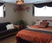
Country Charm Bed & Breakfast
Videos from this area
These are videos related to the place based on their proximity to this place.
Welcome to Cultus Cottages Vacation Rentals
http://www.cultuscottages.com The amazing Cultus Lake Cottages resort offers vacation rentals by owners at brand new cabins, complete with access to the on-site amenities including 2 swimming...
1159 Iverson Rd Lindell Beach BC - Real Estate - John Corrie - RE/MAX Little Oak Realty
View http://johncorrie.com/mylistings.html/videos-35023748 to see PRICE and more PHOTOS. Columbia Valley says it all. 11.26 acre Hobby farm close to Cultus Lake. Quality 2 storey home with...
Lakeside Community Home
Located in a Cultus Lake Community, is a 3 bedroom home on .28 acre. Updated and ready for the right buyer. Located in a cul de sac right next to the community park. Awesome home in the best...
LaVerna at Columbia Valley Lookout on Vedder Mountain
LaVerna showing us hows its done!! Coming down from the Columbia Valley Lookout on Vedder Mountain.
Ranch Park Lodge - Luxury Log Cabin Rental - Chilliwack, BC
Ranch Park Lodge is one of Western Canada's premiere vacation rentals. Family holidays, weekend getaways, corporate retreats, intimate weddings and more.
Videos provided by Youtube are under the copyright of their owners.
Attractions and noteworthy things
Distances are based on the centre of the city/town and sightseeing location. This list contains brief abstracts about monuments, holiday activities, national parcs, museums, organisations and more from the area as well as interesting facts about the region itself. Where available, you'll find the corresponding homepage. Otherwise the related wikipedia article.
Sumas Lake
Sumas Lake was a body of water between Sumas and Vedder mountains, midway between the present-day cities of Chilliwack and Abbotsford, British Columbia. Its name means "a big level opening" and is a reference to the site of the lake, which lay between Sumas Mountain and its American counterpart, Sumas Mountain, Washington, part of the foothills of the Cascade Mountains.
Chadsey Lake
Chadsey Lake, also known as Lost Lake, is located on Sumas Mountain near Abbotsford, British Columbia.
Sumas Peak
Sumas Peak is an official name for the summit of Sumas Mountain, which is located in the on the south shore of the Fraser River in the Fraser Valley between Abbotsford and Chilliwack, British Columbia. Elevation 910 m above sea level, prominence 875 m . The mountain is mostly tree covered to the summit, with only its far southwestern end being the locale for development of residential neighbourhoods adjacent to downtown Abbotsford and the Mission By-Pass.
Leq' a: mel First Nation
The Leq' a: mel First Nation, formerly known as the Lakahahmen First Nation, is a First Nations band government whose community and offices are located in the area near Deroche, British Columbia, Canada, about 12 kilometres east of the District of Mission. They are a member government of the Sto:lo Nation tribal council, which is one of two tribal councils of the Sto:lo (though many bands are independent of either).
Sumas, British Columbia
Sumas was a district municipality in the Fraser Valley region of British Columbia, Canada, located between the then-Village of Abbotsford (W) and Chilliwack (E). It was amalgamated with the Village of Abbotsford in 1972 into the City of Abbotsford. It, prior to amalgamation and after, until 1995, was a member municipality of the now-abolished Central Fraser Valley Regional District.


