Address & Contact
Contact Information:
Wikipedia page
Street address:
Captain Auguste George Airport
Britische Jungferninseln
GPS Coordinates:
Longitude: -64,330°
Latitude: 18,727°
Summary
Captain Auguste George Airport is a small airport in British Virgin Islands, serving the region of Anegada. The longest runway is 2.500 feet or 762 meters long.
Facts:
Airport size: small airport Serving area: Anegada Longest runway: 2500 (ft)
Codes:
IATA: NGD,
ICAO: TUPA
Flight information:
Departure times (FlightStats)
Flight times (FlightRadar24)
Location on map
Show bigger map on Openstreetmap
About the airport
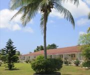
Captain Auguste George Airport, with the IATA code "NGD" and the ICAO code "TUPA," is located in the beautiful British Virgin Islands. Situated on the island of Anegada, this airport serves as a gateway for travelers visiting this stunning Caribbean destination.
Despite being a small airport, Captain Auguste George Airport offers essential facilities and services to ensure a smooth travel experience. The airport features a single runway and a small terminal building that provides basic amenities such as check-in counters, baggage claim, and a waiting area.
Travelers can access the airport via domestic flights from the neighboring islands or by private charter flights. The airport's location on Anegada allows visitors to easily explore the island's pristine beaches, coral reefs, and unique wildlife.
When planning your trip to the British Virgin Islands, consider Captain Auguste George Airport as a convenient entry point to experience the natural beauty and tranquility of Anegada.
Hotels and places to stay
ANEGADA BEACH CLUB
Videos from the area of the airport
Videos provided by Youtube are under the copyright of their owners.


