Safety Score: 3,5 of 5.0 based on data from 9 authorites. Meaning please reconsider your need to travel to Bosnia and Herzegovina.
Travel warnings are updated daily. Source: Travel Warning Bosnia and Herzegovina. Last Update: 2024-08-13 08:21:03
Discover Skejići
Skejići in Republika Srpska is a town in Bosnia and Herzegovina about 53 mi (or 86 km) east of Sarajevo, the country's capital city.
Current time in Skejići is now 03:22 PM (Friday). The local timezone is named Europe / Sarajevo with an UTC offset of one hour. We know of 10 airports near Skejići, of which 4 are larger airports. The closest is airport we know is Ponikve Airport in Serbia in a distance of 16 mi (or 25 km). The closest airport in Bosnia and Herzegovina is Tuzla International Airport in a distance of 47 mi (or 25 km), East. Besides the airports, there are other travel options available (check left side).
There are several Unesco world heritage sites nearby. The closest heritage site in Bosnia and Herzegovina is Mehmed Paša Sokolović Bridge in Višegrad in a distance of 15 mi (or 25 km), South. Looking for a place to stay? we compiled a list of available hotels close to the map centre further down the page.
When in this area, you might want to pay a visit to some of the following locations: Bajina Basta, Srebrenica, Ljubovija, Bratunac and Visegrad. To further explore this place, just scroll down and browse the available info.
Local weather forecast
Todays Local Weather Conditions & Forecast: 12°C / 54 °F
| Morning Temperature | 12°C / 54 °F |
| Evening Temperature | 1°C / 34 °F |
| Night Temperature | -0°C / 31 °F |
| Chance of rainfall | 2% |
| Air Humidity | 94% |
| Air Pressure | 995 hPa |
| Wind Speed | Fresh Breeze with 16 km/h (10 mph) from North-East |
| Cloud Conditions | Overcast clouds, covering 97% of sky |
| General Conditions | Rain and snow |
Saturday, 23rd of November 2024
3°C (37 °F)
-5°C (23 °F)
Light snow, light breeze, broken clouds.
Sunday, 24th of November 2024
3°C (38 °F)
-1°C (31 °F)
Few clouds, light breeze.
Monday, 25th of November 2024
4°C (40 °F)
-1°C (31 °F)
Few clouds, light breeze.
Hotels and Places to Stay
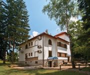
Vila Drina
Videos from this area
These are videos related to the place based on their proximity to this place.
Zlatibor 2009 Part 4
Sirogojno ethnic village, Manastir Raca, Hidro elektrana Bajina Basta, Perucac, Mitrovac, Potpecka pecina, Zlakusa.
Tara Mountain Part 7: Perućac Lake
Mountain Tara is one of the most beautiful mountains in Serbia. I've spent a week there and visited a lot of fantastic places: river Drina, lakes, monasteries, waterfalls, canyons, viewpoints,...
Barkom jezerom Perućac
Promotivni video za vožnju čamcem za 10 osoba jezerom Perućac. Više informacija možete videti na adresi: http://drina-reka.com/barkom-jezerom-perucac.html Video: Nenad Maric Muzika: http://ww...
Mirante Banjska Stena | MONTANHA TARA | Sérvia
http://www.bemvindoaservia.com | https://www.facebook.com/bemvindoaservia Confiram a incrível vista do mirante "Banjska Stena", localizado no alto da montanha Tara, no oeste da Sérvia. ...
Сербия, озеро Перучац, каньон реки Дрина
Короткое описание акумуляционного озера Перучац, которое находится на Юго-западе Сербии. Формируется оно...
Experiencing The Balkans with XShot - Review
Click below to get your own XShot today! http://www.shareasale.com/r.cfm?B=229025&U=931385&M=20695&urllink= http://davidsbeenhere.com In the Spring of 2014 I had the pleasure of traveling...
Chillin on the Perucac Lake (Full HD)
Soundtrack: Overwerk-Contact Recorded with: Nikon CoolPix AW100.
Videos provided by Youtube are under the copyright of their owners.
Attractions and noteworthy things
Distances are based on the centre of the city/town and sightseeing location. This list contains brief abstracts about monuments, holiday activities, national parcs, museums, organisations and more from the area as well as interesting facts about the region itself. Where available, you'll find the corresponding homepage. Otherwise the related wikipedia article.
Perućac
Perućac is a village in western Serbia in the immediate proximity of the border with Bosnia and Herzegovina. It is situated near the 346 km-long Drina River, which constitutes the natural border between Serbia and Bosnia. The main feature of the village is the Bajina Bašta hydro-electric power plant, which is the second largest of its kind in Serbia. It was built in 1966 as a result of a joint venture by ex-Yugoslavian and Japanese companies.
Perućac lake
Perućac Lake, also known as Lake Perućac, is an artificial lake partly in the municipalities of Srebrenica and Višegrad in Bosnia and Herzegovina and partly in the municipality of Bajina Bašta, Serbia. The lake was created by damming the Drina River and harnessing its flow to power the Bajina Bašta hydroelectric power station. The lake is notorious as one of the locations in Serbia where the transported remains of Kosovo Albanians killed during the 1999 conflict were concealed.
Nogačevići
Nogačevići is a village in the municipality of Srebrenica, Bosnia and Herzegovina.
Osatica
Osatica is a village in the municipality of Srebrenica, Bosnia and Herzegovina.
Peći (Srebrenica)
Peći is a village in the municipality of Srebrenica, Bosnia and Herzegovina.
Postolje
Postolje is a village in the municipality of Srebrenica, Bosnia and Herzegovina.
Sulice (Srebrenica)
Sulice (Srebrenica) is a village in the municipality of Srebrenica, Bosnia and Herzegovina.
Mramorje (Perućac)
Mramorje or Bagruša (Serbian: Мраморје or Багруша) is a medieval necropolis, located in Perućac, Serbia, and is among the best preserved necropoli of the region. The necropolis was built in the 14th century, and extends between the Drina river and the main road that follows its course, at the entrance of the settlement.


