Safety Score: 3,5 of 5.0 based on data from 9 authorites. Meaning please reconsider your need to travel to Bosnia and Herzegovina.
Travel warnings are updated daily. Source: Travel Warning Bosnia and Herzegovina. Last Update: 2024-08-13 08:21:03
Delve into Gornji Čakari
Gornji Čakari in Republika Srpska is located in Bosnia and Herzegovina about 67 mi (or 108 km) north of Sarajevo, the country's capital town.
Current time in Gornji Čakari is now 01:17 PM (Sunday). The local timezone is named Europe / Sarajevo with an UTC offset of one hour. We know of 11 airports close to Gornji Čakari, of which 4 are larger airports. The closest airport in Bosnia and Herzegovina is Tuzla International Airport in a distance of 39 mi (or 62 km), South-East. Besides the airports, there are other travel options available (check left side).
There are several Unesco world heritage sites nearby. The closest heritage site is Early Christian Necropolis of Pécs (Sopianae) in Hungary at a distance of 88 mi (or 141 km). The closest in Bosnia and Herzegovina is Mehmed Paša Sokolović Bridge in Višegrad in a distance of 92 mi (or 141 km), North. If you need a hotel, we compiled a list of available hotels close to the map centre further down the page.
While being here, you might want to pay a visit to some of the following locations: Doboj, Klokotnica, Matuzici, Omanjska and Gracanica. To further explore this place, just scroll down and browse the available info.
Local weather forecast
Todays Local Weather Conditions & Forecast: 3°C / 37 °F
| Morning Temperature | -5°C / 23 °F |
| Evening Temperature | 2°C / 35 °F |
| Night Temperature | 1°C / 33 °F |
| Chance of rainfall | 0% |
| Air Humidity | 97% |
| Air Pressure | 1033 hPa |
| Wind Speed | Light breeze with 5 km/h (3 mph) from North |
| Cloud Conditions | Few clouds, covering 12% of sky |
| General Conditions | Few clouds |
Monday, 25th of November 2024
6°C (42 °F)
2°C (35 °F)
Scattered clouds, light breeze.
Tuesday, 26th of November 2024
10°C (49 °F)
7°C (45 °F)
Light rain, light breeze, clear sky.
Wednesday, 27th of November 2024
8°C (47 °F)
8°C (46 °F)
Light rain, calm, overcast clouds.
Hotels and Places to Stay
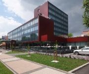
Hotel Park Doboj
Videos from this area
These are videos related to the place based on their proximity to this place.
Tehnicka skola Doboj - Masinski tehnicar za kompjutersko konstruisanje Generacioja '03
Tehnicka skola Doboj - Masinski tehnicar za kompjutersko konstruisanje Generacioja '03 - sa sastanka 2008. godine.
Doboj poslije poplave
Grad Doboj 20.05.2014. god., neposredno poslije velike poplave koja se dogodila s četvrtka na petak, prethodne sedmice.
Doboj - čišćenje nakon poplava
Tokom posjete Doboju zabilježili smo napore jedne porodice da očisti stan nakon poplavnog talasa.
Videos provided by Youtube are under the copyright of their owners.
Attractions and noteworthy things
Distances are based on the centre of the city/town and sightseeing location. This list contains brief abstracts about monuments, holiday activities, national parcs, museums, organisations and more from the area as well as interesting facts about the region itself. Where available, you'll find the corresponding homepage. Otherwise the related wikipedia article.
Bušletić
Bušletić is a village in the municipality of Doboj, Bosnia and Herzegovina. This area is very nice to live in with lots of agriculture and industry.
Grapska Donja
Grapska Donja is a village in the municipality of Doboj, Bosnia and Herzegovina.
Grapska Gornja
Grapska Gornja is a village in the municipality of Doboj, Bosnia and Herzegovina. Grapska Gornja Massacre On 10 May 1992, Serb forces attacked Bosniak village of Gornja Grapska in the municipality of Doboj. Pre-war population of the village consisted of 2,260 Bosniaks, 27 Croats, 6 Yugoslavs, and 4 Others. The village was unarmed and undefended. Serbs slaughtered at least 34 Bosnian Muslim women, children and the elderly men in the massacre.
Osječani Donji
Osječani Donji is a village in the municipality of Doboj, Bosnia and Herzegovina.
Osječani Gornji
Osječani Gornji is a village in the municipality of Doboj, Bosnia and Herzegovina.
Porječje
Porječje is a village in the municipality of Doboj, Bosnia and Herzegovina.
Sjenina Rijeka
Sjenina Rijeka is a village in the municipality of Doboj, Bosnia and Herzegovina.


