Safety Score: 3,5 of 5.0 based on data from 9 authorites. Meaning please reconsider your need to travel to Bosnia and Herzegovina.
Travel warnings are updated daily. Source: Travel Warning Bosnia and Herzegovina. Last Update: 2024-08-13 08:21:03
Discover Crna Gora
Crna Gora in Republika Srpska is a city in Bosnia and Herzegovina about 62 mi (or 100 km) north of Sarajevo, the country's capital city.
Local time in Crna Gora is now 06:41 PM (Thursday). The local timezone is named Europe / Sarajevo with an UTC offset of one hour. We know of 11 airports in the vicinity of Crna Gora, of which 4 are larger airports. The closest airport in Bosnia and Herzegovina is Tuzla International Airport in a distance of 38 mi (or 61 km), South-East. Besides the airports, there are other travel options available (check left side).
There are several Unesco world heritage sites nearby. The closest heritage site in Bosnia and Herzegovina is Mehmed Paša Sokolović Bridge in Višegrad in a distance of 89 mi (or 144 km), South-East. Looking for a place to stay? we compiled a list of available hotels close to the map centre further down the page.
When in this area, you might want to pay a visit to some of the following locations: Matuzici, Doboj, Omanjska, Tesanj and Klokotnica. To further explore this place, just scroll down and browse the available info.
Local weather forecast
Todays Local Weather Conditions & Forecast: 4°C / 40 °F
| Morning Temperature | 3°C / 37 °F |
| Evening Temperature | 3°C / 38 °F |
| Night Temperature | 1°C / 33 °F |
| Chance of rainfall | 0% |
| Air Humidity | 66% |
| Air Pressure | 1028 hPa |
| Wind Speed | Light breeze with 4 km/h (2 mph) from South-West |
| Cloud Conditions | Overcast clouds, covering 100% of sky |
| General Conditions | Overcast clouds |
Friday, 15th of November 2024
4°C (39 °F)
3°C (38 °F)
Overcast clouds, calm.
Saturday, 16th of November 2024
8°C (46 °F)
2°C (36 °F)
Few clouds, light breeze.
Sunday, 17th of November 2024
10°C (50 °F)
6°C (43 °F)
Sky is clear, light breeze, clear sky.
Hotels and Places to Stay
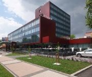
Hotel Park Doboj
Videos from this area
These are videos related to the place based on their proximity to this place.
Doboj poplave, voda progutala automobile -Doboj flood waters engulfed cars 15.05.2014
Hronologija katastrofe u Doboju Ul. Kneza Miloša!
Dan vozača TEŠANJ I DOBOJ JUG 15.01.2013 g.
Dan vozača zajednički obilježen na opštini Tešanj i Doboj Jug...
Doboj poslije poplave
Grad Doboj 20.05.2014. god., neposredno poslije velike poplave koja se dogodila s četvrtka na petak, prethodne sedmice.
Doboj - čišćenje nakon poplava
Tokom posjete Doboju zabilježili smo napore jedne porodice da očisti stan nakon poplavnog talasa.
Videos provided by Youtube are under the copyright of their owners.
Attractions and noteworthy things
Distances are based on the centre of the city/town and sightseeing location. This list contains brief abstracts about monuments, holiday activities, national parcs, museums, organisations and more from the area as well as interesting facts about the region itself. Where available, you'll find the corresponding homepage. Otherwise the related wikipedia article.
Usora Municipality
Usora MunicipalityUsora Location of Usora Municipality within Bosnia and Herzegovina. Country 22x20px Bosnia and Herzegovina Entity Federation Canton Zenica-Doboj Government • Municipality president Anto Čičak Population • Total 5,000 Time zone CET • Summer CEST Area code(s) +387 32 Usora Municipality (Općina Usora / Општина Усора) is a rural municipality in the Federation of Bosnia and Herzegovina with a Bosnian Croat majority.
Doboj South
Doboj South (Doboj Jug / Добој Југ) is a small rural municipality in the Zenica-Doboj Canton of the Federation of Bosnia and Herzegovina. It borders with Doboj municipality, part of Republika Srpska entity.
Usora (river)
Usora is a river in central-northern Bosnia and Herzegovina. It begins at the confluence of two smaller Usora rivers, Mala Usora and Velika Usora, at the town of Teslić. Usora runs for some 20 km northeast of Teslić, and becomes a left tributary of the Bosna River, south of Doboj.
Bukovica Mala (Doboj)
Bukovica Mala is a village in the municipality of Doboj, Bosnia and Herzegovina.
Čajre
Čajre is a village in the municipality of Doboj, Bosnia and Herzegovina.
Miljkovac
Miljkovac is a village in the municipality of Doboj, Bosnia and Herzegovina.
Pločnik (Doboj)
Pločnik is a village in the municipality of Doboj, Bosnia and Herzegovina.
Prisade
Prisade is a village in the municipality of Doboj, Bosnia and Herzegovina.


