Safety Score: 3,5 of 5.0 based on data from 9 authorites. Meaning please reconsider your need to travel to Bosnia and Herzegovina.
Travel warnings are updated daily. Source: Travel Warning Bosnia and Herzegovina. Last Update: 2024-08-13 08:21:03
Explore Emerovica
Emerovica in Federation of Bosnia and Herzegovina is located in Bosnia and Herzegovina a little east of Sarajevo, the country's capital.
Local time in Emerovica is now 03:18 AM (Friday). The local timezone is named Europe / Sarajevo with an UTC offset of one hour. We know of 12 airports in the wider vicinity of Emerovica, of which 5 are larger airports. The closest airport in Bosnia and Herzegovina is Sarajevo International Airport in a distance of 7 mi (or 12 km), South-West. Besides the airports, there are other travel options available (check left side).
There are several Unesco world heritage sites nearby. The closest heritage site in Bosnia and Herzegovina is Mehmed Paša Sokolović Bridge in Višegrad in a distance of 42 mi (or 67 km), East. If you need a place to sleep, we compiled a list of available hotels close to the map centre further down the page.
Depending on your travel schedule, you might want to pay a visit to some of the following locations: Hresa, Lukavica, Sarajevo, Vogosca and Pale. To further explore this place, just scroll down and browse the available info.
Local weather forecast
Todays Local Weather Conditions & Forecast: 3°C / 38 °F
| Morning Temperature | -2°C / 28 °F |
| Evening Temperature | 1°C / 34 °F |
| Night Temperature | 1°C / 35 °F |
| Chance of rainfall | 0% |
| Air Humidity | 66% |
| Air Pressure | 1026 hPa |
| Wind Speed | Light breeze with 3 km/h (2 mph) from South-East |
| Cloud Conditions | Broken clouds, covering 54% of sky |
| General Conditions | Broken clouds |
Saturday, 16th of November 2024
7°C (45 °F)
2°C (35 °F)
Few clouds, light breeze.
Sunday, 17th of November 2024
12°C (53 °F)
6°C (42 °F)
Scattered clouds, light breeze.
Monday, 18th of November 2024
9°C (48 °F)
2°C (35 °F)
Rain and snow, light breeze, broken clouds.
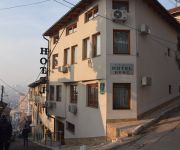
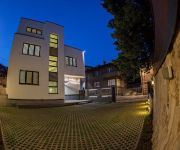
Hotels and Places to Stay
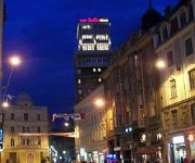
Europa Hotel Sarajevo
Hecco Deluxe
Old Town
Pansion River
Luxury Boutique Hotel Central
Herc
Villa Melody
Guest house Halvat
Harmony
Art Hotel ART
Videos from this area
These are videos related to the place based on their proximity to this place.
Put do OC Hrasno
Momentalno, Tabački mesdžid koordinira grupa studenata koji djeluju pod Omladinskim centrom Hrasnom, koji funkcionira kao ogranak Medžlisa IZ Sarajevo. U OC Hrasno se održavaju predavanja...
Fiat Panda 4x4 pushing through deep forest snow
This video shows how the vehicle (Fiat Panda 4x4 Mk1) pushes upward through deep snow in a forest. The snow was a bit higher than the vehicle's chassis for the most part (so the vehicle was...
Fiat Panda 4x4 on-Bosnian-roading at Grdonj, near Sarajevo city (part 2 of 2)
This video shows how the vehicle (Fiat Panda 4x4 Mk1) climbs upward a rather difficult and relatively perilous terrain (it has steep inclines, side inclines, bumpy/rocky surface and a lot of...
Fiat Panda 4x4 on-Bosnian-roading at Grdonj, near Sarajevo city (part 1 of 2)
This is a "warming-up" video which shows how the vehicle (Fiat Panda 4x4 Mk1) goes through very muddy terrain. However, the terrain is only lightly/moderately difficult (no steep inclines,...
Interior of Sedrenik mosque in Sarajevo city's Sedrenik suburb
Video was recorded in Summer 2012 (I can't remember exact date). The mosque is about 10-15 years old.
5. Magazin- Nek Neretva hladna tece (Rafting od Glavatičeva)
5. Magazin - Nek Neretva hladna tece (Rafting od Glavatičeva do ušća Rakitnice)
Visočica,Džamija 1967 m nv.wmv
Prirodnu granicu između Hercegovine i Bosne čini planina Visočica. Sa istočne strane od Treskavice odvojena je rijekom Ljutom, sa juga i jugozapada rijekom Neretvom od Prenja, a sa zapada...
Videos provided by Youtube are under the copyright of their owners.
Attractions and noteworthy things
Distances are based on the centre of the city/town and sightseeing location. This list contains brief abstracts about monuments, holiday activities, national parcs, museums, organisations and more from the area as well as interesting facts about the region itself. Where available, you'll find the corresponding homepage. Otherwise the related wikipedia article.
National and University Library of Bosnia and Herzegovina
The National and University Library of Bosnia and Herzegovina (NUBBiH) is the national library of Bosnia and Herzegovina, located in the city of Sarajevo. It was designed in 1891 by the Czech architect Karel Pařík, but criticisms by the minister, Baron Benjamin Kallay, caused him to stop working on the project. It was initially the largest and most representative building of the Austro-Hungarian period in Sarajevo and served as the city hall.
Barice, Stari Grad
Barice is a village in Bosnia and Herzegovina. According to the 1991 census, the village is located in the municipality of Stari Grad, Sarajevo.
Donje Biosko
Donje Biosko is a village in Bosnia and Herzegovina. According to the 1991 census, the village is located in the municipality of Stari Grad, Sarajevo.
Faletići
Faletići is a village in Bosnia and Herzegovina. According to the 1991 census, the village is located in the municipality of Stari Grad, Sarajevo.
Gornje Biosko
Gornje Biosko is a village in Bosnia and Herzegovina. According to the 1991 census, the village is located in the municipality of Stari Grad, Sarajevo.
Goat's Bridge
The Goat Bridge's is a large stone bridge that crosses the Miljacka river to the east of Sarajevo, Bosnia and Herzegovina. It was built by the Ottomans in the 16th century.
Babića bašća
Babića bašća (Babić's garden) is a local community within the municipality of Stari Grad, Sarajevo. It's one of the oldest neighborhoods in the city of Sarajevo. It derives its name from a garden that was the property of a certain Babić family, and it was located in a street that now has the same name as the local community.
Alifakovac
Alifakovac is a neighborhood in Babića bašća local community, municipality of Stari Grad, Sarajevo. As one of the oldest urban settlements in Sarajevo, it is situated on the spine of the northern end of the slope Trebević, on the lowest hill in the row at the last meander of Miljacka, before it pours out of its narrow canyon. Ever since people settled this part of land roads to Tsargrad, across the Kozja ćuprija, went through it.









!['barice i valter run [RAW edit]' preview picture of video 'barice i valter run [RAW edit]'](https://img.youtube.com/vi/hEWTcZ1nPKM/mqdefault.jpg)


