Safety Score: 3,5 of 5.0 based on data from 9 authorites. Meaning please reconsider your need to travel to Bosnia and Herzegovina.
Travel warnings are updated daily. Source: Travel Warning Bosnia and Herzegovina. Last Update: 2024-08-13 08:21:03
Discover Blaženovići
Blaženovići in Federation of Bosnia and Herzegovina is a place in Bosnia and Herzegovina about 54 mi (or 87 km) north of Sarajevo, the country's capital city.
Current time in Blaženovići is now 06:34 PM (Thursday). The local timezone is named Europe / Sarajevo with an UTC offset of one hour. We know of 11 airports near Blaženovići, of which 4 are larger airports. The closest airport in Bosnia and Herzegovina is Tuzla International Airport in a distance of 34 mi (or 54 km), East. Besides the airports, there are other travel options available (check left side).
There are several Unesco world heritage sites nearby. The closest heritage site in Bosnia and Herzegovina is Mehmed Paša Sokolović Bridge in Višegrad in a distance of 83 mi (or 133 km), South-East. If you need a hotel, we compiled a list of available hotels close to the map centre further down the page.
While being here, you might want to pay a visit to some of the following locations: Maglaj, Matuzici, Tesanj, Doboj and Omanjska. To further explore this place, just scroll down and browse the available info.
Local weather forecast
Todays Local Weather Conditions & Forecast: 4°C / 40 °F
| Morning Temperature | 3°C / 37 °F |
| Evening Temperature | 3°C / 38 °F |
| Night Temperature | 1°C / 33 °F |
| Chance of rainfall | 0% |
| Air Humidity | 66% |
| Air Pressure | 1028 hPa |
| Wind Speed | Light breeze with 4 km/h (2 mph) from South-West |
| Cloud Conditions | Overcast clouds, covering 100% of sky |
| General Conditions | Overcast clouds |
Friday, 15th of November 2024
4°C (39 °F)
3°C (38 °F)
Overcast clouds, calm.
Saturday, 16th of November 2024
8°C (46 °F)
2°C (36 °F)
Few clouds, light breeze.
Sunday, 17th of November 2024
10°C (50 °F)
6°C (43 °F)
Sky is clear, light breeze, clear sky.
Hotels and Places to Stay
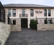
Villa Ukus Boutique Hotel
Videos from this area
These are videos related to the place based on their proximity to this place.
KOSOVA - MAGLAJ Obnova i Izgradnja poslije klizišta
PREDAJA U UPORABU NOVOIZGRADJENE KUĆE OD DONATORA IZ AUSTRIJE MUHAMEDU ALIĆU ČIJA JE KUĆA NASTRADALU U KLIZIŠTU MAJA 2014 God. Izgradnju je koordinirao Medžlis ...
Kliziste Bistrica - Poljice / Ravna
kliziste na rjeci Bistrici izmedju Poljice-Ravna Odrunjena zemjla dala je uspon rijeci i formirano je manje jezerce ,dok voda otice kroz uzak kanal u daljni svoj tok prema bosni.
SVADBA ALDIN I ALISA BAJRIĆ - uvodni spot JELAH 2011
Svadba Šije -Tešanj-Jelah, 18.6.2011. Bajrić Aldin i Alisa.
KULTURNOZABAVNI SUSRETI MZ KOSOVA MAGLAJ i MZ KOZARAC PRIJEDOR u Kosovi 15.maja 2010
ZABAVNI DIO SUSRETA Mz. KOSOVA I KOZARAC POVODOM 15 Maja DANA MJESNE ZAJEDNICE KOSOVA. FOLKLOR I MUZIKA NA POLIGONU KOD ŠKOLE U KOSOVI.
Ibrahim Skiljo-Svadbena pjesma - SVADBA- Ado i Alena Kosova-Maglaj
Nova svadbena pjesma Ibre Skilje, Svadba Ado i Alena Kosova Maglaj, maj 2010.
Videos provided by Youtube are under the copyright of their owners.
Attractions and noteworthy things
Distances are based on the centre of the city/town and sightseeing location. This list contains brief abstracts about monuments, holiday activities, national parcs, museums, organisations and more from the area as well as interesting facts about the region itself. Where available, you'll find the corresponding homepage. Otherwise the related wikipedia article.
Kosova, Maglaj
Kosova is a village in Maglaj municipality, in the Federation of Bosnia and Herzegovina, Bosnia and Herzegovina. {{#invoke:Coordinates|coord}}{{#coordinates:44|37|11|N|18|04|40|E| |primary |name= }}
Kosova (Maglaj)
Kosova (Maglaj) is a village in the municipality of Maglaj, Bosnia and Herzegovina.
Moševac
Moševac is a village in the municipality of Maglaj, Bosnia and Herzegovina.
Ravna (Maglaj)
Ravna (Maglaj) is a village in the municipality of Maglaj, Bosnia and Herzegovina.
Rječica Donja
Rječica Donja is a village in the municipality of Maglaj, Bosnia and Herzegovina.
Rječica Gornja
Rječica Gornja is a village in the municipality of Maglaj, Bosnia and Herzegovina.
Trbuk
Trbuk is a village in the municipality of Maglaj, Bosnia and Herzegovina.
Trebačko brdo
Trebačko brdo is a mountain of Bosnia and Herzegovina.


