Safety Score: 3,0 of 5.0 based on data from 9 authorites. Meaning we advice caution when travelling to Belgium.
Travel warnings are updated daily. Source: Travel Warning Belgium. Last Update: 2024-08-13 08:21:03
Discover Sol Prangeleux
Sol Prangeleux in Province du Luxembourg (Wallonia) is a place in Belgium about 64 mi (or 102 km) south-east of Brussels, the country's capital city.
Current time in Sol Prangeleux is now 03:21 PM (Friday). The local timezone is named Europe / Brussels with an UTC offset of one hour. We know of 10 airports near Sol Prangeleux, of which 5 are larger airports. The closest airport in Belgium is Liège Airport in a distance of 20 mi (or 32 km), North. Besides the airports, there are other travel options available (check left side).
There are several Unesco world heritage sites nearby. The closest heritage site is Aachen Cathedral in Germany at a distance of 36 mi (or 58 km). The closest in Belgium is Stoclet House in a distance of 61 mi (or 58 km), North-East. Also, if you like playing golf, there are a few options in driving distance. If you need a hotel, we compiled a list of available hotels close to the map centre further down the page.
While being here, you might want to pay a visit to some of the following locations: Bastogne, Wincrange, Troisvierges, Maastricht and Winseler. To further explore this place, just scroll down and browse the available info.
Local weather forecast
Todays Local Weather Conditions & Forecast: 9°C / 49 °F
| Morning Temperature | 7°C / 45 °F |
| Evening Temperature | 5°C / 41 °F |
| Night Temperature | 3°C / 38 °F |
| Chance of rainfall | 0% |
| Air Humidity | 68% |
| Air Pressure | 1028 hPa |
| Wind Speed | Light breeze with 3 km/h (2 mph) from South-West |
| Cloud Conditions | Few clouds, covering 18% of sky |
| General Conditions | Few clouds |
Saturday, 16th of November 2024
8°C (46 °F)
5°C (41 °F)
Scattered clouds, gentle breeze.
Sunday, 17th of November 2024
6°C (42 °F)
4°C (40 °F)
Moderate rain, moderate breeze, overcast clouds.
Monday, 18th of November 2024
6°C (42 °F)
7°C (45 °F)
Rain and snow, moderate breeze, overcast clouds.
Hotels and Places to Stay
La Buissonnière
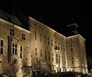
Château de Harzé Centre séminaire
Videos from this area
These are videos related to the place based on their proximity to this place.
IMAGINE
Little film on a charming Bed and Breakfast in the south of Belgium. http://www.entredeuxrives.be.
ENTRE DEUX RIVES B&B _ CLE SUR PORTE
Reportage sur nos chambres d'hôtes diffusé dans l'émission CLE SUR PORTE.
Kayak Les remous Hamoir
Descente de l'Ourthe en kayak mono, duo et trio sur 10, 15 ou 25 km. Accueil et réservation à Hamoir. Parking surveillé. Transport en minibus aux points de départ : Bomal ou Barvaux.
Descente de l'Ourthe 2013/03/03
Afvaart van de ourte op 2013/03/03. Vertrek in Bomal en aankomst in Hamoir. Afstand bedraagt 9 kilometer dit met een watertemperatuur van 6°C. Competitief, recreatief, verkleedpartij. Descente...
jumelage chablis ferrieres banda: tapage diurne
jumelage chablis ferrieres : passage du tour de france 2010 avec le banda de chablis: tapage diurne.
100 km Eco de Ferrières (2009) - Caméra embarquée #1
Vidéo #1, en suivant une 2CV '58 Chemin de Piltus, Ferrières Caméra embarquée à bord de ma Citroën Visa II Spécial '82 5ème place, consommation: 4,95l/100km.
Videos provided by Youtube are under the copyright of their owners.


