Safety Score: 3,0 of 5.0 based on data from 9 authorites. Meaning we advice caution when travelling to Belgium.
Travel warnings are updated daily. Source: Travel Warning Belgium. Last Update: 2024-08-13 08:21:03
Discover Limes
Limes in Province du Luxembourg (Wallonia) is a city in Belgium about 97 mi (or 156 km) south-east of Brussels, the country's capital city.
Local time in Limes is now 12:23 AM (Friday). The local timezone is named Europe / Brussels with an UTC offset of one hour. We know of 9 airports in the vicinity of Limes, of which 3 are larger airports. The closest is airport we know is Verdun-Le Rozelier Airport in France in a distance of 34 mi (or 55 km). The closest airport in Belgium is Suarlée Airport in a distance of 66 mi (or 55 km), South. Besides the airports, there are other travel options available (check left side).
There are several Unesco world heritage sites nearby. The closest heritage site is City of Luxembourg: its Old Quarters and Fortifications in Luxembourg at a distance of 33 mi (or 53 km). The closest in Belgium is The Four Lifts on the Canal du Centre and their Environs, La Louvière and Le Roeulx (Hainaut) in a distance of 82 mi (or 53 km), East. Also, if you like golfing, there is an option about 7 mi (or 12 km). away. Looking for a place to stay? we compiled a list of available hotels close to the map centre further down the page.
When in this area, you might want to pay a visit to some of the following locations: Virton, Neufchateau, Verdun, Sedan and Ell. To further explore this place, just scroll down and browse the available info.
Local weather forecast
Todays Local Weather Conditions & Forecast: 1°C / 34 °F
| Morning Temperature | -1°C / 30 °F |
| Evening Temperature | -0°C / 32 °F |
| Night Temperature | -2°C / 28 °F |
| Chance of rainfall | 0% |
| Air Humidity | 81% |
| Air Pressure | 1000 hPa |
| Wind Speed | Moderate breeze with 11 km/h (7 mph) from East |
| Cloud Conditions | Overcast clouds, covering 100% of sky |
| General Conditions | Light snow |
Friday, 22nd of November 2024
2°C (36 °F)
1°C (34 °F)
Light snow, moderate breeze, overcast clouds.
Saturday, 23rd of November 2024
4°C (39 °F)
5°C (41 °F)
Rain and snow, gentle breeze, overcast clouds.
Sunday, 24th of November 2024
10°C (50 °F)
10°C (49 °F)
Overcast clouds, gentle breeze.
Hotels and Places to Stay
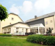
Le Nid d'Izel
Videos from this area
These are videos related to the place based on their proximity to this place.
Des racines et des ailes - Montmédy & Marville
Des racines et des ailes : reportage sur la Lorraine (Marville, Montmédy, Lachaussée.)
Citadelle de Montmédy
De citadel van Montmédy, in het noorden van Frankrijk, nabij de grens met Belgie.
Honda Deauville in the citadel of Montmédy France.
A stop at the citadel of Montmédy (sixteenth century) in the north east of France Lorraine. Considered one of the largest military installations in the North-East of France, built in the Renaissan...
Montmedy sous l' occupation. Meuse - Lorraine .wmv
http://www.montmedy.net Montmédy est situé sur la N43 à 43 km au sud-est de Sedan et à 25 km au nord-ouest de Longuyon ; Stenay est à 16 km à l'ouest via la D947 et la frontière belge...
Montmedy - ville basse - Meuse - Lorraine ..wmv
http://www.montmedy.net Montmédy est situé sur la N43 à 43 km au sud-est de Sedan et à 25 km au nord-ouest de Longuyon ; Stenay est à 16 km à l'ouest via la D947 et la frontière belge...
Copain d'école
Court-métrage réalisé par la classe de CE1/CE2 de l'école Brassens à Montmédy, dans le cadre du festival Courts culottés du 22 juin 2013.
Un jour au collège
Court-métrage réalisé par des élèves de l'école de Brassens et des écoles du collège Jean d'Allamont à Montmédy, dans le cadre du festival Courts culottés du 22 juin 2013.
Explication de mon crash + État du quad
Voilà, cette vidéo explique vite fait le crash que j'ai eu avec mon Shineray XY250ST-9E à la citadelle de Montmédy. J'ai aussi filmé mon quad pour vous montrez la chance que j'ai eu niveau...
Videos provided by Youtube are under the copyright of their owners.


