Safety Score: 3,0 of 5.0 based on data from 9 authorites. Meaning we advice caution when travelling to Belgium.
Travel warnings are updated daily. Source: Travel Warning Belgium. Last Update: 2024-08-13 08:21:03
Discover Ronquières
Ronquières in Province du Hainaut (Wallonia) is a place in Belgium about 18 mi (or 28 km) south of Brussels, the country's capital city.
Current time in Ronquières is now 03:17 AM (Saturday). The local timezone is named Europe / Brussels with an UTC offset of one hour. We know of 10 airports near Ronquières, of which 3 are larger airports. The closest airport in Belgium is Brussels South Charleroi Airport in a distance of 15 mi (or 23 km), South-East. Besides the airports, there are other travel options available (check left side).
There are several Unesco world heritage sites nearby. The closest heritage site in Belgium is The Four Lifts on the Canal du Centre and their Environs, La Louvière and Le Roeulx (Hainaut) in a distance of 10 mi (or 15 km), South. Also, if you like playing golf, there are a few options in driving distance. If you need a hotel, we compiled a list of available hotels close to the map centre further down the page.
While being here, you might want to pay a visit to some of the following locations: Enghien, Lennik, Brussels, Chasse Royale and Chastre. To further explore this place, just scroll down and browse the available info.
Local weather forecast
Todays Local Weather Conditions & Forecast: 4°C / 39 °F
| Morning Temperature | 2°C / 35 °F |
| Evening Temperature | 5°C / 42 °F |
| Night Temperature | 8°C / 46 °F |
| Chance of rainfall | 0% |
| Air Humidity | 79% |
| Air Pressure | 1016 hPa |
| Wind Speed | Fresh Breeze with 17 km/h (11 mph) from North |
| Cloud Conditions | Overcast clouds, covering 100% of sky |
| General Conditions | Light rain |
Sunday, 24th of November 2024
13°C (56 °F)
14°C (57 °F)
Light rain, strong breeze, overcast clouds.
Monday, 25th of November 2024
10°C (51 °F)
8°C (47 °F)
Moderate rain, strong breeze, overcast clouds.
Tuesday, 26th of November 2024
9°C (48 °F)
7°C (45 °F)
Scattered clouds, moderate breeze.
Hotels and Places to Stay
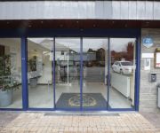
Hôtel Le Relais Du Marquis
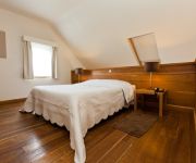
Le Manoir du Capitaine Apart Hotel
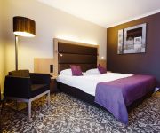
Van der Valk Nivelles-Sud
Videos from this area
These are videos related to the place based on their proximity to this place.
Halloween au bois du tricot à ittre
Montage de Halloween façon Walking Dead au bois du tricot à Ittre. Merci à VideoCopilot pour le pack Halloween.
Videos provided by Youtube are under the copyright of their owners.
Attractions and noteworthy things
Distances are based on the centre of the city/town and sightseeing location. This list contains brief abstracts about monuments, holiday activities, national parcs, museums, organisations and more from the area as well as interesting facts about the region itself. Where available, you'll find the corresponding homepage. Otherwise the related wikipedia article.
Ronquières inclined plane
The Ronquières Inclined Plane is a Belgian canal inclined plane on the Brussels-Charleroi Canal in the province of Hainaut in Wallonia that opened in April 1968 after a six-year construction period. It is located in the municipality of Braine-le-Comte, and takes its name from the nearby village of Ronquières.
Brussels–Charleroi Canal
The Brussels–Charleroi Canal, also known as the Charleroi Canal amongst other similar names, is an important canal in Belgium. The canal is quite large, with a Class IV Freycinet gauge, and its Wallonian portion is 47.9 kilometres long. It runs from Charleroi in the south to Brussels in the north.
Ronquières
Ronquières is a village in the municipality of Braine-le-Comte in the Belgian province of Hainaut in the Walloon region. It is best known as the location of the Ronquières inclined plane on the Brussels-Charleroi Canal. The lower end of the inclined plane is just a few hundred metres from the centre of the village. The population of the village was 1370 as of January 2006.


