Safety Score: 3,0 of 5.0 based on data from 9 authorites. Meaning we advice caution when travelling to Belgium.
Travel warnings are updated daily. Source: Travel Warning Belgium. Last Update: 2024-08-13 08:21:03
Delve into Longfaye
Longfaye in Province de Liège (Wallonia) is a city located in Belgium about 80 mi (or 129 km) east of Brussels, the country's capital town.
Current time in Longfaye is now 09:46 PM (Friday). The local timezone is named Europe / Brussels with an UTC offset of one hour. We know of 10 airports closer to Longfaye, of which 5 are larger airports. The closest is airport we know is Aachen-Merzbrück Airport in Germany in a distance of 25 mi (or 40 km). The closest airport in Belgium is Liège Airport in a distance of 30 mi (or 40 km), North. Besides the airports, there are other travel options available (check left side).
There are several Unesco world heritage sites nearby. The closest heritage site is Aachen Cathedral in Germany at a distance of 21 mi (or 34 km). The closest in Belgium is Stoclet House in a distance of 77 mi (or 34 km), North. Also, if you like playing golf, there are some options within driving distance. In need of a room? We compiled a list of available hotels close to the map centre further down the page.
Since you are here already, you might want to pay a visit to some of the following locations: Roetgen, Simmerath, Winterspelt, Mutzenich and Winterscheid. To further explore this place, just scroll down and browse the available info.
Local weather forecast
Todays Local Weather Conditions & Forecast: 6°C / 42 °F
| Morning Temperature | 5°C / 42 °F |
| Evening Temperature | 3°C / 37 °F |
| Night Temperature | 2°C / 35 °F |
| Chance of rainfall | 0% |
| Air Humidity | 87% |
| Air Pressure | 1028 hPa |
| Wind Speed | Light breeze with 3 km/h (2 mph) from South |
| Cloud Conditions | Overcast clouds, covering 100% of sky |
| General Conditions | Overcast clouds |
Saturday, 16th of November 2024
7°C (44 °F)
2°C (36 °F)
Scattered clouds, gentle breeze.
Sunday, 17th of November 2024
4°C (39 °F)
0°C (32 °F)
Moderate rain, moderate breeze, overcast clouds.
Monday, 18th of November 2024
2°C (35 °F)
2°C (35 °F)
Light rain, moderate breeze, broken clouds.
Hotels and Places to Stay
Domaine des Hautes Fagnes
Hotel des Bains & Wellness - Spa NUXE
Le Val D'Arimont Resort
Cyrano
Hotel La Forge
Hotleu
Videos from this area
These are videos related to the place based on their proximity to this place.
Downhill to Malmedy (Belgium) - Exige vs. Elise
Two Loti (Exige MY10 and Elise S2) playing in the Ardennes near Spa Francorchamps. Truly a great drive, it was the last one of our 2011 driving season.
Police Helicoptère MD900 Explorer extinction d'incendie dans les Hautes Fagnes
Exercice réalisé par les pompiers de Waimes, en Fagnes, avec la police fédérale.
Camping La Plage - Frankrijk
Camping La Plage, Bretagne, Frankrijk: meer informatie en direct reserveren » http://www.Eurocamp.nl/BS021.
JMC Rallye 2014 | Onboard Warlomont - Deru | Peugeot 206 RC | ES9 Sourbrodt [HD] by JHVideo
JMC Rallye 2014 Désolé pour le problème de son indépendant de ma volonté ! Maxime Warlomont - Philippe Deru Peugeot 206 RC ES9 Sourbrodt Scratch général Vidéo en HD 1080p Chaine...
Sourbrodt 01 Octobre 2005 Show Laser par Sam.wmv
Soirée Hardbass à Sourbrodt le 01 Octobre 2005. Show Laser par Sam :-) (laser à cristal de Yag 5 Watts vert, sous logiciel Pangolin) Light Show via logiciel Sunlight Dj D-Feat, Dj Gast,...
20140327 Flying over the Belgian Highest Point
My first short nav since my PPL ;-) The top of Belgium is very close to Spa: Signal de Botrange in the High Fenns (Hautes Fagnes in French). Its elevation is 2267 ft, so, in order to be 1000...
PFT-TSP, 08/08/1998, 10 ans d'existence, voyage spécial sur la Vennbahn (video 8)
Pour cet anniversaire, le PFT-TSP organisa un parcours spécial sur la défunte ligne touristique de la Vennbahn, le train était tracté par les GM ex-CFL 1602 + 1603, maintenant propriétés...
Wanderweg E3 - Wegzeichen am Weg : Rhein-Eifel.TV
Die Wegmarkierungen am Fernwanderweg E3 in den belgischen Ardennen sind die Grundlage dieser Bild-Meditation. Die gemalten Wegzeichen werden zum Kunst-Video.
Videos provided by Youtube are under the copyright of their owners.
Attractions and noteworthy things
Distances are based on the centre of the city/town and sightseeing location. This list contains brief abstracts about monuments, holiday activities, national parcs, museums, organisations and more from the area as well as interesting facts about the region itself. Where available, you'll find the corresponding homepage. Otherwise the related wikipedia article.
Ovifat
Ovifat is a village situated in the municipality of Waimes, in eastern Belgium, population about 500. Its inhabitants are called Barras.
Lake Robertville
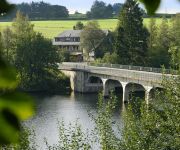
Lake Robertville is an artificial lake near the city of Malmedy in Belgium. The water volume is 8,000,000 m³ and the area is 0,62 km². The lake is located in the High Fens park. The dam on the river Warche was built in 1928.
Operation Stösser
Operation Stösser was a paratroop drop into the American rear in the High Fens area during the Battle of the Bulge. Their objective was to take and hold the "Baraque Michel" crossroads until the arrival of the 12th SS Panzer Division. The operation was led by Oberst Friedrich August Freiherr von der Heydte. He was given only 8 days to prepare the mission. The majority of the paratroopers and pilots assigned to the operation were untrained and inexperienced. The mission was a complete failure.
Reinhardstein Castle
Reinhardstein Castle is a castle in Belgium, in the valley of the Warche, in the village of Ovifat in the municipality of Waimes (Weismes) near Robertville in the province of Liège. It was built in 1354 for Wenceslaus of Luxembourg, while still Count, by his vassal Reinhard of Weismes. In the 19th century it was nearly destroyed by quarrying, and since 1969 has been reconstructed.


!['JMC Rallye 2014 | Onboard Warlomont - Deru | Peugeot 206 RC | ES9 Sourbrodt [HD] by JHVideo' preview picture of video 'JMC Rallye 2014 | Onboard Warlomont - Deru | Peugeot 206 RC | ES9 Sourbrodt [HD] by JHVideo'](https://img.youtube.com/vi/f1X_K6-xBJI/mqdefault.jpg)


