Safety Score: 3,0 of 5.0 based on data from 9 authorites. Meaning we advice caution when travelling to Belgium.
Travel warnings are updated daily. Source: Travel Warning Belgium. Last Update: 2024-08-13 08:21:03
Discover Espeler
Espeler in Province de Liège (Wallonia) is a town in Belgium about 87 mi (or 140 km) south-east of Brussels, the country's capital city.
Current time in Espeler is now 09:23 PM (Sunday). The local timezone is named Europe / Brussels with an UTC offset of one hour. We know of 10 airports near Espeler, of which 5 are larger airports. The closest is airport we know is Bitburg Airport in Germany in a distance of 29 mi (or 46 km). The closest airport in Belgium is Liège Airport in a distance of 40 mi (or 46 km), South-East. Besides the airports, there are other travel options available (check left side).
There are several Unesco world heritage sites nearby. The closest heritage site is Aachen Cathedral in Germany at a distance of 40 mi (or 64 km). The closest in Belgium is Stoclet House in a distance of 84 mi (or 64 km), North. Also, if you like playing golf, there are a few options in driving distance. Looking for a place to stay? we compiled a list of available hotels close to the map centre further down the page.
When in this area, you might want to pay a visit to some of the following locations: Weiswampach, Troisvierges, Harspelt, Lutzkampen and Clervaux. To further explore this place, just scroll down and browse the available info.
Local weather forecast
Todays Local Weather Conditions & Forecast: 5°C / 41 °F
| Morning Temperature | 4°C / 39 °F |
| Evening Temperature | 4°C / 39 °F |
| Night Temperature | 2°C / 36 °F |
| Chance of rainfall | 3% |
| Air Humidity | 96% |
| Air Pressure | 1013 hPa |
| Wind Speed | Moderate breeze with 10 km/h (6 mph) from East |
| Cloud Conditions | Overcast clouds, covering 100% of sky |
| General Conditions | Light rain |
Monday, 18th of November 2024
4°C (39 °F)
5°C (40 °F)
Moderate rain, moderate breeze, overcast clouds.
Tuesday, 19th of November 2024
7°C (45 °F)
1°C (33 °F)
Rain and snow, fresh breeze, overcast clouds.
Wednesday, 20th of November 2024
-0°C (32 °F)
-4°C (25 °F)
Snow, fresh breeze, overcast clouds.
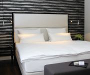
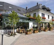
Hotels and Places to Stay
Wemperhardt
Hotel Paquet
Le Tapis Rouge
Relaxhotel Pip Margraff
Ulftaler Schenke
Videos from this area
These are videos related to the place based on their proximity to this place.
Hearthstone • Tournoi Bruxelles #3 • Deck Cham • Partie classé
Lire une description par jour peut sauver un chaton----- Brussels Cup #3 Hearthstone @Outpost / Samedi 12 avril 2014 Voici les détails du tournoi: • Heures: ouverture à 11h00 -...
Le seigneur des anneaux-La Guerre du Nord | Fun, bug et Jesus ! Playthrough #4
Lire une description par jour peut sauver un chaton----- LOTR-La guerre du nord-Episode 4 Hellow! Voici la suite de notre aventure en Terre Du millieu ! La guerre du nord avec la SBBD...
|Les Dynastes Insociables| Quand Azren Vinom Mélüne et Nalo sont de sorties !
Lire une description par jour peut sauver un chaton----- World of warcraft-Azren ft. Vinom Mélüne et Nalo Pour le plaisir des yeux ! Suite à la pression de dame Mél, Azren nous à...
The Stanley Parable | Test de février 2014 [Jeux indépendant] [FR] [HD]
Lire une description par jour peut sauver un chaton----- The Stanley Parable/ Galactic Cafe - Indie Games Pour y jouer et essayer la démo ••▻http://www.stanleyparable.com/ Pour...
Kneiff - 560m (1837ft) - Huldange, Ardennes, Luxembourg
LX/PD2U/P and LX/PD4U/P at the Kneiff at 560m (1837ft) in Luxembourg.
Tunnel Wilwerdange (L) - Lengeler (B)
Een tochtje op 12 februari 2011 doorheen de 800 meter lange tunnel. Aangelegd in de jaren 1888-1889 was deze tunnel onderdeel van de Vennbahn tussen Lommersweiler en Troisvierges. Hier zie...
Warframe | Le Test de fin d'année - [2013] [FR] [HD]
Lire une description par jour peut sauver un chaton----- Warframe | Le test de fin d'année ! [2013] Je suis N.U.L Warframe est un Free to play, shooter à la 3ème personne, jouable...
Burrigplatz - Huldange, Ardennes, Luxembourg
Burrigplatz 1831ft (558m), Huldange, Ardennes, Luxembourg.
Deltaloop-Quad, Kneiff - Huldange, Ardennes, Luxembourg
Der Kneiff 1837ft (560m). Highest point of Luxembourg, Deltaloop antenna for 20m and 2 stacked cubical quads for 2m. LX/PD2U/P and LX/PD4U/P.
Invitation RT91 Euromeeting 2002 St.Vith/Belgium
Invitation to the 91er Euromeeting 2002 in St.Vith/Belgium www.rt91.be.
Videos provided by Youtube are under the copyright of their owners.
Attractions and noteworthy things
Distances are based on the centre of the city/town and sightseeing location. This list contains brief abstracts about monuments, holiday activities, national parcs, museums, organisations and more from the area as well as interesting facts about the region itself. Where available, you'll find the corresponding homepage. Otherwise the related wikipedia article.
Buurgplaatz
Buurgplaatz is a hill in the commune of Troisvierges, in northern Luxembourg. The 559 metre high summit lies within the Oesling region at {{#invoke:Coordinates|coord}}{{#coordinates:50.1615|6.0281|type:landmark_region:LU|||||| |primary |name= }}. It is often erroneously considered the highest point in Luxembourg (so much so that there is a plaque on the summit celebrating as such). Actually, it is the second highest, after Kneiff (560 m).
Huldange
Huldange is a small town in the commune of Troisvierges, in far northern Luxembourg. As of 2005, the town has a population of 353. Nearby is the source of the Clerve.
Extreme points of Luxembourg
This is a list of the extreme points of Luxembourg, the points that are farther north, south, east or west, higher or lower than any other location on the territory of the state.


!['The Stanley Parable | Test de février 2014 [Jeux indépendant] [FR] [HD]' preview picture of video 'The Stanley Parable | Test de février 2014 [Jeux indépendant] [FR] [HD]'](https://img.youtube.com/vi/jCBzJmsk_Kg/mqdefault.jpg)


!['Warframe | Le Test de fin d'année - [2013] [FR] [HD]' preview picture of video 'Warframe | Le Test de fin d'année - [2013] [FR] [HD]'](https://img.youtube.com/vi/smean3YFsag/mqdefault.jpg)


