Safety Score: 3,0 of 5.0 based on data from 9 authorites. Meaning we advice caution when travelling to Belgium.
Travel warnings are updated daily. Source: Travel Warning Belgium. Last Update: 2024-08-13 08:21:03
Touring Bende
Bende in Province de Liège (Wallonia) is a town located in Belgium about 46 mi (or 74 km) south-east of Brussels, the country's capital place.
Time in Bende is now 09:52 PM (Friday). The local timezone is named Europe / Brussels with an UTC offset of one hour. We know of 9 airports nearby Bende, of which 5 are larger airports. The closest airport in Belgium is Liège Airport in a distance of 9 mi (or 15 km), North-East. Besides the airports, there are other travel options available (check left side).
There are several Unesco world heritage sites nearby. The closest heritage site is Aachen Cathedral in Germany at a distance of 38 mi (or 62 km). The closest in Belgium is Stoclet House in a distance of 43 mi (or 62 km), North-East. Also, if you like the game of golf, there are several options within driving distance. Need some hints on where to stay? We compiled a list of available hotels close to the map centre further down the page.
Being here already, you might want to pay a visit to some of the following locations: Hannut, Lincent, Namur, Maastricht and Scherpenheuvel-Zichem. To further explore this place, just scroll down and browse the available info.
Local weather forecast
Todays Local Weather Conditions & Forecast: 9°C / 49 °F
| Morning Temperature | 8°C / 46 °F |
| Evening Temperature | 7°C / 45 °F |
| Night Temperature | 4°C / 39 °F |
| Chance of rainfall | 0% |
| Air Humidity | 66% |
| Air Pressure | 1028 hPa |
| Wind Speed | Light breeze with 3 km/h (2 mph) from North |
| Cloud Conditions | Overcast clouds, covering 93% of sky |
| General Conditions | Overcast clouds |
Saturday, 16th of November 2024
8°C (46 °F)
6°C (42 °F)
Broken clouds, gentle breeze.
Sunday, 17th of November 2024
7°C (44 °F)
2°C (36 °F)
Moderate rain, moderate breeze, overcast clouds.
Monday, 18th of November 2024
5°C (41 °F)
8°C (46 °F)
Light rain, strong breeze, overcast clouds.
Hotels and Places to Stay
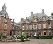
Domaine du Château de la Neuville
Château de la Neuville
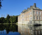
Chateau de Vierset
Videos from this area
These are videos related to the place based on their proximity to this place.
DH AMAY 2014-partie technique
petite partie de la dh d'amay (partie shappée par Robin Matot) Filmée avec un iPhone 5S.
Beautiful road gap @ Amay DH (Belgium) - Scott FR20 with Drift X170
Very nice road gap! Landing in a very steep hill, lots of fun!
Teaser Robin Matot-Mazo
Petit teaser avant la venue de la video de " Robin Matot -Mazo " ! Rider : Robin Matot Cameraman : Jeremy Mathot Tournage : Amay !
Videos provided by Youtube are under the copyright of their owners.
Attractions and noteworthy things
Distances are based on the centre of the city/town and sightseeing location. This list contains brief abstracts about monuments, holiday activities, national parcs, museums, organisations and more from the area as well as interesting facts about the region itself. Where available, you'll find the corresponding homepage. Otherwise the related wikipedia article.
Jehay-Bodegnée Castle
Jehay Castle or Jehay-Bodegnée Castle (French: Château de Jehay or Jehay-Bodegnée) is a castle situated in the municipality of Amay in the province of Liège in Belgium.
Mur de Huy
The Mur de Huy (English: Wall of Huy) is a 128 metres high hill located in Huy, Belgium. It is also known as le Chemin des Chapelles (English: The Path of the Chapels) because of the seven chapels along its route. This climb is famous for being part of the route of La Flèche Wallonne professional cycling race.


