Safety Score: 3,0 of 5.0 based on data from 9 authorites. Meaning we advice caution when travelling to Belgium.
Travel warnings are updated daily. Source: Travel Warning Belgium. Last Update: 2024-08-13 08:21:03
Delve into Romarin
Romarin in Provincie West-Vlaanderen (Flanders) is located in Belgium about 66 mi (or 107 km) west of Brussels, the country's capital town.
Current time in Romarin is now 03:02 PM (Monday). The local timezone is named Europe / Brussels with an UTC offset of one hour. We know of 13 airports close to Romarin, of which 5 are larger airports. The closest is airport we know is Merville-Calonne Airport in France in a distance of 11 mi (or 18 km). The closest airport in Belgium is Wevelgem Airport in a distance of 17 mi (or 18 km), South-West. Besides the airports, there are other travel options available (check left side).
There are several Unesco world heritage sites nearby. The closest heritage site in Belgium is Notre-Dame Cathedral in Tournai in a distance of 25 mi (or 41 km), East. Also, if you like playing golf, there are some options within driving distance. We encountered 1 points of interest near this location. If you need a hotel, we compiled a list of available hotels close to the map centre further down the page.
While being here, you might want to pay a visit to some of the following locations: Saint-Yvon, Ieper, Lille, Bethune and Lens. To further explore this place, just scroll down and browse the available info.
Local weather forecast
Todays Local Weather Conditions & Forecast: 11°C / 51 °F
| Morning Temperature | 14°C / 58 °F |
| Evening Temperature | 10°C / 50 °F |
| Night Temperature | 8°C / 47 °F |
| Chance of rainfall | 3% |
| Air Humidity | 84% |
| Air Pressure | 1004 hPa |
| Wind Speed | Strong breeze with 20 km/h (12 mph) from North |
| Cloud Conditions | Overcast clouds, covering 100% of sky |
| General Conditions | Light rain |
Tuesday, 26th of November 2024
10°C (51 °F)
9°C (49 °F)
Light rain, moderate breeze, broken clouds.
Wednesday, 27th of November 2024
7°C (45 °F)
5°C (41 °F)
Moderate rain, strong breeze, overcast clouds.
Thursday, 28th of November 2024
7°C (45 °F)
4°C (40 °F)
Overcast clouds, gentle breeze.
Hotels and Places to Stay
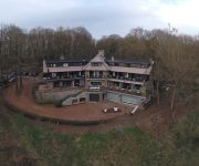
Hostellerie Kemmelberg
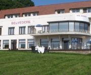
Belvedere
Videos from this area
These are videos related to the place based on their proximity to this place.
Le Collège Saint Jude à Armentières (Nord)
Présentation du collège Saint Jude à Armentières (59-Nord) : projet pédagogique, environnement d'apprentissage et état d'esprit...
Présentation 3D du projet de liaison de Nieppe à Armentières
Présentation 3D du projet de liaison de Nieppe à Armentières.
Le Lycée Saint Jude à Armentières (59-Nord)
Présentation du Lycée Saint Jude à Armentières : projet pédagogique, spécialités, environnement...
La pastorale de l'Institution Saint Jude (Armentières)
Présentation de la pastorale et de ses actions à Saint Jude (Armentières, Nord)
PRÉSENTATION DE L'INSTITUTION SAINT JUDE A ARMENTIERES
Institution Saint Jude - 18 Rue Lamartine 59 280 Armentières - 03 20 77 10 49 Située à Armentières, l'Institution Saint Jude est un groupe scolaire privé en contrat d'association...
TESTATHLON 2013 by Flop
TESTATHLON 2013 à Armentières avec la fondation DigestScience Au profit de la recherche sur les maladies digestives et la nutrition.
MSO Evenementiel - Chti Bike Tour 2012
Petit clip de présentation du Chti Bike Tour 2012, "la Laurent Debiens" que nous avons eu l'honneur d'escorter. Armentières les 25 & 26 août 2012.
Ploegsteert Memorial to the Missing
Pipers Remembering WWI at Ploegsteert Memorial to the Missing, in company of Mr Peter White, former piper of the Black Watch. Playing Amazing Grace. #cwgc #lestweforget Also like our Facebook...
ZICOZ (Cover) - The animals - The house of the rising sun
Reprise version covertherapy de "The house of the rising sun" des Animals par les Zic'Oz - juin 2013.
Videos provided by Youtube are under the copyright of their owners.
Attractions and noteworthy things
Distances are based on the centre of the city/town and sightseeing location. This list contains brief abstracts about monuments, holiday activities, national parcs, museums, organisations and more from the area as well as interesting facts about the region itself. Where available, you'll find the corresponding homepage. Otherwise the related wikipedia article.
Berks Commonwealth War Graves Commission Cemetery Extension
Berks Cemetery Extension is a Commonwealth War Graves Commission (CWGC) burial ground for the dead of the First World War located in Ploegsteert in the Ypres Salient on the Western Front. The cemetery grounds were assigned to the United Kingdom in perpetuity by King Albert I of Belgium in recognition of the sacrifices made by the British Empire in the defence and liberation of Belgium during the war.
Hyde Park Corner (Royal Berks) Commonwealth War Graves Commission Cemetery
Hyde Park Corner (Royal Berks) Cemetery is a Commonwealth War Graves Commission (CWGC) burial ground for the dead of the First World War located in the Ypres Salient on the Western Front. The cemetery grounds were assigned to the United Kingdom in perpetuity by King Albert I of Belgium in recognition of the sacrifices made by the British Empire in the defence and liberation of Belgium during the war.
Ploegsteert Memorial to the Missing
The Ploegsteert Memorial to the Missing (also known as Hyde Park Corner and referred to colloquially as "Plug Street") is a Commonwealth War Graves Commission (CWGC) memorial for the missing soldiers of World War I who fought in the immediate area of the Ypres Salient on the Western Front. The grounds were assigned to the United Kingdom in perpetuity by King Albert I of Belgium in recognition of the sacrifices made by the British Empire in the defence and liberation of Belgium during the war.
Ploegsteert
Ploegsteert is a village in Belgium located in the municipality of Comines-Warneton in the Hainaut province and is the most westerly settlement of the Walloon region. It is approximately 2 kilometres north of the French border. Created in 1850 on part of the territory of Warneton, it includes the hamlet of Le Bizet. It is largely francophone, with facilities for Dutch speakers. The nearby Ploegsteert Wood was the site of fierce WWI fighting.


