Safety Score: 3,0 of 5.0 based on data from 9 authorites. Meaning we advice caution when travelling to Belgium.
Travel warnings are updated daily. Source: Travel Warning Belgium. Last Update: 2024-08-13 08:21:03
Discover Ouderdom
Ouderdom in Provincie West-Vlaanderen (Flanders) is a place in Belgium about 68 mi (or 110 km) west of Brussels, the country's capital city.
Current time in Ouderdom is now 03:57 AM (Friday). The local timezone is named Europe / Brussels with an UTC offset of one hour. We know of 10 airports near Ouderdom, of which 5 are larger airports. The closest is airport we know is Merville-Calonne Airport in France in a distance of 15 mi (or 25 km). The closest airport in Belgium is Wevelgem Airport in a distance of 18 mi (or 25 km), South-West. Besides the airports, there are other travel options available (check left side).
There are several Unesco world heritage sites nearby. The closest heritage site in Belgium is Notre-Dame Cathedral in Tournai in a distance of 31 mi (or 49 km), South-East. Also, if you like playing golf, there are a few options in driving distance. We encountered 1 points of interest in the vicinity of this place. If you need a hotel, we compiled a list of available hotels close to the map centre further down the page.
While being here, you might want to pay a visit to some of the following locations: Ieper, Saint-Yvon, Diksmuide, Veurne and Bethune. To further explore this place, just scroll down and browse the available info.
Local weather forecast
Todays Local Weather Conditions & Forecast: 5°C / 42 °F
| Morning Temperature | 3°C / 37 °F |
| Evening Temperature | 4°C / 39 °F |
| Night Temperature | 2°C / 35 °F |
| Chance of rainfall | 0% |
| Air Humidity | 65% |
| Air Pressure | 1007 hPa |
| Wind Speed | Fresh Breeze with 14 km/h (8 mph) from East |
| Cloud Conditions | Scattered clouds, covering 26% of sky |
| General Conditions | Light rain |
Saturday, 23rd of November 2024
4°C (40 °F)
9°C (47 °F)
Light rain, fresh breeze, overcast clouds.
Sunday, 24th of November 2024
15°C (59 °F)
15°C (59 °F)
Overcast clouds, strong breeze.
Monday, 25th of November 2024
12°C (53 °F)
9°C (48 °F)
Moderate rain, strong breeze, broken clouds.
Hotels and Places to Stay
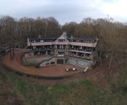
Hostellerie Kemmelberg
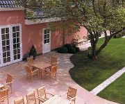
Hotel Recour
Romantik Hotel Manoir Ogygia
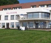
Belvedere
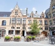
Amfora
Domein De Lissewal
Belle INTER-HOTEL
Landhuis ' T Wilgenerf
Videos from this area
These are videos related to the place based on their proximity to this place.
Publireportage tende® by Inhuis Poperinge
tende® by Inhuis Poperinge is al jarenlang dé decoratie speciaalzaak in uw streek. Van gordijnen en zonwering op gebied van raamdecoratie tot behang en tapijten voor uw interieur.
LoTRO - Vipe&Manak - The good (not so old) days :)
Me and a good friend sparring. This is after the release of moria, so before book 7 Enjoy :)
Piano's Verhulst, Wilh. Steinberg Signature 188. Mendelssohn Etudes Op. 104 no. 1, Sarah Robaeys
Piano's Verhulst staat enerzijds bekend voor zijn persoonlijk en deskundig advies en anderzijds voor zijn flexibele en professionele service. Van beginnende tot professionele pianisten, bij...
Heuvellandse kerken: Westouter
Van veel gebouwen in de streek rond Poperinge (West-Vlaanderen) resteerden na de eerste wereldoorlog (1914-1918) slechts de puinhopen. De 'wederopbouwarchitectuur' waarin alles in rap tempo.
Videos provided by Youtube are under the copyright of their owners.
Attractions and noteworthy things
Distances are based on the centre of the city/town and sightseeing location. This list contains brief abstracts about monuments, holiday activities, national parcs, museums, organisations and more from the area as well as interesting facts about the region itself. Where available, you'll find the corresponding homepage. Otherwise the related wikipedia article.
Brandhoek
Brandhoek is a small hamlet in Belgium situated between Ieper, Vlamertinge and Poperinge just off the N308/N38. Brandhoek was used as a Field Ambulance and Casualty Clearing Station during World War I and contains three Commonwealth War Graves Commission cemeteries: Brandhoek Military with 601 burials Brandhoek New Military with 514 burials, including Captain Noel Chavasse, Double VC (a memorial plaque is situated just outside Brandhoek Church with the British flag flying) and also Private C.A.
Brandhoek Military Commonwealth War Graves Commission Cemetery
Brandhoek Military Cemetery is a Commonwealth War Graves Commission burial ground for the dead of the First World War located near Ypres (now Ieper) in Belgium on the Western Front. The cemetery grounds were assigned to the United Kingdom in perpetuity by King Albert I of Belgium in recognition of the sacrifices made by the British Empire in the defence and liberation of Belgium during the war.
Brandhoek New Military Commonwealth War Graves Commission Cemetery
Brandhoek New Military Cemetery is a Commonwealth War Graves Commission burial ground for the dead of the First World War located near Ypres (now Ieper) in Belgium on the Western Front. The cemetery grounds were assigned to the United Kingdom in perpetuity by King Albert I of Belgium in recognition of the sacrifices made by the British Empire in the defence and liberation of Belgium during the war.
Brandhoek New Military Number 3 Commonwealth War Graves Commission Cemetery
Brandhoek New Military Cemetery Number 3 is a Commonwealth War Graves Commission burial ground for the dead of the First World War located near Ypres (now Ieper) in Belgium on the Western Front. The cemetery grounds were assigned to the United Kingdom in perpetuity by King Albert I of Belgium in recognition of the sacrifices made by the British Empire in the defence and liberation of Belgium during the war.
Kemmelberg
The Kemmelberg, also known as Kemmel Hill or Mont Kemmel, is a 156m high hill near Kemmel in the municipality of Heuvelland in West Flanders, Belgium. During World War I, it was an important battle site. It was taken on 25 April 1918 by Germans. Several streets and barracks (Kemmelkaserne in Murnau, 1935) in Germany were named after this event.
Reningelst
Reningelst is a rural village in the Belgian province of West-Flanders, and a "deelgemeente" of the municipality Poperinge. The village has about 1405 inhabitants. The deelgemeente of De Klijte used to be a part of Reningelst (then independent, now part of Heuvelland). De Klijte split from Reningelst in 1976 and is now part of the Heuvelland municipality.
De Klijte
De Klijte is a village in the municipality of Heuvelland in West Flanders, Belgium. Before the 1977 Belgian municipal reforms, De Klijte was part of the municipality Reningelst. Reningelst proper joined Poperinge, but De Klijte joined the new municipality Heuvelland. The village is located near the hill Scherpenberg.
Fliegerhorst Vlamertinge
Fliegerhorst Vlamertinge is a former military air base, located 8.4 km east-southest of Poperinge in West Flanders, Belgium. It was closed in 1945 and is now in agricultural use.


